Updates on Yellowstone activity
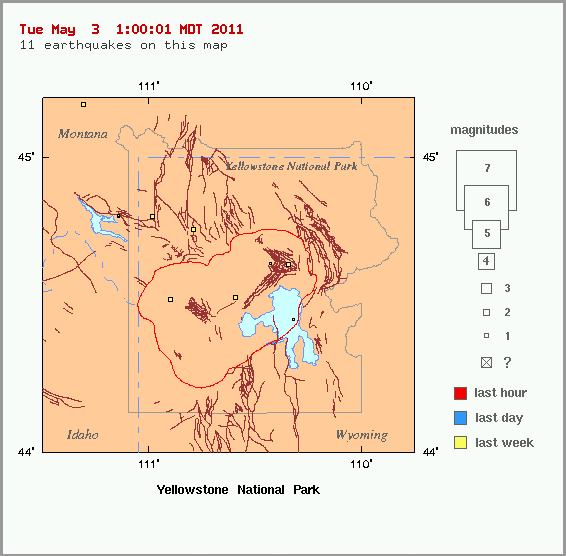
During the month of April 2011, 91 earthquakes were located in the Yellowstone National Park region. The largest was a magnitude 2.2 event on April 13 at 7:11 AM MDT, located about 15 miles southeast of West Thumb, YNP. A small swarm of 24 earthquakes was recorded on April 14, located about 5 miles east of West Thumb, YNP, with magnitudes ranging from M 2.0 to M -0.1.
The period of caldera uplift that began in 2004 ended about one year ago. Since then, the caldera has been subsiding, though seasonal deformation from ground water changes may temporarily mask the trend. (USGS)
Map of GPS stations in the Yellowstone vicinity
Graph of daily GPS positions at White Lake, within the Yellowstone caldera.
Featured image credit: YVO
Commenting rules and guidelines
We value the thoughts and opinions of our readers and welcome healthy discussions on our website. In order to maintain a respectful and positive community, we ask that all commenters follow these rules:
We reserve the right to remove any comments that violate these rules. By commenting on our website, you agree to abide by these guidelines. Thank you for helping to create a positive and welcoming environment for all.