Magnitude 5.8 shallow earthquake hit off the east coast of North Island, New Zealand
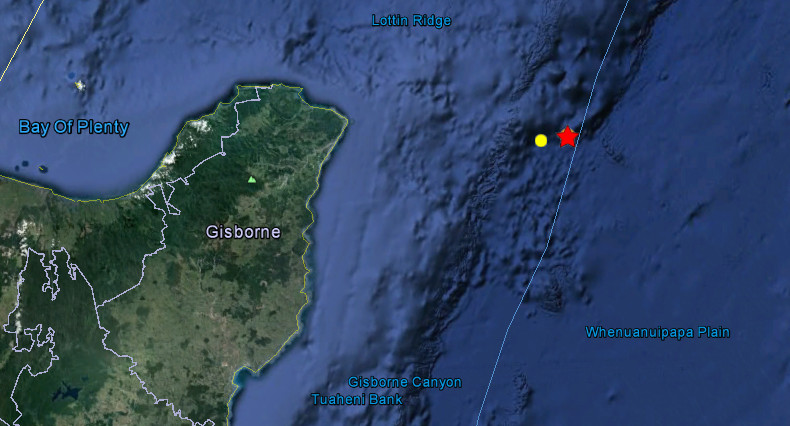
Strong and shallow earthquake with recorded magnitude of 5.8 hit off the east coast of North Island, New Zealand on July 21, 2012 at 4:54 UTC. Magnitude of 5.8 was confirmed by GeoNet, EMSC and USGS. GeoNet is reporting depth of 12km, EMSC 10km and USGS 20 km. Epicenter was located 179 km NE Gisborne (population 34,274) and 318 km E Tauranga (population 110,338) at 37.755°S, 179.677°E.
Despite the strength of the quake – which was felt as far away as Whakatane, Opotiki and Wairoa – locals reported no damage.
It comes as a series of quakes in the central North Island saw the Volcano Alert Level at Mt Tongariro being raised on Friday.
GNS Science volcanologist Brad Scott told Stuff on Friday the increased activity ‘‘just means that something has upset Tongariro, and some subterranean process is occurring’’.
| Magnitude | 5.8 |
|---|---|
| Date-Time |
|
| Location | 37.755°S, 179.677°E |
| Depth | 20 km (12.4 miles) |
| Region | OFF EAST COAST OF THE NORTH ISLAND, N.Z. |
| Distances | 177 km (109 miles) NE of Gisborne, New Zealand 238 km (147 miles) E of Whakatane, New Zealand 304 km (188 miles) E of Rotorua, New Zealand 308 km (191 miles) NE of Napier, New Zealand |
| Location Uncertainty | horizontal +/- 15.5 km (9.6 miles); depth +/- 4.9 km (3.0 miles) |
| Parameters | NST=185, Nph=185, Dmin=122.5 km, Rmss=1.02 sec, Gp= 32°, M-type=regional moment magnitude (Mw), Version=D |
| Source |
|
| Event ID | usb000bccw |

Featured image: Google Earth + USGS
Commenting rules and guidelines
We value the thoughts and opinions of our readers and welcome healthy discussions on our website. In order to maintain a respectful and positive community, we ask that all commenters follow these rules:
We reserve the right to remove any comments that violate these rules. By commenting on our website, you agree to abide by these guidelines. Thank you for helping to create a positive and welcoming environment for all.