Active volcanoes in the world: December 26, 2012 – January 1, 2013
New unrest has been noticed around 5 volcanoes, ongoing activity was reported for 5 volcanoes. This report covers active volcanoes in the world recorded from December 26, 2012 – January 1, 2013 based on Smithsonian/USGS criteria.
New activity/unrest: | Chirpoi, Kuril Islands (Russia) | Copahue, Central Chile-Argentina border | Pacaya, Guatemala | San Cristóbal, Nicaragua | Sangeang Api, Lesser Sunda Islands (Indonesia)
Ongoing activity: | Karymsky, Eastern Kamchatka (Russia) | Kilauea, Hawaii (USA) | Sakura-jima, Kyushu | Shiveluch, Central Kamchatka (Russia) | Tolbachik, Central Kamchatka (Russia)
The Weekly Volcanic Activity Report is a cooperative project between the Smithsonian’s Global Volcanism Program and the US Geological Survey’s Volcano Hazards Program. Updated by 2300 UTC every Wednesday, notices of volcanic activity posted on these pages are preliminary and subject to change as events are studied in more detail. This is not a comprehensive list of all of Earth’s volcanoes erupting during the week, but rather a summary of activity at volcanoes that meet criteria discussed in detail in the “Criteria and Disclaimers” section. Carefully reviewed, detailed reports on various volcanoes are published monthly in the Bulletin of the Global Volcanism Network.
New activity/unrest
CHIRPOI, Kuril Islands (Russia)
46.525°N, 150.875°E; summit elev. 742 m
SVERT reported that a thermal anomaly was detected over Snow, a volcano of Chirpoi, during 24-25, 28, and 30 December; cloud cover prevented observations of the volcano on other days during 24-31 December.
Geologic summary: Chirpoi, a small island lying between the larger islands of Simushir and Urup, contains a half dozen volcanic edifices constructed within an 8-9 km wide, partially submerged caldera. The southern rim of the caldera is exposed on nearby Brat Chirpoev Island. Two volcanoes on Chirpoi Island have been historically active. The symmetrical Cherny volcano, which forms the 691 m high point of the island, erupted twice during the 18th and 19th centuries. The youngest volcano, Snow, originated between 1770 and 1810. It is composed almost entirely oflava flows, many of which have reached the sea on the southern coast. No historical eruptions are known from 742-m-high Brat Chirpoev, but its youthful morphology suggests recent strombolian activity.
COPAHUE, Central Chile-Argentina border
37.85°S, 71.17°W; summit elev. 2997 m
OVDAS-SERNAGEOMIN reported that during 25-29 December white plumes observed with a web camera installed near Copahue rose 450-850 m and drifted NE and E. Plumes detected in satellite imagery drifting 16 km NE on 26 December. Incandescence from the crater was observed at night during 26-28 December; explosions were detected during 27-28 December. Seismicity had decreased during the reporting period. The Alert Level was lowered to Yellow on 29 December.
Geologic summary: Volcán Copahue is an elongated composite cone constructed along the Chile-Argentina border within the 6.5 x 8.5 km wide Trapa-Trapa caldera that formed between 0.6 and 0.4 million years ago near the NW margin of the 20 x 15 km Pliocene Caviahue (Del Agrio) caldera. The eastern summit crater, part of a 2-km-long, ENE-WSW line of nine craters, contains a briny, acidic 300-m-wide crater lake (also referred to as El Agrio or Del Agrio) and displays intense fumarolic activity. Acidic hot springs occur below the eastern outlet of the crater lake, contributing to the acidity of the Río Agrio, and another geothermal zone is located within Caviahue caldera about 7 km NE of the summit. Infrequent mild-to-moderate explosive eruptions have been recorded at Copahue since the 18th century. Twentieth-century eruptions from the crater lake have ejected pyroclastic rocks and chilled liquid sulfur fragments.
PACAYA, Guatemala
14.381°N, 90.601°W; summit elev. 2552 m
INSIVUMEH noted in a special report that on 28 December patterns of activity from Pacaya’s MacKenney cone changed; three explosions detected at 1150 generated plumes that rose less than 500 m and drifted 5 km W and SW. During 30 December-1 January bluish-white plumes rose 50 m and drifted S and SW.
Geologic summary: Eruptions from Pacaya, one of Guatemala’s most active volcanoes, are frequently visible from Guatemala City, the nation’s capital. Pacaya is a complex volcano constructed on the southern rim of the 14 x 16 km Pleistocene Amatitlan caldera. A cluster of dacitic lava domes occupies the caldera floor. The Pacaya massif includes the Cerro Grande lava dome and a younger volcano to the SW. Collapse of Pacaya volcano about 1,100 years ago produced a debris-avalanche deposit that extends 25 km onto the Pacific coastal plain and left an arcuate somma rim inside which the modern Pacaya volcano (MacKenney cone) grew. During the past several decades, activity at Pacaya has consisted of frequent Strombolian eruptions with intermittent lava flow extrusion on the flanks of MacKenney cone, punctuated by occasional larger explosive eruptions.
SAN CRISTOBAL, Nicaragua
12.702°N, 87.004°W; summit elev. 1745 m
INETER reported that on 26 December four explosions at San Cristóbal produced ash plumes that were observed in satellite imagery drifting W and reaching the Pacific Ocean. Ashfall was reported in areas within 5-6 km of the volcano. The next day explosions produced ash plumes that rose 200 m above the crater. On 28 December gas-and-ash plumes drifted NW, W, and SW, reaching the Pacific Ocean and the coast of El Salvador. Explosions were detected until 1100. Sulfur dioxide emissions continued and drifted W and SW; the emissions decreased the next day.
Geologic summary: The San Cristóbal volcanic complex, consisting of five principal volcanic edifices, forms the NW end of the Marrabios Range. The symmetrical 1,745-m-high youngest cone, San Cristóbal itself (also known as El Viejo), is Nicaragua’s highest volcano and is capped by a 500 x 600 m wide crater. El Chonco, with several flanklava domes, is located 4 km to the west of San Cristóbal; it and the eroded Moyotepe volcano, 4 km to the NE of San Cristóbal, are of Pleistocene age. Volcán Casita contains an elongated summit crater and lies immediately E of San Cristóbal; Casita was the site of a catastrophic landslide and lahar in 1998. The Plio-Pleistocene La Pelona caldera is located at the eastern end of the San Cristóbal complex. Historical eruptions from San Cristóbal, consisting of small-to-moderate explosive activity, have been reported since the 16th century. Some other 16th-century eruptions attributed to Casita volcano are uncertain and may pertain to other Marrabios Range volcanoes.
SANGEANG API, Lesser Sunda Islands (Indonesia)
8.20°S, 119.07°E; summit elev. 1949 m
CVGHM reported that during November through mid-December observers at the Sangeang, Bima observation post (50 km SW) noted occasional diffuse white plumes rising 5-15 m above Sangeang Api’s crater. The lava dome and surrounding areas had not changed compared to October observations. Avalanches had occurred on the W and SW flanks. Earthquakes had declined. The Alert Level was lowered to 2 (on a scale of 1-4) on 21 December.
Geologic summary: Sangeang Api volcano, one of the most active in the Lesser Sunda Islands, forms a small 13-km-wide island off the NE coast of Sumbawa Island. Two large trachybasaltic-to-tranchyandesitic volcanic cones, 1949-m-high Doro Api and 1795-m-high Doro Mantoi, were constructed in the center and on the eastern rim, respectively, of an older, largely obscured caldera. Flank vents occur on the south side of Doro Mantoi and near the northern coast. Intermittent historical eruptions have been recorded since 1512.
Ongoing activity
KARYMSKY, Eastern Kamchatka (Russia)
54.05°N, 159.45°E; summit elev. 1536 m
KVERT reported that weak-to-moderate seismic activity at Karymsky was detected during 21-28 December. Satellite imagery showed a thermal anomaly on the volcano during 26-27 December. The Aviation Color Coderemained at Orange.
Geologic summary: Karymsky, the most active volcano of Kamchatka’s eastern volcanic zone, is a symmetrical stratovolcano constructed within a 5-km-wide caldera that formed about 7,600-7,700 radiocarbon years ago. Construction of the Karymsky stratovolcano began about 2,000 years later. The latest eruptive period began about 500 years ago, following a 2,300-year quiescence. Much of the cone is mantled by lava flows less than 200 years old. Historical eruptions have been Vulcanian or Vulcanian-Strombolian with moderate explosive activity and occasional lava flows from the summit crater. Most seismicity preceding Karymsky eruptions has originated beneath Akademia Nauk caldera, which is located immediately S of Karymsky volcano and erupted simultaneously with Karymsky in 1996.
KILAUEA, Hawaii (USA)
19.421°N, 155.287°W; summit elev. 1222 m
During 26 December-1 January HVO reported that the circulating lava lake periodically rose and fell in the deep pit within Kilauea’s Halema’uma’u Crater. The gas plume from the vent continued to deposit variable amounts of ash, spatter, and Pele’s hair onto nearby areas.
At Pu’u ‘O’o Crater, glow emanated from spatter cones on the SE part of the crater floor, from a spatter cone at the NW edge of the floor, and from a circulating lava lake on the NE part of the floor. The lava lake briefly overflowed on 27 December. During 29-30 December lava flowed from the easternmost spatter cone in the S part of the crater floor. Lava flows were active in a 1-km-wide area that stretched from near the base of the pali to the coast. During 28-30 December web cameras recorded infrequent and weak steam plumes from lava sporadically entering the ocean at multiple locations.
Geologic summary: Kilauea, one of five coalescing volcanoes that comprise the island of Hawaii, is one of the world’s most active volcanoes. Eruptions at Kilauea originate primarily from the summit caldera or along one of the lengthy E and SW rift zones that extend from the caldera to the sea. About 90% of the surface of Kilauea is formed of lava flows less than about 1,100 years old; 70% of the volcano’s surface is younger than 600 years. A long-term eruption from the East rift zone that began in 1983 has produced lava flows covering more than 100 sq km, destroying nearly 200 houses and adding new coastline to the island.
SAKURA-JIMA, Kyushu
31.585°N, 130.657°E; summit elev. 1117 m
JMA reported that during 25-28 December explosions from Sakura-jima’s Showa Crater ejected tephra as far as 1.8 km from the crater. A small pyroclastic flow traveled 500 m E. Very small eruptions periodically occurred at Minami-dake Crater.
Geologic summary: Sakura-jima, one of Japan’s most active volcanoes, is a post-caldera cone of the Aira caldera at the northern half of Kagoshima Bay. Eruption of the voluminous Ito pyroclastic flow was associated with the formation of the 17 x 23-km-wide Aira caldera about 22,000 years ago. The construction of Sakura-jima began about 13,000 years ago and built an island that was finally joined to the Osumi Peninsula during the major explosive and effusive eruption of 1914. Activity at the Kita-dake summit cone ended about 4,850 years ago, after which eruptions took place at Minami-dake. Frequent historical eruptions, recorded since the 8th century, have deposited ash on Kagoshima, one of Kyushu’s largest cities, located across Kagoshima Bay only 8 km from the summit. The largest historical eruption took place during 1471-76.
SHIVELUCH, Central Kamchatka (Russia)
56.653°N, 161.360°E; summit elev. 3283 m
Based on visual observations and analyses of satellite data, KVERT reported that during 21-28 December a viscous lava flow continued to effuse on the NW flank of Shiveluch’s lava dome, accompanied by hot avalanches, incandescence, and fumarolic activity. Satellite imagery showed a daily thermal anomaly on the lava dome. TheAviation Color Code remained at Orange.
Geologic summary: The high, isolated massif of Shiveluch volcano (also spelled Sheveluch) rises above the lowlands NNE of the Kliuchevskaya volcano group and forms one of Kamchatka’s largest and most active volcanoes. The currently active Molodoy Shiveluch lava-dome complex was constructed during the Holocene within a large breached caldera formed by collapse of the massive late-Pleistocene Strary Shiveluch volcano. At least 60 large eruptions of Shiveluch have occurred during the Holocene, making it the most vigorous andesitic volcano of the Kuril-Kamchatka arc. Frequent collapses of lava-dome complexes, most recently in 1964, have produced large debris avalanches whose deposits cover much of the floor of the breached caldera. Intermittent explosive eruptions began in the 1990s from a new lava dome that began growing in 1980. The largest historical eruptions from Shiveluch occurred in 1854 and 1964.
TOLBACHIK, Central Kamchatka (Russia)
55.830°N, 160.330°E; summit elev. 3682 m
KVERT reported that the S fissure along the W side of Tolbachinsky Dol, a lava plateau on the SW side of Tolbachik, continued to produce very fluid lava flows during 21-28 December. Strong seismicity was detected. Gas-and-ash plumes drifted in multiple directions, and a fifth cone continued to grow above the fissure. A very large thermal anomaly on the N part of Tolbachinsky Dol was visible daily in satellite imagery. The Aviation Color Coderemained at Orange.
Geologic summary: The massive Tolbachik basaltic volcano is located at the southern end of the dominantly andesitic Kliuchevskaya volcano group. The Tolbachik massif is composed of two overlapping, but morphologically dissimilar volcanoes. The flat-topped Plosky Tolbachik shield volcano with its nested Holocene Hawaiian-type calderas up to 3 km in diameter is located east of the older and higher sharp-topped Ostry Tolbachik stratovolcano. The summit caldera at Plosky Tolbachik was formed in association with major lava effusion about 6500 years ago and simultaneously with a major southward-directed sector collapse of Ostry Tolbachik volcano. Lengthy rift zones extending NE and SSW of the volcano have erupted voluminous basaltic lava flows during the Holocene, with activity during the past two thousand years being confined to the narrow axial zone of the rifts. The 1975-76 eruption originating from the SSW-flank fissure system and the summit was the largest historical basaltic eruption in Kamchatka.
Source: Global Volcanism Program
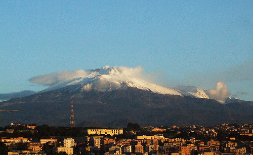
Featured image: Etna volcano, Sicily, Italy. Author: gnuckx
[…] Active volcanoes in the world […]