Tropical Storm Sonamu continues to weaken
JTWC and JMA upgraded to a Sonamu to a severe Tropical Storm yesterday. The system continues to move across the South China Sea, for now staying south of Vietnam. Heavy rains and strong winds remain offshore although light rains may affect Southern Vietnam in the next 24 hours.
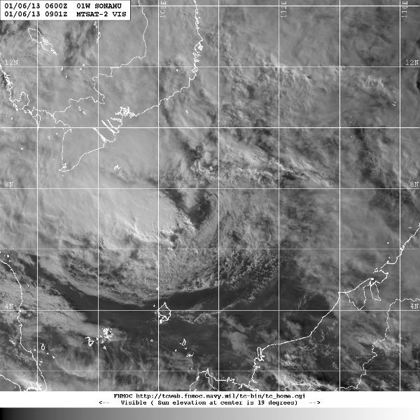 Storm region visible satellite image (Credit: MTSAT/FNMOC)
According to latest report by JTWC, Tropical Storm Sonamu was located approximately 270 nm southeast of Ho Chi Minh city, Vietnam, has tracked west-southwestward at 5 knots. As Sonamu has been tracking westward, it has started to slow in the weakening steering environment. Sea surface temperatures are currently favorable for further development (28 to 29 degrees Celsius).
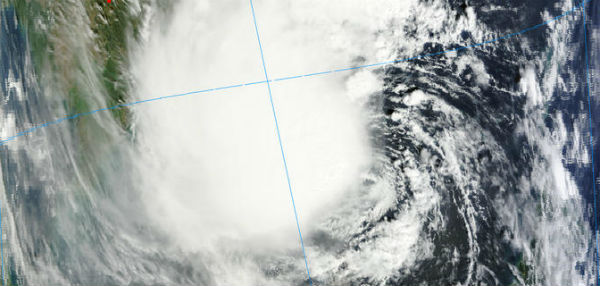
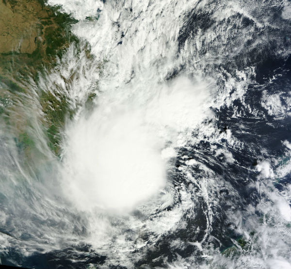 TC Sonamu seen by MODIS/Aqua satellite on January 5, 2013 (Credit: LANCE/MODIS)
Sonamu is forecast to begin weakening by Monday as it heads towards the Malay Peninsula. It will track slowly along the southern periphery of the low- to mid-level subtropical ridge over the Andaman Aea in a generally westward direction through the next three days. It is forecasted to weaken to a Tropical Depression before making landfall near Thailand and Malaysia. A large swath of vertical wind shear associated with the North East monsoon will rapidly weaken the system.
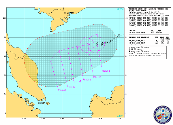 TC Sonamu forecast track by JTWC
Two more areas of low pressure formed along Inter-Tropical Convergence Zone – the trail of convection running eastward from the Philippines. They could potentially develop into weak cyclones next week.
Tropical Storm SONAMU Warning Text (JTWC)
Tropical Storm SONAMU Prognostic Reasoning (JTWC)
Tropical Storm SONAMU JMV 3.0 Data (JTWC)
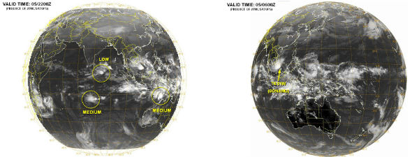 Current tropical disturbances (Credit: MTSAT/JTWC)
 Satellite Animations
- Storm-Centered Infrared (MTSAT; NOAA/SSD)
- Storm-Centered Infrared (Aviation Color Enhancement) (MTSAT; NOAA/SSD)
- Storm-Centered Water Vapor (MTSAT; NOAA/SSD)
- Storm-Centered Visible (MTSAT; NOAA/SSD)
- Storm-Centered Visible (Colorized) (MTSAT; NOAA/SSD)
- West Pacific/South China Sea Infrared (MTSAT2; NOAA)
- West Pacific/South China Sea Enhanced Infrared (MTSAT2; NOAA)
- West Pacific/South China Sea Water Vapor (MTSAT2; NOAA)
Commenting rules and guidelines
We value the thoughts and opinions of our readers and welcome healthy discussions on our website. In order to maintain a respectful and positive community, we ask that all commenters follow these rules.