Dust plumes from Sahara over Mediterranean Sea
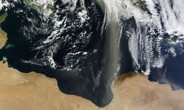
A plume of Saharan dust, extending roughly 1,110 kilometers (700 miles), spanned the Mediterranean Sea in late January 2013. A swath of dust blows northward from the Sahara Desert in Libya, over the Gulf of Sidra, past the western end of the Jebel Akhdar (Green Mountain) range and far north across the Mediterranean Sea to southern Italy.
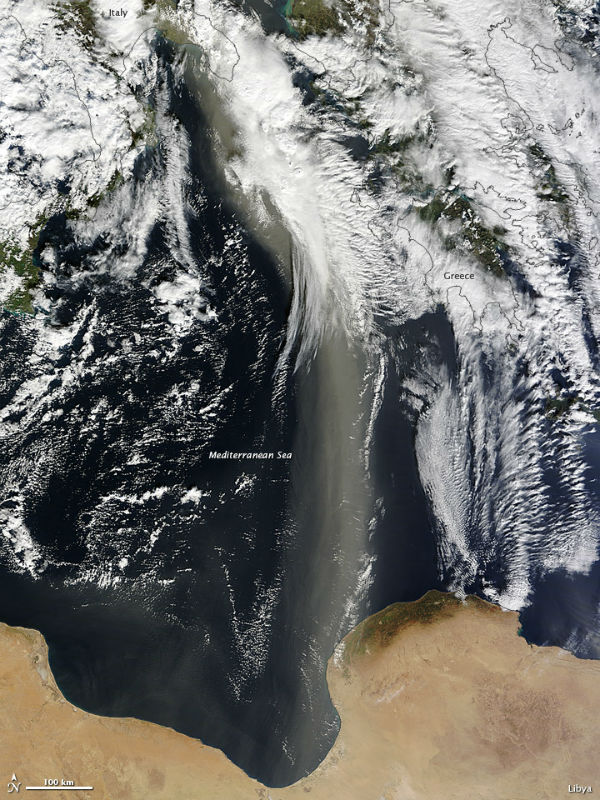
The Moderate Resolution Imaging Spectroradiometer (MODIS) on NASA’s Terra satellite captured this natural-color image on January 21, 2013 (NASA image courtesy Jeff Schmaltz, LANCE MODIS Rapid Response. Caption by Michon Scott)
The dust plumes was translucent but thick enough to remain discernible across the Mediterranean Sea. This plume followed days of intermittent dust storm activity off the coast of Libya. Away from the coast, which enjoys a Mediterranean climate, the Libyan landscape consists largely of sand seas. Only about 1 percent of the land is arable, and dust storms rank among the country’s leading natural hazards.
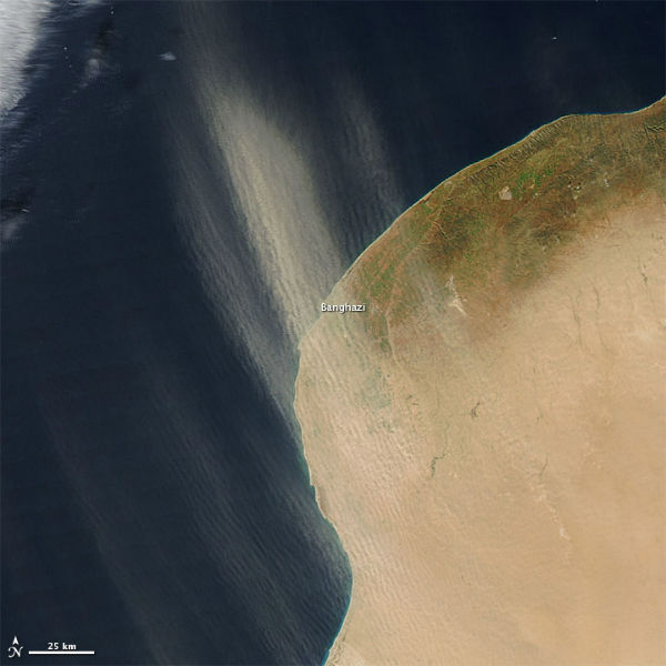
The Moderate Resolution Imaging Spectroradiometer (MODIS) on NASA’s Aqua satellite captured this natural-color image on January 15, 2013, as plumes blew toward the north-northwest over the coastal city. (NASA image by Jeff Schmaltz, LANCE/EOSDIS MODIS Rapid Response. Caption by Michon Scott)
Libya is 95% desert, mostly barren with flat to undulating plains. This, combined with the Mediterranean climate, renders many parts of the country susceptible to floods, sandstorms, dust storms, and desertification.
Many of the dust plumes arose in Western Sahara, perhaps fueled by the fine sediments of impermanent rivers and lakes. The dust storm likely picked up more material in northeastern Mauritania, where sand seas cover most of the land surface. Dust-laden winds are some of the most common natural hazards in Mauritania, and less than 1 percent of the land is arable.
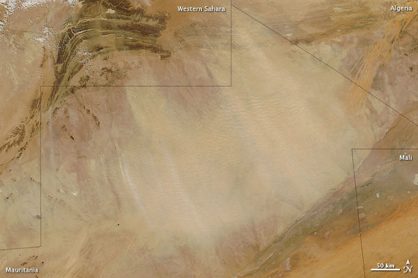
A dust storm blew through northeastern Mauritania in late January 2013. The Moderate Resolution Imaging Spectroradiometer (MODIS) on NASA’s Aqua satellite captured this natural-color image on January 20, 2013 (NASA image courtesy Jeff Schmaltz, LANCE MODIS Rapid Response. Caption by Michon Scott)
Source: Earth Observatory
Commenting rules and guidelines
We value the thoughts and opinions of our readers and welcome healthy discussions on our website. In order to maintain a respectful and positive community, we ask that all commenters follow these rules:
We reserve the right to remove any comments that violate these rules. By commenting on our website, you agree to abide by these guidelines. Thank you for helping to create a positive and welcoming environment for all.