USGS Landslide Photo Library – copyright free, high-resolution images of landslides
Lynn Highland, a geographer with the Landslide Program of the U.S. Geological Survey (USGS) is joining the USGS Library in a project to compile an archive of copyright free, high-resolution (if possible) photographs of all aspects of landslides. These contributed photos would be archived permanently with, and obtainable through, the USGS Library website, which can be accessed here:
http://libraryphoto.cr.usgs.gov/index.html
The photographs archived at the library are public domain and can be downloaded for free by anyone accessing the website. Lynn has asked if you would consider submitting your best photographs by sending the photos in as high a resolution as possible, with a caption, and credit. The photos will be searched by users, using key words, so including as much information as possible in the caption is desirable. You may attach them, along with a text description, or send a website or file-sharing site where they can be accessed.
If you are willing to support this initiative by providing some photographs then please send them to: highland@usgs.gov
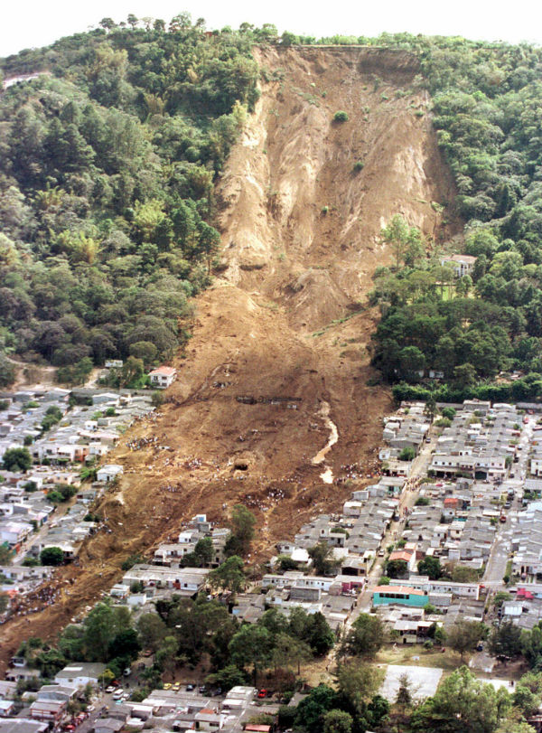 Landslide during the El Salvador quake on January 13, 2001 (Credit: USGS)
 All types of landslide photos will be gladly accepted – those affecting the natural and/or built environments, those illustrating types of landslides, engineered and remedial sites, rockfall, debris flow, creep, lateral spreads, lahars, volcanic landslides and of course, “mudslides” which many users use as a search term.
If you’re unsure about whether the photo is useful, please send it anyway! Someone is always looking for good quality, non-copyrighted, landslide photos, and your photo could be the one they are looking for! If you know of others who might want to contribute photos, please let them know about the USGS project.
Credit: USGS Photo Library, TheLandslideBlog
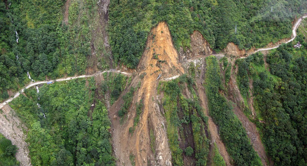
Featured image: An aerial view of the Gangtok-Mangan highway damaged by a landslide following 6.9-magnitude earthquake in Sikkim, India on September 20, 2011 (Credit: Indian Army)
Commenting rules and guidelines
We value the thoughts and opinions of our readers and welcome healthy discussions on our website. In order to maintain a respectful and positive community, we ask that all commenters follow these rules:
We reserve the right to remove any comments that violate these rules. By commenting on our website, you agree to abide by these guidelines. Thank you for helping to create a positive and welcoming environment for all.