Strong M 6.1 earthquake struck Santa Cruz Islands
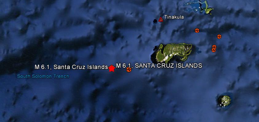
Another strong and shallow earthquake recorded as magnitude 6.1 (USGS) struck Santa Cruz Islands on February 02, 2013 at 18:58 UTC. Epicenter of the quake was located 66 km (41 miles) WSW of Lata, Solomon Islands and 551 km (342 miles) NNW of Luganville, Vanuatu and at depth of 10 km (6.2 miles), coordinates were 10.912°S, 165.260°E. EMSC reported magnitude 5.6 at depth of 40 km(24.85 miles). There is no tsunami warning issued yet.
| Magnitude | 6.1 |
|---|---|
| Date-Time |
|
| Location | 10.912°S, 165.260°E |
| Depth | 10 km (6.2 miles) |
| Region | SANTA CRUZ ISLANDS |
| Distances | 66 km (41 miles) WSW of Lata, Solomon Islands 551 km (342 miles) NNW of Luganville, Vanuatu 604 km (375 miles) ESE of Honiara, Solomon Islands 824 km (512 miles) NNW of Port-Vila, Vanuatu |
| Location Uncertainty | horizontal +/- 16.8 km (10.4 miles); depth +/- 1.7 km (1.1 miles) |
| Parameters | NST=107, Nph=107, Dmin=604.5 km, Rmss=0.99 sec, Gp= 97°, M-type=regional moment magnitude (Mw), Version=6 |
| Source |
|
| Event ID | usc000f05y |
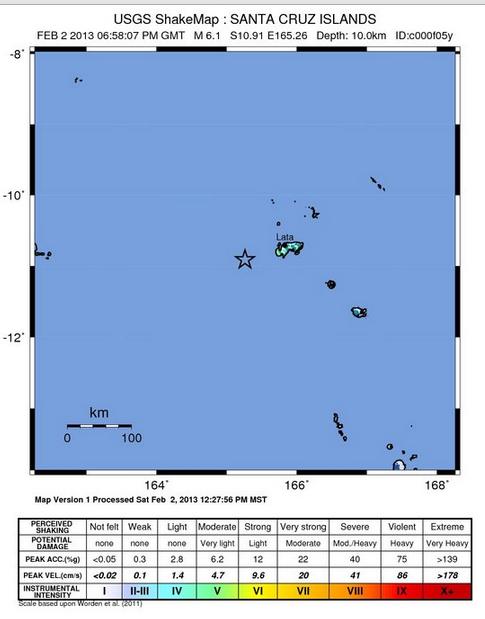 USGS shake map of the earthquake. Credits: USGS
In past four days, 6 major earthquakes (including this one) has been reported in this region, along with several lower magnitude earthquakes. Previously, magnitude 6.7 earthquake was recorded yesterday.
Commenting rules and guidelines
We value the thoughts and opinions of our readers and welcome healthy discussions on our website. In order to maintain a respectful and positive community, we ask that all commenters follow these rules.