Winter storm “Nemo” progress in the Eastern US
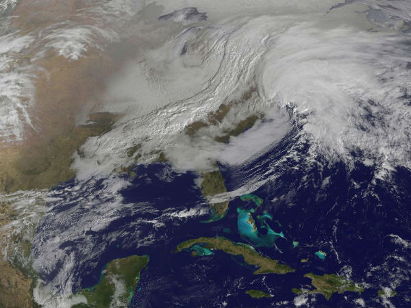
The second and most powerful “nor’easter” of the season, aims New England and states in the region are preparing for the worst. The western frontal system stretching from Canada through the Ohio and Tennessee valleys and down into the Gulf of Mexico is expected to bring high winds and up to 2–3 feet of snowfall across much of New England. The convergence of two massive low-pressure systems is forecast to create a powerful nor’easter, which The Weather Channel has dubbed “Nemo.”
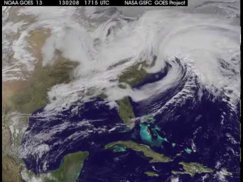
Watch as two low-pressure systems converge to bring a storm with record snowfall amounts to the US northeast on February 8, 2013.
Know the dangers of nor’easter
Video from NASA GOES-13 satellite imagery.
Featured image: GOES-13 (East) satellite view of the eastern US on February 8, 2013 (Credit: NASA)
Commenting rules and guidelines
We value the thoughts and opinions of our readers and welcome healthy discussions on our website. In order to maintain a respectful and positive community, we ask that all commenters follow these rules.