Operation IceBridge: Flying low over Southeast Greenland
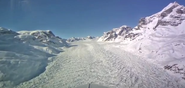
A view from cockpit camera installed on NASA’s P-3B airborne laboratory and operated by the National Suborbital Education and Research Center (NSERC) shows southeast Greenland from 500 meters above, recorded during Operation IceBridge‘s flyover on April 9, 2013.
Following a glacier’s sometimes winding flow line gives IceBridge researchers a perspective on the ice not possible from satellites which pass in straight lines overhead. By gathering such data, IceBridge is helping to build a continuous record of change in the polar regions.
Credit: NASAexplorer
Featured image: Youtube screenshot
Look it up for yourself do you own homework. Weather Action DOT COM Earth is cooling and going into a mini ice age for the next 30 years. Why you may ask Solor activity from the Sun and sunspots is lacking..meaning longer winters shorter Summers.