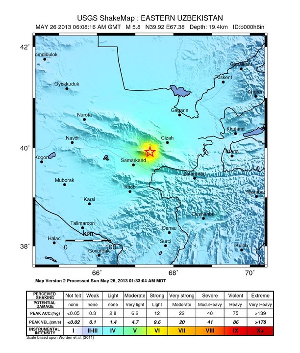
Dangerous earthquake M 5.8 struck southeastern Uzbekistan
Shallow earthquake M 5.8 (USGS) struck southeastern Uzbekistan on May 26, 2013 at 06:18 UTC. By preliminary reports USGS is reporting depth of 19.4 km, EMSC is reporting M 6.0 and depth at 10 km. GFZ is reporting M 5.8 at depth of 15 km.
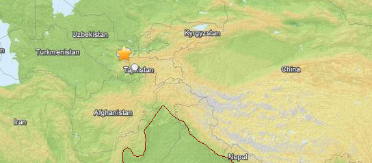
Epicenter was located 19km (12mi) NNE of Bulung'ur, Uzbekistan and 34km (21mi) NE of Jomboy, Uzbekistan at coordinates 39.919°N 67.385°E.
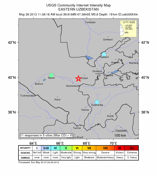
ER reported that data arriving from their readers are telling there might be serious damage near the epicenter as this earthquake was well felt in Tashkent and even more in Dushambe, both at 200 km distance from the epicenter (ER).
Samarkand, the second-largest city in Uzbekistan, reports that the cellular network went down, but no damage known as yet.
Tectonic summary by USGS
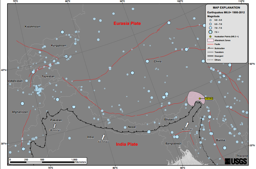
Seismotectonics of the Himalaya and Vicinity
Seismicity in the Himalaya dominantly results from the continental collision of the India and Eurasia plates, which are converging at a relative rate of 40-50 mm/yr. Northward underthrusting of India beneath Eurasia generates numerous earthquakes and consequently makes this area one of the most seismically hazardous regions on Earth. The surface expression of the plate boundary is marked by the foothills of the north-south trending Sulaiman Range in the west, the Indo-Burmese Arc in the east and the east-west trending Himalaya Front in the north of India.
The India-Eurasia plate boundary is a diffuse boundary, which in the region near the north of India, lies within the limits of the Indus-Tsangpo (also called the Yarlung-Zangbo) Suture to the north and the Main Frontal Thrust to the south. The Indus-Tsangpo Suture Zone is located roughly 200 km north of the Himalaya Front and is defined by an exposed ophiolite chain along its southern margin. The narrow (<200km) Himalaya Front includes numerous east-west trending, parallel structures. This region has the highest rates of seismicity and largest earthquakes in the Himalaya region, caused mainly by movement on thrust faults. Examples of significant earthquakes, in this densely populated region, caused by reverse slip movement include the 1934 M8.1 Bihar, the 1905 M7.5 Kangra and the 2005 M7.6 Kashmir earthquakes. The latter two resulted in the highest death tolls for Himalaya earthquakes seen to date, together killing over 100,000 people and leaving millions homeless. The largest instrumentally recorded Himalaya earthquake occurred on 15th August 1950 in Assam, eastern India. This M8.6 right-lateral, strike-slip, earthquake was widely felt over a broad area of central Asia, causing extensive damage to villages in the epicentral region. Read more here.
Credit: USGS. Check full size image here.
Featured image: USGS/Leaflet
Commenting rules and guidelines
We value the thoughts and opinions of our readers and welcome healthy discussions on our website. In order to maintain a respectful and positive community, we ask that all commenters follow these rules:
We reserve the right to remove any comments that violate these rules. By commenting on our website, you agree to abide by these guidelines. Thank you for helping to create a positive and welcoming environment for all.