First global map of vegetation from recently launched Proba-V
The first global map of vegetation from the recently launched Proba-V has been unveiled, demonstrating that the new minisatellite is on track to continue a 15-year legacy of global vegetation monitoring from space.
Proba-V was designed to map land cover and vegetation growth across the entire planet every two days but the data can also be used for day-by-day tracking of extreme weather, alerting authorities to crop failures, monitoring inland water resources and tracing the steady spread of deserts and deforestation.
While still being commissioned, the satellite continued to acquire images that have been stitched together to give us the mission’s first, uncalibrated map of global vegetation. The map was unveiled last week at the Probing Vegetation conference in Antwerp, Belgium.
“The results of these weeks of Proba-V commissioning give us confidence that the Vegetation users will not be disappointed and will benefit from the new higher performance Proba-V products,” noted Alberto Tobias, Head of ESA’s Systems, Software and Technology Department.
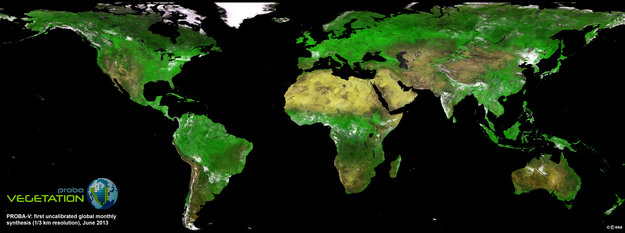
First uncalibrated global mosaic of vegetation from Proba-V, June 2013. Copyright: ESA
The commissioning phase includes a careful cross-calibration of the Vegetation imager with the previous generation of the instrument, operating on France’s Spot-5 satellite, to ensure data compatibility.
The Spot-Vegetation mission, flown aboard both the Spot-4 and Spot-5 satellites, marked 15 years of service in May this year, but will come to an end after Proba-V takes over later this year. Achievements of the Vegetation imaging instruments were also highlighted at the conference.
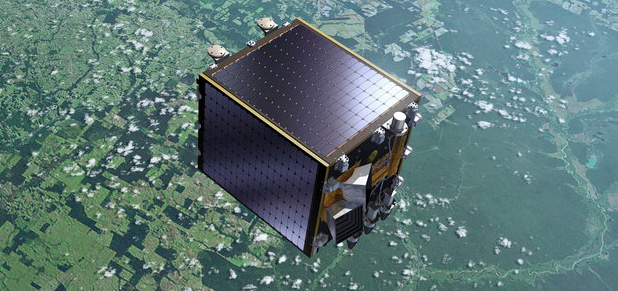
Proba-V is a miniaturised ESA satellite tasked with a full-scale mission: to map land cover and vegetation growth across the entire planet every two days. It has a mass of 140 kg and is in Sun-synchronous polar orbit at altitude of 820 km altitude.
The new satellite will also bridge the gap in vegetation monitoring between Spot-Vegetation and the future Sentinel-3 mission.
Source: ESA
Featured image: Proba-V satellite – Copyright ESA-P.Carril
Commenting rules and guidelines
We value the thoughts and opinions of our readers and welcome healthy discussions on our website. In order to maintain a respectful and positive community, we ask that all commenters follow these rules:
We reserve the right to remove any comments that violate these rules. By commenting on our website, you agree to abide by these guidelines. Thank you for helping to create a positive and welcoming environment for all.