Heat wave across the U.S. about to end
The Northeast and Midwest US is enduring its fourth heat wave of the summer. It started over the Northeast and Midwest US a week ago and has broken a few records. High temperatures persist in parts of the Northeast, Great Lakes and Ohio Valley. High humidity over the day and night time created a feeling of sauna, especially in urban areas. Heat index values reached between 105 and 110 degrees Fahrenheit ( 40.5 – 43.5 degree Celsius) across the Northeast US.
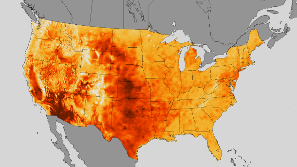
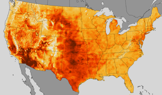
Data from NOAA's Real-Time Mesoscale Analysis shows just how warm it has been in the U.S over the past week and a half. The maximum air temperatures (not including heat index) is plotted in this RTMA heat map showing period from July 10-19, 2013. (Credit: NOAA/RTMA)
According to Dr. Kevin Baumlin, associate professor and vice chair for Clinical, Operations, Quality and Finance in the Department of Emergency Medicine at the Ichan School of Medicine, the duration of the heat index being 97 to over 100 degrees F (36 to 37.7 degree C) has diminished the population's ability to respond to the heat.
The heat index on July 19, 2013 reached as high as 110 degrees F (43.5 degree C) at Stewart airport in southeastern New York. In Traverse City, Michigan the overnight recorded low temperature was 82 degrees Fahrenheit (27.8 degree Celsius) on July 18, 2013.
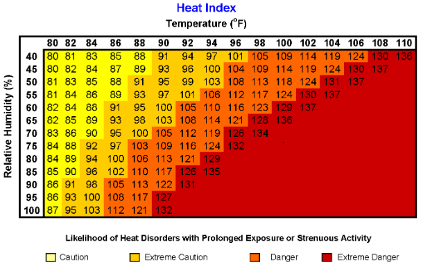
National Weather Service's Heat Index Chart shaded zone above 105°F (orange or red) shows a level that may cause increasingly severe heat disorders with continued exposure or physical activity. Exposure to full sunshine can increase heat index values by up to 15°F. Also, strong winds, particularly with very hot, dry air, can be extremely hazardous. (Credit: NOAA/NWS)
The unusual weather pattern that caused the heat wave this past week will be replaced by a frequent heavy rains with thunderstorms and generally lower temperatures. Moisture from the Gulf of Mexico and also from Pacific Ocean will bring heavy, gusty thunderstorms and frequent showers over the Plains and Midwest US. Heavy showers will bring high risk of widespread flooding.
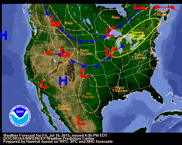
NWS weather forecast ( Credit: NOAA/DOC/NWS/NCEP/WPC)
Featured image: NOAA's Real-Time Mesoscale Analysis heat map showing period from July 10-19, 2013. (Credit: NOAA/RTMA)
Commenting rules and guidelines
We value the thoughts and opinions of our readers and welcome healthy discussions on our website. In order to maintain a respectful and positive community, we ask that all commenters follow these rules.