Saharan dust cloud travels across Atlantic
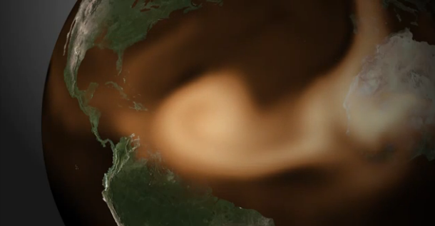
NOAA's satellites have detected a plume of dust moving off the coast of Africa. The Saharan Air Layer has a relatively constrained area of high concentration. This animation bellow, released by NOAA Environmental Visualization Laboratory, uses a recently enhanced version of the NOAA-NGAC aerosol model to show how the plume is expected to travel across the Atlantic Basin over the next four days. The Saharan Air Layer plays an important role in lessening "cyclogenesis," or the formation of hurricanes.

NEMS GFS Aerosol Component (NGAC) is a global aerosol forecast system where NCEP has adopted NASA GOCART model in NEMS GFS for forecasting dust, sulfate, sea salt, and carbonaceous aerosols. Development and planned operational implementation of the NGAC represents a successful three-year "research to operations" project sponsored by NASA Applied Science Program, Joint Center for Satellite Data Assimilation (JCSDA), and NOAA National Weather Service (NWS).
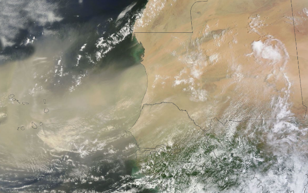
Saharan dust cloud captured by Aqua MODIS satellite on July 30, 2013 (Credit: LANCE Rapid Response/MODIS/Worldview)
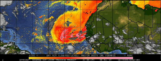
Saharan air layer forecast track model (Credit: NOAA-HRD/METEOSAT9/UW-CIMSS)
Featured image: Saharan Air Layer prediction model (Credit: NOAA/NGAC)
Commenting rules and guidelines
We value the thoughts and opinions of our readers and welcome healthy discussions on our website. In order to maintain a respectful and positive community, we ask that all commenters follow these rules:
We reserve the right to remove any comments that violate these rules. By commenting on our website, you agree to abide by these guidelines. Thank you for helping to create a positive and welcoming environment for all.