Deadly Typhoon Wipha slams Japan, including Fukushima nuclear site
Powerful counter-clockwise flow of moist, tropical air around the center of Wipha is meeting up with the cold front currently over Japan and undergoing the transition to an extratropical storm. According to the Japan Meteorological Agency, Wipha is the strongest typhoon to hit Japan since Typhoon Tokage of October 2004. Wipha is now the eighth typhoon of 2013 and also the 26th named tropical cyclone of the year.

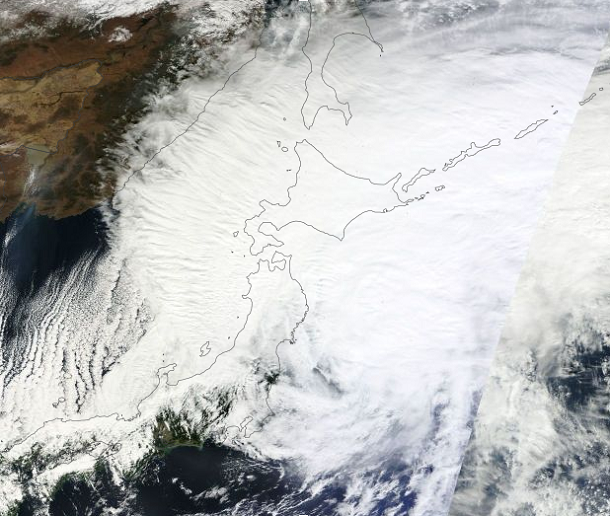
Terra MODIS satellite image of Typhoon Wipha taken at 01:40 UTC on October 16, 2013 (Credit: LANCE Rapid Response/MODIS)
Heavy rains of 6 – 12" are causing damaging flash flooding over Japan, including the Fukushima nuclear site, where rainfall from Typhoon Man-Yi on September 16, 2013 complicated clean-up efforts of the reactors damaged in Great Tohoku earthquake in 2011. Workers at the damaged Fukushima Daiichi nuclear power plant have released rainwater that had accumulated in the compound from typhoon Wipha. The plant operator says the water had cleared tests for radioactivity. The utility says the water accumulating in reactor buildings is seeping into the ground and mixing with underground water. It assumes that 200 tons of radioactive water is leaking into the ocean every day.

Typhoon Wipha has left at least 14 dead in its wake and over 50 are still missing across Japan. The typhoon flooded homes and caused power outages and mudslides in some areas in and around Tokyo. The rainfall over the past 24 hours has exceeded 815 millimeters. Izu Oshima Island, south of Tokyo, had 122 millimeters of rain in a one-hour period – or more than double the average rainfall for October. Also, it is the heaviest rainfall on record.
Wipha is now targeting northern Honshu through eastern Hokkaido before pulling quickly away to the northeast. According to latest report by Joint Typhoon Warning Center (JTWC), the center of Typhoon Wipha is located approximately 345 nm south-southwest of Yokosuka. The system is moving northeastward at speed of 25 knots. Upper level analysis indicates the system has begun a rapid extra-tropical transition.
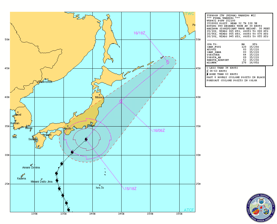
Typhoon Wipha forecast track (Credit: JTWC)
Typhoon Wipha will accelerate further northeastward ahead of the approaching trough to the northwest. It will continue to weaken due to increasing vertical wind shear, passage over cooler water and immersion deeper into the cold baroclinic air mass. The system is expected to become a strong cold-core low by the next 12 hours.
.jpg)
MTSAT2 visible satellite image of Typhoon Wipha taken at 05:01 UTC on October 16, 2013 (Credit: FNMOC/MTSAT)
New tropical disturbance east of the Philippines will develop into a tropical storm later this week, which will then head northwest and threaten Japan around October 23, 2013.
.jpg)
Radar
- Hokuriku (East) (JMA)
- Tohoku (South) (JMA)
- Tohoku (North) (JMA)
Satellite Animations
- Storm-Centered Infrared (MTSAT2; NOAA/SSD)
- Storm-Centered Infrared (Aviation Color Enhancement) (MTSAT2; NOAA/SSD)
- Storm-Centered Water Vapor (MTSAT2; NOAA/SSD)
- Storm-Centered Visible (MTSAT2; NOAA/SSD)
- Storm-Centered Visible (Colorized) (MTSAT2; NOAA/SSD)
- Northwest Pacific Infrared (MTSAT2; NOAA/SSD)
- Northwest Pacific Infrared (Aviation Color Enhancement) (MTSAT2; NOAA/SSD)
- Northwest Pacific Water Vapor (MTSAT2; NOAA/SSD)
- Northwest Pacific Visible (MTSAT2; NOAA/SSD)
- Northwest Pacific Visible (Colorized) (MTSAT2; NOAA/SSD)
Commenting rules and guidelines
We value the thoughts and opinions of our readers and welcome healthy discussions on our website. In order to maintain a respectful and positive community, we ask that all commenters follow these rules:
We reserve the right to remove any comments that violate these rules. By commenting on our website, you agree to abide by these guidelines. Thank you for helping to create a positive and welcoming environment for all.