Tropical Storm Krosa (Vinta) formed in Philippine Sea
Tropical Depression 29W organized and strengthened into Tropical Storm Krosa (Vinta) in the Philippine Sea late on October 29, 2013. The system will affect the northernmost parts of Luzon, Philippines and move into the South China Sea after.
According to latest report by Joint Typhoon Warning Center (JTWC), the center Tropical Storm Krosa (Vinta) was located approximately 451 nm east- northeast of Manila, Philippines. The system is moving west- northwestward at 14 knots (26 km/h, 16 mph). Maximum sustained winds are 45 knots (83 km/h, 52 mph) with gusts up to 55 knots (102 km/h, 63 mph).
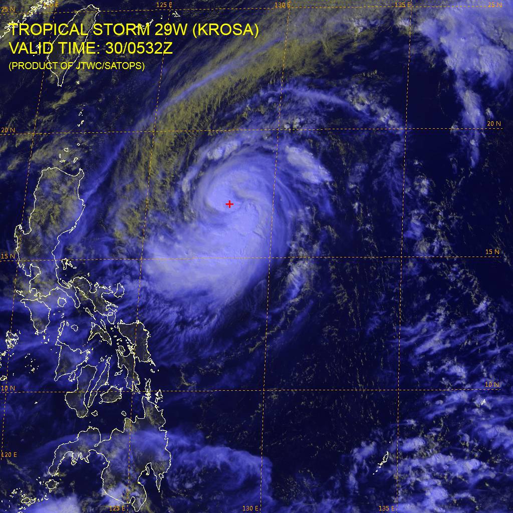
Multispectral satellite imagery from 05:32 UTC on October 30, 2013 (Credit: JTWC/SATOPS)
The upper-level environment continues to be favorable for further development with good poleward and equatorward outflow and weak to moderate (10-15 knot) vertical wind shear.
Krosa is forecast to track generally westward and favorable upper level conditions, in addition to perennially warm sea surface temperatures in the Philippine Sea will ensure rapid intensification through the next 24 hours prior to making landfall into Luzon. Once the system emerges in the South China Sea, it will once again begin to re-intensify. The system is then expected to make a slightly west-southwest turn as it drags across Hainan, eventually emerging in the Gulf of Tonkin. Interaction with Hainan's terrain will gradually erode the system.
(1).gif)
TS Krosa forecast track (Credit: JTWC)
Public storm warning signal #1 was issued by PAGASA for Ilocos Norte, Mt. Province, Abra, Ilocos Sur, La Union, Benguet, Ifugao, Nueva Vizcaya, Quirino, Aurora, Pangasinan, Nueva Ecija and Batanes Group of Islands.
Public storm warning signal #2 was issued for Cagayan, Calayan Group of Island, Babuyan Group of Island, Isabela, Kalinga and Apayao.
Although Krosa is not expected to become major typhoon, it will still bring heavy rains capable of producing flash floods and mudslides. PAGASA expects moderate to heavy rainfall amount from 5.0 – 15.0 mm per hour.
Satellite Animations
- Storm-Centered Infrared (MTSAT2; NOAA/SSD)
- Storm-Centered Infrared (Aviation Color Enhancement) (MTSAT2; NOAA/SSD)
- Storm-Centered Water Vapor (MTSAT2; NOAA/SSD)
- Storm-Centered Visible (MTSAT2; NOAA/SSD)
- Storm-Centered Visible (Colorized) (MTSAT2; NOAA/SSD)
- West Pacific/South China Sea Infrared (MTSAT2; NOAA)
- West Pacific/South China Sea Enhanced Infrared (MTSAT2; NOAA)
- West Pacific/South China Sea Water Vapor (MTSAT2; NOAA)
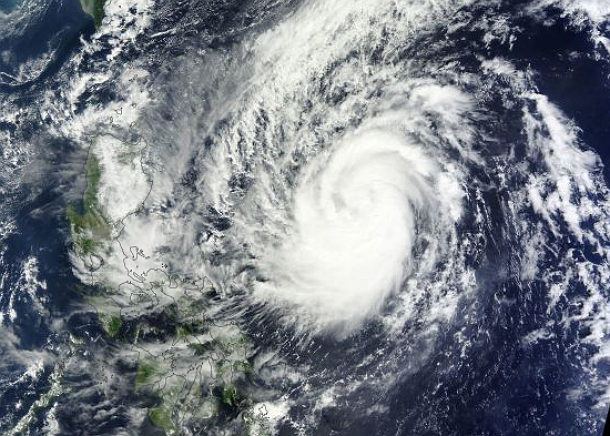
Featured image: Tropical Storm Krosa early on October 30, 2013 (Credit: LANCE Rapid Response/MODIS/Worldview)
Commenting rules and guidelines
We value the thoughts and opinions of our readers and welcome healthy discussions on our website. In order to maintain a respectful and positive community, we ask that all commenters follow these rules:
We reserve the right to remove any comments that violate these rules. By commenting on our website, you agree to abide by these guidelines. Thank you for helping to create a positive and welcoming environment for all.