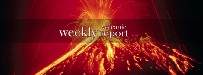
Active volcanoes in the world: January 8 – January 14, 2014
New activity was observed at 5 volcanoes in last 7 days. During the same period, ongoing activity was observed at 9 volcanoes.
New activity/unrest: | Asosan, Kyushu | Cleveland, Chuginadak Island | Pacaya, Guatemala | San Miguel, El Salvador | Sinabung, Sumatra (Indonesia)
Ongoing activity: | Chirinkotan, Kuril Islands | Dukono, Halmahera | Etna, Sicily (Italy) | Fuego, Guatemala | Karymsky, Eastern Kamchatka (Russia) | Kilauea, Hawaii (USA) | Sakurajima, Kyushu | Shiveluch, Central Kamchatka (Russia) | Suwanosejima, Ryukyu Islands and Kyushu
The Weekly Volcanic Activity Report is a cooperative project between the Smithsonian's Global Volcanism Program and the US Geological Survey's Volcano Hazards Program. Updated by 23:00 UTC every Wednesday, notices of volcanic activity posted on these pages are preliminary and subject to change as events are studied in more detail. This is not a comprehensive list of all of Earth's volcanoes erupting during the week, but rather a summary of activity at volcanoes that meet criteria discussed in detail in the "Criteria and Disclaimers" section. Carefully reviewed, detailed reports on various volcanoes are published monthly in the Bulletin of the Global Volcanism Network.
New activity/unrest
ASOSAN, Kyushu
32.881°N, 131.106°E; summit elev. 1592 m
On 27 December 2013 JMA raised the Alert Level for Asosan to 2 (on a scale of 1-5) because volcanic tremor amplitude had been increasing since 20 December. However, on 2 January 2014 the amplitude rapidly decreased. Sulfur dioxide emissions were 1,200 tons per day during 2-9 January and 1,500 tons on 10 January. Volcanic tremor amplitude increased between 0800 and 1900 on 12 January. At 1215 on 13 January a very small eruption from Naka-dake Crater generated a grayish white plume that rose 600 m and drifted S, producing ashfall downwind.
Geologic summary: The 24-km-wide Aso caldera was formed during four major explosive eruptions from 300,000 to 80,000 years ago. These produced voluminous pyroclastic flows that covered much of Kyushu. A group of 17 central cones was constructed in the middle of the caldera, one of which, Naka-dake, is one of Japan's most active volcanoes. It was the location of Japan's first documented historical eruption in 553 AD. The Naka-dake complex has remained active throughout the Holocene. Several other cones have been active during the Holocene, including the Kometsuka scoria cone as recently as about 210 AD. Historical eruptions have largely consisted of basaltic to basaltic-andesite ash emission with periodic Strombolian and phreatomagmatic activity. The summit crater of Naka-dake is accessible by toll road and cable car, and is one of Kyushu's most popular tourist destinations.
CLEVELAND, Chuginadak Island
52.825°N, 169.944°W; summit elev. 1730 m
AVO reported that no further activity at Cleveland had been detected after three brief explosions on 28 and 30 December, and 2 January; satellite images suggested no new lava effusion. On 10 January AVO lowered the Volcanic Alert Level to Advisory and the Aviation Color Code to Yellow.
Geologic summary: Symmetrical Mount Cleveland stratovolcano is situated at the western end of the uninhabited dumbbell-shaped Chuginadak Island in the east-central Aleutians. The 1,730-m-high stratovolcano is the highest of the Islands of Four Mountains group and is one of the most active in the Aleutians. Numerous large lava flows descend its flanks. It is possible that some 18th to 19th century eruptions attributed to Carlisle (a volcano located across the Carlisle Pass Strait to the NW) should be ascribed to Cleveland. In 1944 Cleveland produced the only known fatality from an Aleutian eruption. Recent eruptions from Mt. Cleveland have been characterized by short-lived explosive ash emissions, at times accompanied by lava fountaining and lava flows down the flanks.
PACAYA, Guatemala
14.381°N, 90.601°W; summit elev. 2552 m
INSIVUMEH reported that during 9-10 January explosions at Pacaya ejected lapilli up to 70 m above the crater. White and blue fumarolic plumes drifted SE, and the seismographs recorded constant tremor. On 11 January Strombolian activity was observed, and new craters on the E, S, and W flanks produced lava flows as long as 1.5 km. Activity from the main crater increased; explosions ejected tephra 75 m high and gas plumes rose 200-600 m. CONRED reported evacuations from Villa Canales (14 km NW), El Chupadero (2-2.5 km S), and San Vicente Pacaya (5 km NW). INSIVUMEH noted that RSAM values decreased throughout the day. Activity further decreased on 12 January. Explosions ejected tephra 100 m above the crater and gas plumes rose 200-300 m. Lava effusion, Strombolian activity, and seismicity declined. During 12-13 January lava effusion remained low and lava flows reached 2.8-3 km long. Bluish-white gas plumes rose 300 m. During 13-14 January Strombolian activity ejected lapilli as high as 70 m, and blue and white plumes drifted S.
Geologic summary: Eruptions from Pacaya, one of Guatemala's most active volcanoes, are frequently visible from Guatemala City, the nation's capital. Pacaya is a complex volcano constructed on the southern rim of the 14 x 16 km Pleistocene Amatitlan caldera. A cluster of dacitic lava domes occupies the caldera floor. The Pacaya massif includes the Cerro Grande lava dome and a younger volcano to the SW. Collapse of Pacaya volcano about 1,100 years ago produced a debris-avalanche deposit that extends 25 km onto the Pacific coastal plain and left an arcuate somma rim inside which the modern Pacaya volcano (MacKenney cone) grew. During the past several decades, activity at Pacaya has consisted of frequent Strombolian eruptions with intermittent lava flow extrusion on the flanks of MacKenney cone, punctuated by occasional larger explosive eruptions.
SAN MIGUEL, El Salvador
13.434°N, 88.269°W; summit elev. 2130 m
SNET reported that during 8-10 January activity at San Miguel was low. The number of seismic events fluctuated but remained at low levels, sometimes lower than values recorded before the eruption on 29 December 2013. Gas emissions were also low and characterized by light gray plumes that rose 100-150 m above the crater and drifted S. RSAM values and sulfur dioxide emissions increased for a period of time during 11-12 January, but decreased again to low levels.
Geologic summary: The symmetrical cone of San Miguel volcano, one of the most active in El Salvador, rises from near sea level to form one of the country's most prominent landmarks. A broad, deep crater that has been frequently modified by historical eruptions (recorded since the early 16th century) caps the truncated summit of the towering volcano, which is also known locally as Chaparrastique. Radial fissures on the flanks of the basaltic volcano have fed a series of fresh lava flows, including several erupted during the 17th-19th centuries that reached beyond the base of the volcano on the N, W, and SE sides. The SE-flank lava flows are the largest and form broad sparsely vegetated lava fields.
SINABUNG, Sumatra (Indonesia)
3.17°N, 98.392°E; summit elev. 2460 m
PVMBG described activity at Sinabung during 3-10 January based on observations from a post in the Ndokum Siroga village, 8.5 km away. Each day ash plumes rose as high as 5 km, pyroclastic flows traveled 0.5-4.5 km E, SE, and S, and incandescent material was observed as far as 2 km SE and E. Roaring was periodically heard and burned trees on the S flank were noted on 4 January. Seismicity remained high, with constant tremor, hybrid earthquakes indicating a growing lava dome, and volcanic earthquakes. The number of low-frequency earthquakes dropped dramatically, however. The Alert Level remained at 4 (on a scale of 1-4). Visitors and tourists were prohibited from approaching the crater within a radius of 7 km on the SE flank and 5 km elsewhere. Badan Nacional Penanggulangan Bencana (BNPB) reported that the number of hybrid earthquakes decreased on 11 January and volcanic earthquakes increased. Ash plumes rose 1-5 km and drifted W, and pyroclastic flows traveled 1-4.5 km SE and 1 km E. Several villages in the Namanteran district reported ashfall. The 11 January report noted that the number of displaced people reached 25,516 (7,898 families) in 38 evacuation centers.
Geologic summary: Gunung Sinabung is a Pleistocene-to-Holocene stratovolcano with many lava flows on its flanks. The migration of summit vents along a N-S line gives the summit crater complex an elongated form. The youngest crater of this conical, 2460-m-high andesitic-to-dacitic volcano is at the southern end of the four overlapping summit craters. An unconfirmed eruption was noted in 1881, and solfataric activity was seen at the summit and upper flanks of Sinabung in 1912, although no confirmed historical eruptions were recorded prior to 2010.
Ongoing activity
CHIRINKOTAN, Kuril Islands
48.980°N, 153.480°E; summit elev. 724 m
SVERT reported that a thermal anomaly over Chirinkotan was observed in satellite images on 9 and 12 January. Cloud cover obscured views on the other days during 7-13 January. The Aviation Color Code remained at Yellow.
Geologic summary: The small, mostly unvegetated 3-km-wide island of Chirinkotan occupies the far end of an E-W-trending volcanic chain that extends nearly 50 km west of the central part of the main Kuril Islands arc. Chirinkotan is the emergent summit of a volcano that rises 3000 m from the floor of the Kuril Basin. A small 1-km-wide caldera about 300-400 m deep is open to the SE. Lava flows from a cone within the breached crater reached the north shore of the island. Historical eruptions have been recorded at Chirinkotan since the 18th century. Fresh lava flows also descended the SE flank of Chirinkotan during an eruption in the 1880s that was observed by the English fur trader Captain Snow.
DUKONO, Halmahera
1.68°N, 127.88°E; summit elev. 1335 m
Based on analyses of satellite imagery and wind data, the Darwin VAAC reported that during 13-14 January ash plumes from Dukono rose to an altitude of 3 km (10,000 ft) a.s.l. and drifted about 110 km NE.
Geologic summary: Reports from this remote volcano in northernmost Halmahera are rare, but Dukono has been one of Indonesia's most active volcanoes. More-or-less continuous explosive eruptions, sometimes accompanied by lava flows, occurred from 1933 until at least the mid-1990s, when routine observations were curtailed. During a major eruption in 1550, a lava flow filled in the strait between Halmahera and the N-flank cone of Gunung Mamuya. Dukono is a complex volcano presenting a broad, low profile with multiple summit peaks and overlapping craters. Malupang Wariang, 1 km SW of Dukono's summit crater complex, contains a 700 x 570 m crater that has also been active during historical time.
ETNA, Sicily (Italy)
37.734°N, 15.004°E; summit elev. 3330 m
INGV reported that during 4-9 January 2014 pulsating and almost continuous ash emissions rose from Etna's Northeast Crater (NEC). Volcanic tremor amplitude remained at low levels.
Geologic summary: Mount Etna, towering above Catania, Sicily's second largest city, has one of the world's longest documented records of historical volcanism, dating back to 1500 BC. Historical lava flows cover much of the surface of this massive basaltic stratovolcano, the highest and most voluminous in Italy. Two styles of eruptive activity typically occur at Etna. Persistent explosive eruptions, sometimes with minor lava emissions, take place from one or more of the three prominent summit craters, the Central Crater, NE Crater, and SE Crater. Flank eruptions, typically with higher effusion rates, occur less frequently and originate from fissures that open progressively downward from near the summit. A period of more intense intermittent explosive eruptions from Etna's summit craters began in 1995. The active volcano is monitored by the Instituto Nazionale di Geofisica e Volcanologia (INGV) in Catania.
FUEGO, Guatemala
14.473°N, 90.880°W; summit elev. 3763 m
In a special report, INSIVUMEH reported that on 7 January seismicity at Fuego increased. Explosions generated shock waves that vibrated structures more than 15 km away, and rumbling noises were audible 30 km away. Ash plumes rose 4.2 km above the crater and drifted 10 km SW. Lava flowed 500 m down the SW flank and produced avalanches that reached vegetated areas. During 9-10 January Vulcanian explosions generated shock waves detected within 10 km, ejected pulses of incandescent material 100 m high, and produced ash plumes that rose 300 m and drifted 10 km NE. Avalanches descended the Ceniza (SSW), Trinidad (S), and Taniluya (SW) drainages, and lava flows continued to descend the flanks. During 10-11 January explosions produced shock waves, and ash plumes that rose 650 m and drifted S, SW, and W. Crater incandescence was observed at night. During 12-13 January explosions caused shock waves that vibrated structures in Panimaché I and II (8 km SW), Morelia (9 km SW), Santa Sofía (12 km SW), Ceilán, La Rochela, and San Andrés Osuna. Ash plumes rose 350-650 m and drifted 10 km SW and W. Incandescent material was ejected 200 m above the crater and avalanches descended the Taniluya, Ceniza, Trinidad, Las Lajas (SE), and Honda (E) drainages. A 200-m-long lava flow traveled down the Trinidad drainage. Seismicity remained high on 13 January. Ashfall was reported in Panimaché, Morelia, and Sangre de Cristo (8 km WSW). A 500-m-long lava flow remained active in the Ceniza drainage. On 14 January explosions generated shock waves audible 8 km away, ejected incandescent material 150 m high, and produced ash plumes that rose 300-800 m and drifted 8 km W and SW. Avalanches again descended multiple flanks. Ash fell in Santa Sofía, Panimaché, Morelia, and Sangre de Cristo.
Geologic summary: Volcán Fuego, one of Central America's most active volcanoes, is one of three large stratovolcanoes overlooking Guatemala's former capital, Antigua. The scarp of an older edifice, Meseta, lies between 3,763-m-high Fuego and its twin volcano to the N, Acatenango. Construction of Meseta volcano continued until the late Pleistocene or early Holocene, after which growth of the modern Fuego volcano continued the southward migration of volcanism that began at Acatenango. Frequent vigorous historical eruptions have been recorded at Fuego since the onset of the Spanish era in 1524, and have produced major ashfalls, along with occasional pyroclastic flows and lava flows. The last major explosive eruption from Fuego took place in 1974, producing spectacular pyroclastic flows visible from Antigua.
KARYMSKY, Eastern Kamchatka (Russia)
54.05°N, 159.45°E; summit elev. 1536 m
KVERT reported that Vulcanian and Strombolian activity at Karymsky continued during 3-10 January. Satellite images detected a bright thermal anomaly on the volcano daily, and an ash plume that drifted 10 km SSE on 8 January. The Aviation Color Code remained at Orange.
Geologic summary: Karymsky, the most active volcano of Kamchatka's eastern volcanic zone, is a symmetrical stratovolcano constructed within a 5-km-wide caldera that formed about 7,600-7,700 radiocarbon years ago. Construction of the Karymsky stratovolcano began about 2,000 years later. The latest eruptive period began about 500 years ago, following a 2,300-year quiescence. Much of the cone is mantled by lava flows less than 200 years old. Historical eruptions have been Vulcanian or Vulcanian-Strombolian with moderate explosive activity and occasional lava flows from the summit crater. Most seismicity preceding Karymsky eruptions has originated beneath Akademia Nauk caldera, which is located immediately S of Karymsky volcano and erupted simultaneously with Karymsky in 1996.
KILAUEA, Hawaii (USA)
19.421°N, 155.287°W; summit elev. 1222 m
During 8-14 January 2014 HVO reported that the circulating lava lake occasionally rose and fell in the deep pit within Kilauea's Halema'uma'u Crater. The plume from the vent continued to deposit variable amounts of ash, spatter, and Pele's hair onto nearby areas. At Pu'u 'O'o Crater, glow emanated from spatter cones on the N and S portions of the crater floor. Fed by the NE spatter cone, the Kahauale’a 2 lava flow had reached 7.5 km long by 9 January (based on a satellite image), and was active with scattered break-out flows that burned the forest N of Pu'u 'O'o.
Geologic summary: Kilauea, one of five coalescing volcanoes that comprise the island of Hawaii, is one of the world's most active volcanoes. Eruptions at Kilauea originate primarily from the summit caldera or along one of the lengthy E and SW rift zones that extend from the caldera to the sea. About 90% of the surface of Kilauea is formed of lava flows less than about 1,100 years old; 70% of the volcano's surface is younger than 600 years. A long-term eruption from the East rift zone that began in 1983 has produced lava flows covering more than 100 sq km, destroying nearly 200 houses and adding new coastline to the island.
SAKURAJIMA, Kyushu
31.585°N, 130.657°E; summit elev. 1117 m
JMA reported that during 6-10 January two explosions from Sakurajima's Showa Crater ejected tephra as far as 1,300 m. The Alert Level remained at 3 (on a scale of 1-5). The Tokyo VAAC reported that an explosion on 9 January generated a plume that rose to an altitude of 1.8 km (6,000 ft) a.s.l. and drifted SE. A pilot observed an ash plume drifting SE on 14 January.
Geologic summary: Sakura-jima, one of Japan's most active volcanoes, is a post-caldera cone of the Aira caldera at the northern half of Kagoshima Bay. Eruption of the voluminous Ito pyroclastic flow was associated with the formation of the 17 x 23-km-wide Aira caldera about 22,000 years ago. The construction of Sakura-jima began about 13,000 years ago and built an island that was finally joined to the Osumi Peninsula during the major explosive and effusive eruption of 1914. Activity at the Kita-dake summit cone ended about 4,850 years ago, after which eruptions took place at Minami-dake. Frequent historical eruptions, recorded since the 8th century, have deposited ash on Kagoshima, one of Kyushu's largest cities, located across Kagoshima Bay only 8 km from the summit. The largest historical eruption took place during 1471-76.
SHIVELUCH, Central Kamchatka (Russia)
56.653°N, 161.360°E; summit elev. 3283 m
KVERT reported that during 3-10 January a newer lava dome continued to extrude onto the NW part of Shiveluch's older lava dome. Lava-dome extrusion was accompanied by hot avalanches, incandescence, and fumarolic activity. Moderate ash explosions generated ash plumes that rose to altitudes of 4-5 km (13,100-16,400) a.s.l. A thermal anomaly was detected daily in satellite images, and ash plumes drifted 360 km SW and 278 km WNW on 7 and 9 January, respectively. On 12 January strong explosions generated ash plumes that rose to altitudes of 7-8 km (23,000-26,200 ft) a.s.l. and drifted ESE. The next day a video camera recorded an ash plume from an explosion that again rose to altitudes of 7-8 km (23,000-26,200 ft) a.s.l. The ash plume drifted 50 km WSW. According to a news report minor amounts of ash fell in Klyuchi Village, 50 km SW. The Aviation Color Code remained at Orange.
Geologic summary: The high, isolated massif of Shiveluch volcano (also spelled Sheveluch) rises above the lowlands NNE of the Kliuchevskaya volcano group and forms one of Kamchatka's largest and most active volcanoes. The currently active Molodoy Shiveluch lava-dome complex was constructed during the Holocene within a large breached caldera formed by collapse of the massive late-Pleistocene Strary Shiveluch volcano. At least 60 large eruptions of Shiveluch have occurred during the Holocene, making it the most vigorous andesitic volcano of the Kuril-Kamchatka arc. Frequent collapses of lava-dome complexes, most recently in 1964, have produced large debris avalanches whose deposits cover much of the floor of the breached caldera. Intermittent explosive eruptions began in the 1990s from a new lava dome that began growing in 1980. The largest historical eruptions from Shiveluch occurred in 1854 and 1964.
SUWANOSEJIMA, Kyushu
29.635°N, 129.716°E; summit elev. 799 m
Based on information from JMA, the Tokyo VAAC reported that explosions from Suwanosejima during 8-9 January sometimes generated plumes that rose to an altitude 1.2 km (4,000 ft) a.s.l. and drifted NE and SE.
Geologic summary: The 8-km-long, spindle-shaped island of Suwanose-jima in the northern Ryukyu Islands consists of an andesitic stratovolcano with two historically active summit craters. Only about 50 persons live on the sparsely populated island. The summit of the volcano is truncated by a large breached crater extending to the sea on the east flank that was formed by edifice collapse. Suwanose-jima, one of Japan's most frequently active volcanoes, was in a state of intermittent strombolian activity from On-take (Otake), the NE summit crater, that began in 1949 and lasted until 1996, after which periods of inactivity lengthened. The largest historical eruption took place in 1813-14, when thick scoria deposits blanketed residential areas, and the SW crater produced two lava flows that reached the western coast. At the end of the eruption the summit of On-take collapsed forming a large debris avalanche and creating the horseshoe-shaped Sakuchi caldera, which extends to the eastern coast. The island remained uninhabited for about 70 years after the 1813-1814 eruption. Lava flows reached the eastern coast of the island in 1884.
Source: GVP
Commenting rules and guidelines
We value the thoughts and opinions of our readers and welcome healthy discussions on our website. In order to maintain a respectful and positive community, we ask that all commenters follow these rules.