Tropical Storm “Tapah” formed in Northwestern Pacific Ocean
A tropical storm warning is in force today for Saipan and Tinian, Commonwealth of the Northern Mariana Islands, as Tropical Storm Tapah moves north through the Northwestern Pacific Ocean.
In addition to the tropical storm warning, a typhoon watch is in effect for Alamagan and Pagan as Tapah is expected to strengthen into a typhoon sometime on April 29 and continue in a generally northerly direction over the next couple of days.
Tapah will slowly pass through the Northern Mariana Islands and will be far enough away that the winds it brings to Guam and Rota will not be of tropical-storm strength.
Education Commissioner Rita A. Sablan announced that classes in Saipan and Tinian public schools have been canceled.
A port heavy weather condition (PHWC) Yankee is issued for the ports of Saipan and Tinian: All commercial vessels greater than or equal to 200 gross tons must depart and all inbound vessels are prohibited from entering. All cargo/bunker operations must stop. No terminal, facility, vessel or marina operations are permitted.
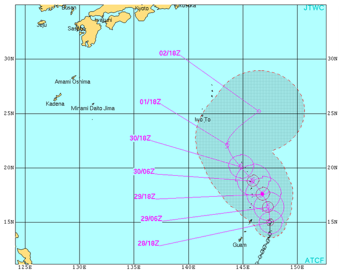
TS Tapah forecast track. Image credit: JTWC
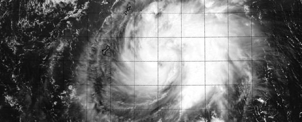
NASA-NOAA's Suomi NPP satellite captured an image of Tapah (below) as it passed overhead on April 28 at 03:21 UTC and the VIIRS instrument aboard captured a visible image that showed an eye surrounded by bands of thunderstorms around the center of circulation, and a large band of thunderstorms wrapping around the eastern quadrant and spiraling into the center.
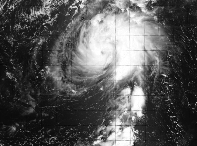
Image credit: NRL/NASA/NOAA
On April 28 at 15:00 UTC, Tropical Storm Tapah had maximum sustained winds near 50 knots/57.5 mph/92.6 km/h. It was centered near 14.2 north latitude and 147.4 east longitude, about 121 nautical miles/139 miles/224 km east of Andersen Air Force Base, Guam. Tapah is moving north at 6 knots/6.9 mph/11.1 km/h and the Joint Typhoon Warning Center expects a turn to the northwest.
A gradual weakening trend is expected on Wednesday.
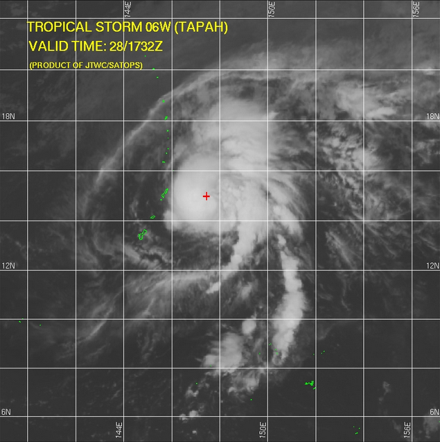
TS Tapah – IR satellite image on April 28, 2014. Image credit: JTWC/SATOPS
Featured image: NRL/NASA/NOAA
Commenting rules and guidelines
We value the thoughts and opinions of our readers and welcome healthy discussions on our website. In order to maintain a respectful and positive community, we ask that all commenters follow these rules:
We reserve the right to remove any comments that violate these rules. By commenting on our website, you agree to abide by these guidelines. Thank you for helping to create a positive and welcoming environment for all.