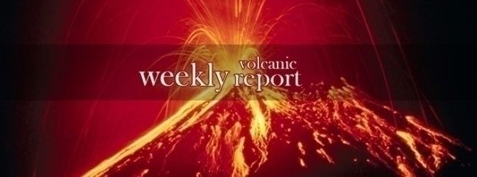
Active volcanoes in the world: June 18 -24, 2014
New activity/unrest was observed at 8 volcanoes from June 18 – 24, 2014. Ongoing activity was reported for 18 volcanoes.
New activity/unrest: Bezymianny, Central Kamchatka (Russia) | Kusatsu-Shiranesan, Honshu (Japan) | Pavlof, United States | Piton de la Fournaise, Reunion Island (France) | Sangeang Api, Indonesia | Semisopochnoi, United States | Stromboli, Aeolian Islands (Italy) | Zhupanovsky, Eastern Kamchatka (Russia)
Ongoing activity: Aira, Kyushu (Japan) | El Misti, Peru | Etna, Sicily (Italy) | Fuego, Guatemala | Karymsky, Eastern Kamchatka (Russia) | Kilauea, Hawaiian Islands (USA) | Pagan, Mariana Islands (USA) | Poás, Costa Rica | Popocatépetl, Mexico | Raung, Eastern Java (Indonesia) | Reventador, Ecuador | Santa María, Guatemala | Shishaldin, Fox Islands (USA) | Shiveluch, Central Kamchatka (Russia) | Sinabung, Indonesia | Suwanosejima, Ryukyu Islands (Japan) | Tungurahua, Ecuador | Ubinas, Peru
The Weekly Volcanic Activity Report is a cooperative project between the Smithsonian's Global Volcanism Program and the US Geological Survey's Volcano Hazards Program. Updated by 23:00 UTC every Wednesday, notices of volcanic activity posted on these pages are preliminary and subject to change as events are studied in more detail.
New activity/unrest
Bezymianny, Central Kamchatka (Russia)
55.978°N, 160.587°E, Summit elev. 2882 m
KVERT reported that Bezymianny’s activity gradually increased during the week; shallow earthquakes were registered. Video data captured moderate gas-and-steam plumes rising from the volcano. Satellite data showed a thermal anomaly over the lava dome on 12, 16, and 18 June. The Aviation Color Code remained at Orange.
Geologic summary: Prior to its noted 1955-56 eruption, Bezymianny volcano had been considered extinct. The modern Bezymianny, much smaller in size than its massive neighbors Kamen and Kliuchevskoi, was formed about 4700 years ago over a late-Pleistocene lava-dome complex and an ancestral volcano that was built between about 11,000-7000 years ago. Three periods of intensified activity have occurred during the past 3000 years. The latest period, which was preceded by a 1000-year quiescence, began with the dramatic 1955-56 eruption. This eruption, similar to that of Mount St. Helens in 1980, produced a large horseshoe-shaped crater that was formed by collapse of the summit and an associated lateral blast. Subsequent episodic but ongoing lava-dome growth, accompanied by intermittent explosive activity and pyroclastic flows, has largely filled the 1956 crater.
Kusatsu-Shiranesan, Honshu (Japan)
36.618°N, 138.528°E, Summit elev. 2165 m
JMA reported that anomalous temperatures and deformation of Kusatsu-Shirane’s crater, which began earlier in March, continued during 13-20 June. This activity has been focused in the area immediately of N of Mizugama crater. Elevated seismicity was also reported, although tremor was absent. The Alert Level was raised to 2 (on a scale of 1-5).
Geologic summary: The summit of Kusatsu-Shiranesan volcano, located immediately north of Asama volcano, consists of a series of overlapping pyroclastic cones and three crater lakes. The andesitic-to-dacitic volcano was formed in three eruptive stages beginning in the early to mid Pleistocene. The Pleistocene Oshi pyroclastic flow produced extensive welded tuffs and non-welded pumice that covers much of the east, south and SW flanks. The latest eruptive stage began about 14,000 years ago. All historical eruptions have consisted of phreatic explosions from the acidic crater lakes or their margins. Fumaroles and hot springs that dot the flanks have strongly acidified many rivers draining from the volcano. The crater was the site of active sulfur mining for many years during the 19th and 20th centuries.
Pavlof, United States
55.42°N, 161.887°W, Summit elev. 2519 m
AVO reported that seismicity at Pavlof continued steadily with intermittent seismic events during 18-23 June. The Aviation Color Code remained at Orange and the Volcano Alert Level remained at Watch.
Geologic summary: The most active volcano of the Aleutian arc, Pavlof is a 2519-m-high Holocene stratovolcano that was constructed along a line of vents extending NE from the Emmons Lake caldera. Pavlof and its twin volcano to the NE, 2142-m-high Pavlof Sister, form a dramatic pair of symmetrical, glacier-covered stratovolcanoes that tower above Pavlof and Volcano bays. A third cone, Little Pavlof, is a smaller volcano on the SW flank of Pavlof volcano, near the rim of Emmons Lake caldera. Unlike Pavlof Sister, Pavlof has been frequently active in historical time, typically producing Strombolian to Vulcanian explosive eruptions from the summit vents and occasional lava flows. The active vents lie near the summit on the north and east sides. The largest historical eruption took place in 1911, at the end of a 5-year-long eruptive episode, when a fissure opened on the N flank, ejecting large blocks and issuing lava flows.
Piton de la Fournaise, Reunion Island (France)
21.244°S, 55.708°E, Summit elev. 2632 m
OVPDLF reported that an eruption began at Piton de la Fournaise at 0120 on 21 June 2014 following a period of elevated seismicity. This new activity marks the end of more than three years of quiescence.
During 7-20 June volcano-tectonic and rockfall-type earthquakes were recorded, with the largest number occurring on 17 June. The locations of these earthquakes were relatively consistent between 500 and 1,200 m a.s.l. within Dolomieu crater. There were neither significant gas emissions nor indicators of pre-eruptive deformation. On 19 June, a field campaign by the Observatory team confirmed the activity detected by the permanent monitoring network (geodetic, thermal, and gas).
At 0006 on 21 June the seismic crises escalated and continued for 74 minutes. Localized deformation began at 0020 and continued for ~3 hours. Tremor began at 0120 and incandescence was observed by the remote cameras at 0135. The eruption was entirely contained within the Enclos Fouqué area on the ESE side of the central cone. Aerial observations by helicopter revealed an active lava fountain from a fissure that was within view of the Piton Bert webcamera. The fountaining built a spatter rampart and two lava flows extended ~1.5 km from the fissure. One lava flow extended 250 m after passing the Langlois crater (~2 km SE of Dolomieu crater); the second lava flow passed that crater on the E and S edge and extended an additional 500 m.
Public access to the volcano was restricted on 21 June and Alert Level 1 (“probable or imminent eruption”) was announced.
Geologic summary: The massive Piton de la Fournaise basaltic shield volcano on the French island of Réunion in the western Indian Ocean is one of the world's most active volcanoes. Much of its more than 530,000-year history overlapped with eruptions of the deeply dissected Piton des Neiges shield volcano to the NW. Three calderas formed at about 250,000, 65,000, and less than 5000 years ago by progressive eastward slumping of the volcano. Numerous pyroclastic cones dot the floor of the calderas and their outer flanks. Most historical eruptions have originated from the summit and flanks of Dolomieu, a 400-m-high lava shield that has grown within the youngest caldera, which is 8 km wide and breached to below sea level on the eastern side. More than 150 eruptions, most of which have produced fluid basaltic lava flows, have occurred since the 17th century. Only six eruptions, in 1708, 1774, 1776, 1800, 1977, and 1986, have originated from fissures on the outer flanks of the caldera. The Piton de la Fournaise Volcano Observatory, one of several operated by the Institut de Physique du Globe de Paris, monitors this very active volcano.
Sangeang Api, Indonesia
8.2°S, 119.07°E, Summit elev. 1949 m
PVMBG reported seismic and visual monitoring of Sangeang Api during 1-17 June. During clear conditions, incandescence at the summit and white-and-gray plumes (100-1,500 m above the summit) were visible. On 1 June seismicity dramatically decreased, and as of 17 June was still declining. The Alert Level was reduced from 3 to 2 (on a scale of 1-4) on 17 June.
Geologic summary: Sangeang Api volcano, one of the most active in the Lesser Sunda Islands, forms a small 13-km-wide island off the NE coast of Sumbawa Island. Two large trachybasaltic-to-
Semisopochnoi, United States
51.93°N, 179.58°E, Summit elev. 1221 m
AVO reported that the earthquake swarm that had started at Semisopochnoi on 9 June continued until 23 June. No eruptive activity was indicated. The Aviation Color Code remained at Yellow and the Volcano Alert Level remained at Advisory.
Geologic summary: Semisopochnoi, the largest subaerial volcano of the western Aleutians, is 20 km wide at sea level and contains an 8-km-wide caldera. It formed as a result of collapse of a low-angle, dominantly basaltic volcano following the eruption of a large volume of dacitic pumice. The high point of the island is 1221-m-high Anvil Peak, a double-peaked late-Pleistocene cone that forms much of the island's northern part. The three-peaked 774-m-high Mount Cerberus volcano was constructed during the Holocene within the caldera. Each of the peaks contains a summit crater; lava flows on the northern flank of Cerberus appear younger than those on the southern side. Other post-caldera volcanoes include the symmetrical 855-m-high Sugarloaf Peak SSE of the caldera and Lakeshore Cone, a small cinder cone at the edge of Fenner Lake in the NE part of the caldera. Most documented historical eruptions have originated from Cerberus, although Coats (1950) considered that both Sugarloaf and Lakeshore Cone within the caldera could have been active during historical time.
Stromboli, Aeolian Islands (Italy)
38.789°N, 15.213°E, Summit elev. 924 m
INGV reported two episodes of effusive activity at Stromboli, one on 17 June and another on 22 June. Activity on 17 June occurred in the morning within the central part of the crater terrace (Bocca S2) and included explosive spattering. This activity lasted for a few hours and produced a small lava flow directed toward Pizzo Sopra la Fossa. A sharp increase in Strombolian activity began from all of the craters on 22 June, depositing voluminous material along the Sciara del Fuoco. A lava flow ~200 m long extended from the mouth of N2 (within the N part of the crater terrace). During the evening this flow slowed, and then stalled the following day when Strombolian activity decreased.
Geologic summary: Spectacular incandescent nighttime explosions at Stromboli volcano have long attracted visitors to the "Lighthouse of the Mediterranean." Stromboli, the NE-most of the Aeolian Islands, has lent its name to the frequent mild explosive activity that has characterized its eruptions throughout much of historical time. The small, 924-m-high island of Stromboli is the emergent summit of a volcano that grew in two main eruptive cycles, the last of which formed the western portion of the island. The Neostromboli eruptive period from about 13,000 to 5000 years ago was followed by formation of the modern Stromboli edifice. The active summit vents are located at the head of the Sciara del Fuoco, a prominent horseshoe-shaped scarp formed about 5000 years ago as a result of the most recent of a series of slope failures that extend to below sea level. The modern volcano has been constructed within this scarp, which funnels pyroclastic ejecta and lava flows to the NW. Essentially continuous mild strombolian explosions, sometimes accompanied by lava flows, have been recorded at Stromboli for more than a millennium.
Zhupanovsky, Eastern Kamchatka (Russia)
53.59°N, 159.147°E, Summit elev. 2958 m
KVERT reported that, during 14-19 June, satellite images over Zhupanovsky detected gas-and-steam plumes with discrete ash plumes up to 4.5 km (14,800 ft)a.s.l. drifting up to 70 km SE and NW from the volcano. Satellite images detected a thermal anomaly on 14-15 and 17-19 June. The Aviation Color Code was raised from Yellow to Orange.
Tokyo VAAC reported ash plumes during 18-20 June drifting NW and later NE. Plume heights were in range of 3,000-8,500 m (9,800-28,000 ft) a.s.l.
Geologic summary: The Zhupanovsky volcanic massif consists of four overlapping stratovolcanoes along a WNW-trending ridge. The elongated volcanic complex was constructed within a Pliocene-early Pleistocene caldera whose rim is exposed only on the eastern side. Three of the stratovolcanoes were built during the Pleistocene, the fourth is Holocene in age and was the source of all of Zhupanovsky's historical eruptions. An early Holocene stage of frequent moderate and weak eruptions from 7000 to 5000 years before present (BP) was succeeded by a period of infrequent larger eruptions that produced pyroclastic flows. The last major eruption took place about 800-900 years BP. Historical eruptions have consisted of relatively minor explosions from the third cone.
Ongoing activity
Aira, Kyushu (Japan)
31.593°N, 130.657°E, Summit elev. 1117 m
JMA reported that during 13-23 June, 4-10 explosions occurred each day from Showa Crater at Aira Caldera’s Sakurajima volcano. Tephra ejected from these events landed as far as 1,800 m away. A significant explosion on 19 June lasted for 17 minutes; the plume rose ~3,000 m above the crater rim and tephra was ejected to a distance of 1,300-1,800 m. Field surveys conducted on 12 June determined an SO2 flux of 270 tons/day (previous measurement of 2,300 tons/day was measured on 9 May). During this reporting period there was no activity from Minamidake summit crater.
The Tokyo VAAC reported that volcanic ash was visible in satellite images at 0541 on 23 June. The plume reached 1,830 m (6,000 ft) a.s.l. and drifted SE.
Geologic summary: The Aira caldera in the northern half of Kagoshima Bay contains the post-caldera Sakurajima volcano, one of Japan's most active. Eruption of the voluminous Ito pyroclastic flow accompanied formation of the 17 x 23 km caldera about 22,000 years ago. The smaller Wakamiko caldera was formed during the early Holocene in the NE corner of the Aira caldera, along with several post-caldera cones. The construction of Sakurajima began about 13,000 years ago on the southern rim of Aira caldera and built an island that was finally joined to the Osumi Peninsula during the major explosive and effusive eruption of 1914. Activity at the Kitadake summit cone ended about 4850 years ago, after which eruptions took place at Minamidake. Frequent historical eruptions, recorded since the 8th century, have deposited ash on Kagoshima, one of Kyushu's largest cities, located across Kagoshima Bay only 8 km from the summit. The largest historical eruption took place during 1471-76.
El Misti, Peru
16.294°S, 71.409°W, Summit elev. 5822 m
Instituto Geofísico del Perú (IGP) reported that, during the last 12 months, seismicity at El Misti was dominated by volcano-tectonic (VT) earthquakes. Two seismic swarms (more than 100 events per day) occurred during the last three months, on 19 May and 3 June. An increase in tremor was noted in April, although the total duration did not exceed 10 minutes and was generally low-amplitude. Long-period seismicity was not significant. In the last 15 days, seismicity increased slightly and tremor was recorded daily.
Geologic summary: El Misti, Peru's most well-known volcano, is a symmetrical andesitic stratovolcano with nested summit craters that towers above the city of Arequipa. The modern symmetrical cone, constructed within a small 1.5 x 2 km wide summit caldera that formed between about 13,700 and 11,300 years ago, caps older Pleistocene volcanoes that underwent caldera collapse about 50,000 years ago. A large scoria cone has grown with the 830-m-wide outer summit crater of El Misti. At least 20 tephra-fall deposits and numerous pyroclastic-flow deposits have been documented during the past 50,000 years, including a pyroclastic flow that traveled 12 km to the south about 2000 years ago. El Misti's most recent activity has been dominantly pyroclastic, and strong winds have formed a parabolic dune field of volcanic ash extending up to 20 km downwind. An eruption in the 15th century affected Inca inhabitants living near the volcano. Some reports of historical eruptions may represent increased fumarolic activity.
Etna, Sicily (Italy)
37.734°N, 15.004°E, Summit elev. 3330 m
INGV reported that weak Strombolian activity at Etna's New Southeast Crater (NSEC) continued through 10 June. Some explosions ejected incandescent pyroclastic material a few tens of meters above the crater rim that occasionally fell onto the outer flanks.
On 14 June a new eruptive episode began within the NSEC, beginning with near-continuous Strombolian explosions and lava fountaining. Fine ash emissions were concurrent with lava that began to overflow the edge of the SE crater, forming a flow that continued downhill on the W wall of Valle del Bove. During the morning of 15 June the overflowing lava followed the fissure that had been formed on 28 November 2013. A spatter cone also formed in the E sector of the cone. During 14-15 June volcanic tremor increased sharply and remained at a medium-high level until 18 June when it returned to normal levels.
INGV noted that this activity was similar to the episode of effusive lava emissions observed during 14-16 and 19-31 December 2013 in terms of duration and intensity.
Geologic summary: Mount Etna, towering above Catania, Sicily's second largest city, has one of the world's longest documented records of historical volcanism, dating back to 1500 BCE. Historical lava flows of basaltic composition cover much of the surface of this massive volcano, whose edifice is the highest and most voluminous in Italy. The Mongibello stratovolcano, truncated by several small calderas, was constructed during the late Pleistocene and Holocene over an older shield volcano. The most prominent morphological feature of Etna is the Valle del Bove, a 5 x 10 km horseshoe-shaped caldera open to the east. Two styles of eruptive activity typically occur at Etna. Persistent explosive eruptions, sometimes with minor lava emissions, take place from one or more of the three prominent summit craters, the Central Crater, NE Crater, and SE Crater (the latter formed in 1978). Flank vents, typically with higher effusion rates, are less frequently active and originate from fissures that open progressively downward from near the summit (usually accompanied by strombolian eruptions at the upper end). Cinder cones are commonly constructed over the vents of lower-flank lava flows. Lava flows extend to the foot of the volcano on all sides and have reached the sea over a broad area on the SE flank.
Fuego, Guatemala
14.473°N, 90.88°W, Summit elev. 3763 m
INSIVUMEH reported that, during 18-24 June, 7-23 explosions occurred per day at Fuego, generating weak-to-moderate ash plumes to 3,900-4,400 m (12,800-14,400 ft) a.s.l. and drifting with prevailing winds. The explosions during 17-18, 22, and 24 June were accompanied by rumbling sounds, some resembling jet engines that persisted for 1-5 minutes. Small avalanches occurred within the crater and local drainages due to explosion shockwaves on 19 June.
Fine ashfall from explosions on 18-19 June was reported in towns within 15 km of the summit, mainly El Porvenir (8 km ENE), Los Yucales (12 km SW), Santa Sofía (12 km SW), Morelia (10 km SW), and Panimaché (I and II, ~8 km SW). Additionally, ashfall was reported in Sangre de Cristo on 18 June. During 20, 22, and 24 June, incandescence from the summit reached 100-150 m above the crater rim and formed weak avalanches in the immediate summit area. Fumarolic activity continued during 18-24 June, generating white plumes rising to less than 4,200 m (13,800 ft) a.s.l.
Geologic summary: Volcán Fuego, one of Central America's most active volcanoes, is one of three large stratovolcanoes overlooking Guatemala's former capital, Antigua. The scarp of an older edifice, Meseta, lies between 3763-m-high Fuego and its twin volcano to the north, Acatenango. Construction of Meseta volcano dates back to about 230,000 years and continued until the late Pleistocene or early Holocene. Collapse of Meseta volcano may have produced the massive Escuintla debris-avalanche deposit, which extends about 50 km onto the Pacific coastal plain. Growth of the modern Fuego volcano followed, continuing the southward migration of volcanism that began at Acatenango. In contrast to the mostly andesitic Acatenango volcano, eruptions at Fuego have become more mafic with time, and most historical activity has produced basaltic rocks. Frequent vigorous historical eruptions have been recorded at Fuego since the onset of the Spanish era in 1524, and have produced major ashfalls, along with occasional pyroclastic flows and lava flows.
Karymsky, Eastern Kamchatka (Russia)
54.05°N, 159.45°E, Summit elev. 1536 m
KVERT reported that Strombolian and weak Vulcanian activity continued at Karymsky during 14-19 June. Satellite images detected a thermal anomaly on 13 and 16 June; clouds obscured the volcano on the other days. The Aviation Color Code remained at Orange.
Geologic summary: Karymsky, the most active volcano of Kamchatka's eastern volcanic zone, is a symmetrical stratovolcano constructed within a 5-km-wide caldera that formed during the early Holocene. The caldera cuts the south side of the Pleistocene Dvor volcano and is located outside the north margin of the large mid-Pleistocene Polovinka caldera, which contains the smaller Akademia Nauk and Odnoboky calderas. Most seismicity preceding Karymsky eruptions originated beneath Akademia Nauk caldera, which is located immediately south of Karymsky volcano. The caldera enclosing Karymsky volcano formed about 7600-7700 radiocarbon years ago; construction of the Karymsky stratovolcano began about 2000 years later. The latest eruptive period began about 500 years ago, following a 2300-year quiescence. Much of the cone is mantled by lava flows less than 200 years old. Historical eruptions have been vulcanian or vulcanian-strombolian with moderate explosive activity and occasional lava flows from the summit crater.
Kilauea, Hawaiian Islands (USA)
19.421°N, 155.287°W, Summit elev. 1222 m
During 18-23 June HVO reported that the circulating lava lake occasionally rose and fell in the deep pit within Kilauea's Halema‘uma‘u Crater. The lava-lake level dropped several meters on 21 June then returned to an estimated 34-35 m below the floor of Halema‘uma‘u Crater by 22 June. Gas emissions remained elevated. The ambient SO2 concentrations near the vent varied greatly but remained higher than 10 ppm, and frequently exceeded 50 ppm (upper limit of the detector) during times with moderate trade winds. The plume from the vent continued to deposit variable amounts of ash, spatter, and Pele's hair onto nearby areas; smaller particles may have been dropped several kilometers away.
At Pu‘u ‘O‘o Crater, glow emanated from spatter cones on the N, SE, and S portions of the crater floor, and from a small lava lake in the NE spatter cone. On 17 June geologists mapped five small breakouts as far as 7 km NE from Pu‘u ‘O‘o. The local webcam captured views of the active break-out flows at the N base of Pu‘u ‘O‘o cone as well as distant smoke plumes from the slow-moving lava flow burning vegetation along the NE margin of the Kahauale‘a 2 flow. Overall, however, this slow-moving flow has appeared to be weakening over the past few months.
The Aviation Color Code remained at Orange and the Volcano Alert Level remained at Watch.
Geologic summary:Kilauea volcano, which overlaps the east flank of the massive Mauna Loa shield volcano, has been Hawaii's most active volcano during historical time. Eruptions of Kilauea are prominent in Polynesian legends; written documentation extending back to only 1820 records frequent summit and flank lava flow eruptions that were interspersed with periods of long-term lava lake activity that lasted until 1924 at Halemaumau crater, within the summit caldera. The 3 x 5 km caldera was formed in several stages about 1500 years ago and during the 18th century; eruptions have also originated from the lengthy East and SW rift zones, which extend to the sea on both sides of the volcano. About 90% of the surface of the basaltic shield volcano is formed of lava flows less than about 1100 years old; 70% of the volcano's surface is younger than 600 years. A long-term eruption from the East rift zone that began in 1983 has produced lava flows covering more than 100 sq km, destroying nearly 200 houses and adding new coastline to the island.
Pagan, Mariana Islands (USA)
18.13°N, 145.8°E, Summit elev. 570 m
Low-level unrest continued at Pagan during the week of 20 June; seismicity remained above background levels. A steam-and-gas plume was visible in web camera and clear satellite images. The Aviation Color Code remained at Yellow and the Volcano Alert Level remained at Advisory.
Geologic summary: Pagan Island, the largest and one of the most active of the Mariana Islands volcanoes, consists of two stratovolcanoes connected by a narrow isthmus. Both North and South Pagan stratovolcanoes were constructed within calderas, 7 and 4 km in diameter, respectively. The 570-m-high Mount Pagan at the NE end of the island rises above the flat floor of the northern caldera, which may have formed less than 1000 years ago. South Pagan is a 548-m-high stratovolcano with an elongated summit containing four distinct craters. Almost all of the historical eruptions of Pagan, which date back to the 17th century, have originated from North Pagan volcano. The largest eruption of Pagan during historical time took place in 1981 and prompted the evacuation of the sparsely populated island.
Poás, Costa Rica
10.2°N, 84.233°W, Summit elev. 2708 m
OVSICORI-UNA reported that a phreatic eruption from Poás was recorded at 1008 on 20 June. The explosion generated a plume 200 m above the crater lake. The plume was mainly water vapor with entrained lake sediments (which contained sulfur precipitates and altered rocks). Other gases such as SO2, H2S, HCL, HF, and others were also included.
This was the second phreatic explosion to occur in June. There was no visual record of that event, but routine inspections by the National Park staff on 2 June determined that during the night, there had been a large explosion evidenced by significant fall deposits around the crater lake shoreline. A solar panel had also been damaged by falling rocks associated with that explosion. Seismicity suggests indicated explosive signatures at 1954 on 1 June.
On 18 June, observatory staff noted that between 1000 and 1343, small phreatic eruptions were occurring within the lake. One of these explosions released a strong sulfur smell and large waves. The water temperature was recorded at 44.6°C with a pH of -0.49.
Geologic summary: The broad, well-vegetated edifice of Poás, one of the most active volcanoes of Costa Rica, contains three craters along a N-S line. The frequently visited multi-hued summit crater lakes of the basaltic-to-dacitic volcano, which is one of Costa Rica's most prominent natural landmarks, are easily accessible by vehicle from the nearby capital city of San José. A N-S-trending fissure cutting the 2708-m-high complex stratovolcano extends to the lower northern flank, where it has produced the Congo stratovolcano and several lake-filled maars. The southernmost of the two summit crater lakes, Botos, is cold and clear and last erupted about 7500 years ago. The more prominent geothermally heated northern lake, Laguna Caliente, is one of the world's most acidic natural lakes, with a pH of near zero. It has been the site of frequent phreatic and phreatomagmatic eruptions since the first historical eruption was reported in 1828. Poás eruptions often include geyser-like ejections of crater-lake water.
Popocatépetl, Mexico
19.023°N, 98.622°W , Summit elev. 5426 m
CENAPRED reported that during 18-23 June, seismicity at Popocatépetl indicated continuing emissions of water vapor, gas, and occasional small amounts of ash. Cloud cover sometimes prevented visual observations. Slight nighttime incandescence was observed during 18, 19, 20, and 22 June. Explosions from the summit were detected 5-30 times each day and produced plumes with minor ash content that rose 500 m-2,500 m above the crater and drifted NE and NW. The Alert Level remained at to Yellow, Phase Two.
Geologic summary: Volcán Popocatépetl, whose name is the Aztec word for smoking mountain, towers to 5426 m 70 km SE of Mexico City to form North America's 2nd-highest volcano. The glacier-clad stratovolcano contains a steep-walled, 400 x 600 m wide crater. The generally symmetrical volcano is modified by the sharp-peaked Ventorrillo on the NW, a remnant of an earlier volcano. At least three previous major cones were destroyed by gravitational failure during the Pleistocene, producing massive debris-avalanche deposits covering broad areas to the south. The modern volcano was constructed south of the late-Pleistocene to Holocene El Fraile cone. Three major plinian eruptions, the most recent of which took place about 800 CE, have occurred from Popocatépetl since the mid Holocene, accompanied by pyroclastic flows and voluminous lahars that swept basins below the volcano. Frequent historical eruptions, first recorded in Aztec codices, have occurred since precolumbian time.
Raung, Eastern Java (Indonesia)
8.125°S, 114.042°E, Summit elev. 3332 m
PVMBG reported that RSAM values from Raung showed an increase in energy during March-April. Additionally, during March-April, the daily number of volcanic earthquakes was dominated by tremor (with an increase in tremor amplitude); however, since the beginning of May, the number and the amplitude of tremor decreased.
During 1-17 June, when weather permitted, a weak solfatera plume was visible rising up to 100 m above the summit. On 17 June the Alert Level was lowered to 1 (on a scale of 1-4).
Geologic summary: Raung, one of Java's most active volcanoes, is a massive stratovolcano in easternmost Java that was constructed SW of the rim of Ijen caldera. The 3332-m-high, unvegetated summit of Gunung Raung is truncated by a dramatic steep-walled, 2-km-wide caldera that has been the site of frequent historical eruptions. A prehistoric collapse of Gunung Gadung on the west flank produced a large debris avalanche that traveled 79 km from the volcano, reaching nearly to the Indian Ocean. Raung contains several centers constructed along a NE-SW line, with Gunung Suket and Gunung Gadung stratovolcanoes being located to the NE and west, respectively.
Reventador, Ecuador
0.077°S, 77.656°W, Summit elev. 3562 m
IG reported that although cloud cover often prevented observations of Reventador, during 18-24 June ash plumes were occasionally observed. At night on 17 June incandescence was observed on the S and E flanks. In the morning of 18 June a diffuse ash plume was visible rising ~600 m above the summit that dispersed to the NW. A total of 30 explosion signatures were recorded by the seismic network, along with long-period (LP) earthquakes and tremor.
Incandescence was observed in the morning of 19 June. The infrared webcamera recorded incandescent material descending onto the NE flank. Residents of San Rafael (8 km ESE) reported roaring sounds from the volcano on 19 and 20 June. The seismic network detected >=18 explosions, >20 LP, and >=7 tremor events per day during 18-24 June.
Geologic summary: Reventador is the most frequently active of a chain of Ecuadorian volcanoes in the Cordillera Real, well east of the principal volcanic axis. The forested, dominantly andesitic Volcán El Reventador stratovolcano rises to 3562 m above the jungles of the western Amazon basin. A 4-km-wide caldera widely breached to the east was formed by edifice collapse and is partially filled by a young, unvegetated stratovolcano that rises about 1300 m above the caldera floor to a height comparable to the caldera rim. Reventador has been the source of numerous lava flows as well as explosive eruptions that were visible from Quito in historical time. Frequent lahars in this region of heavy rainfall have constructed a debris plain on the eastern floor of the caldera. The largest historical eruption at Reventador took place in 2002, producing a 17-km-high eruption column, pyroclastic flows that traveled up to 8 km, and lava flows from summit and flank vents.
Santa María, Guatemala
14.756°N, 91.552°W, Summit elev. 3772 m
Eruptions continued at Santa María's Santiaguito lava-dome complex during the week of 18-24 June. Incandescence from the E border of the summit observed early on 18 June was accompanied by minor avalanches from a lava flow. On 18 June INSIVUMEH also reported a hot lahar descending the S-flank Nimá I river drainage, carrying blocks 50-150 cm in diameter as well as tree trunks and branches. The lahar was 30 m wide and 1.5 m deep, and had a strong sulfur odor.
Rumbling sounds and an eruption reported at 0630 on 19 June generated an ash plume up to 3,100 m (10,000 ft) a.s.l. Ashfall dispersed SW and was reported in the mountainous areas of Parcelamiento Monte Claro (S of the summit). The lava flow generated several weak avalanches at the leading edges. Degassing plumes from the dome reached 2,900 m (9,500 ft) a.s.l. A white plume was also noted on 20 June, but cloud cover reduced visibility. At 0552 on 21 June an ash plume rose to 3,000 m (9,800 ft) a.s.l. and dispersed SW. Rumbling sounds and strong fumarolic activity were also noted.
On 22 June, three explosions sent gray plumes up to 3,000 m (9,800 ft) a.s.l. Two of these events were accompanied by incandescence. Constant avalanches from the front of the lava flow that were deposited into the Nimá 1 drainage. Degassing continued, generating plumes ~600 m above the crater rim; the sustained plumes were gray. Columns of gas and steam reached 2,200 m (7,200 ft) a.s.l. on 23 June then drifted SW. One weak explosion occurred at 0615, producing a plume to 3,200 m (10,500 ft) a.s.l. plume that drifted SW. A series of weak avalanches were observed from the front of the active lava flow in the direction of Nimá 1 river.
On 23 and 24 June, INSIVUMEH reported that heavy rainfall generated moderate lahars within the Nimá I and San Isidro (on 23 June) rivers. The Nimá 1 contained a hot lahar similar to that on the 18th. One explosion was recorded at 0611 on 24 June; this event generated a white plume.
Geologic summary: Symmetrical, forest-covered Santa María volcano is one of the most prominent of a chain of large stratovolcanoes that rises dramatically above the Pacific coastal plain of Guatemala. The 3772-m-high stratovolcano has a sharp-topped, conical profile that is cut on the SW flank by a large, 1.5-km-wide crater. The oval-shaped crater extends from just below the summit of Volcán Santa María to the lower flank and was formed during a catastrophic eruption in 1902. The renowned plinian eruption of 1902 that devastated much of SW Guatemala followed a long repose period after construction of the large basaltic-andesite stratovolcano. The massive dacitic Santiaguito lava-dome complex has been growing at the base of the 1902 crater since 1922. Compound dome growth at Santiaguito has occurred episodically from four westward-younging vents, the most recent of which is Caliente. Dome growth has been accompanied by almost continuous minor explosions, with periodic lava extrusion, larger explosions, pyroclastic flows, and lahars.
Shishaldin, Fox Islands (USA)
54.756°N, 163.97°W, Summit elev. 2857 m
AVO reported that Shishaldin’s low-level eruptive activity continued during 18-23 June and elevated surface temperatures were detected in satellite data (20-23 June). The volcano was frequently obscured by clouds and fog, but minor low-level steam plumes were observed in web camera images. The Aviation Color Code remained at Orange and the Volcano Alert Level remained at Watch.
Geologic summary: The beautifully symmetrical volcano of Shishaldin is the highest and one of the most active volcanoes of the Aleutian Islands. The 2857-m-high, glacier-covered volcano is the westernmost of three large stratovolcanoes along an E-W line in the eastern half of Unimak Island. The Aleuts named the volcano Sisquk, meaning "mountain which points the way when I am lost." A steady steam plume rises from its small summit crater. Constructed atop an older glacially dissected volcano, Shishaldin is Holocene in age and largely basaltic in composition. Remnants of an older ancestral volcano are exposed on the west and NE sides at 1500-1800 m elevation. Shishaldin contains over two dozen pyroclastic cones on its NW flank, which is blanketed by massive aa lava flows. Frequent explosive activity, primarily consisting of strombolian ash eruptions from the small summit crater, but sometimes producing lava flows, has been recorded since the 18th century.
Shiveluch, Central Kamchatka (Russia)
56.653°N, 161.36°E, Summit elev. 3283 m
KVERT reported that during 14-19 June lava-dome extrusion onto Shiveluch’s SE flank was accompanied by ash explosions, incandescence, hot avalanches, and fumarolic activity. Satellite images detected a thermal anomaly and an ash plume drifting 70 km SW during 15-18 June. The Aviation Color Code remained at Orange.
Geologic summary: The high, isolated massif of Shiveluch volcano (also spelled Sheveluch) rises above the lowlands NNE of the Kliuchevskaya volcano group. The 1300 cu km Shiveluch is one of Kamchatka's largest and most active volcanic structures. The summit of roughly 65,000-year-old Stary Shiveluch is truncated by a broad 9-km-wide late-Pleistocene caldera breached to the south. Many lava domes dot its outer flanks. The Molodoy Shiveluch lava dome complex was constructed during the Holocene within the large horseshoe-shaped caldera; Holocene lava dome extrusion also took place on the flanks of Stary Shiveluch. At least 60 large eruptions of Shiveluch have occurred during the Holocene, making it the most vigorous andesitic volcano of the Kuril-Kamchatka arc. Widespread tephra layers from these eruptions have provided valuable time markers for dating volcanic events in Kamchatka. Frequent collapses of dome complexes, most recently in 1964, have produced debris avalanches whose deposits cover much of the floor of the breached caldera.
Sinabung, Indonesia
3.17°N, 98.392°E, Summit elev. 2460 m
PVMBG reported visual monitoring of Sinabung during 1-17 June from the Ndokum Siroga village (~8.5 km of the summit). Dome growth continued and was accompanied by a lava flow that was frequently visibly incandescent. The observatory noted that the lava flow (particularly avalanches from the flow front) presented a threat to areas S and SE within a 5 km radius from the summit. During this reporting period, seismicity was dominated by tremor associated with avalanches, and there was minor deformation. Alert Level 3 was maintained (on a scale of 1-4).
Geologic summary: Gunung Sinabung is a Pleistocene-to-Holocene stratovolcano with many lava flows on its flanks. The migration of summit vents along a N-S line gives the summit crater complex an elongated form. The youngest crater of this conical, 2460-m-high andesitic-to-dacitic volcano is at the southern end of the four overlapping summit craters. An unconfirmed eruption was noted in 1881, and solfataric activity was seen at the summit and upper flanks of Sinabung in 1912. No confirmed historical eruptions were recorded prior to explosive eruptions during August-September 2010 that produced ash plumes to 5 km above the summit.
Suwanosejima, Ryukyu Islands (Japan)
29.638°N, 129.714°E, Summit elev. 796 m
During 18-20 June, JMA reported explosions at Suwanosejima. Ash plumes were not visible in satellite images. Explosions occurred at 1346 on 18 June, 0834 on 19 June with a plume drifting E, and at 0033 on 20 June.
Geologic summary: The 8-km-long, spindle-shaped island of Suwanosejima in the northern Ryukyu Islands consists of an andesitic stratovolcano with two historically active summit craters. The summit of the volcano is truncated by a large breached crater extending to the sea on the east flank that was formed by edifice collapse. Suwanosejima, one of Japan's most frequently active volcanoes, was in a state of intermittent strombolian activity from Otake, the NE summit crater, that began in 1949 and lasted until 1996, after which periods of inactivity lengthened. The largest historical eruption took place in 1813-14, when thick scoria deposits blanketed residential areas, and the SW crater produced two lava flows that reached the western coast. At the end of the eruption the summit of Otake collapsed forming a large debris avalanche and creating the horseshoe-shaped Sakuchi caldera, which extends to the eastern coast. The island remained uninhabited for about 70 years after the 1813-1814 eruption. Lava flows reached the eastern coast of the island in 1884. Only about 50 persons live on the island.
Tungurahua, Ecuador
1.467°S, 78.442°W, Summit elev. 5023 m
IG reported poor viewing conditions during 18-23 June, and low levels of seismicity. Heavy rain during the night of 22 June generated small lahars within the Pingullo (NW), Romero Achupashal (NW), and Chontapamba (W) rivers. The lahars mobilized rocks up to 25 cm diameter.
Geologic summary: Tungurahua, a steep-sided andesitic-dacitic stratovolcano that towers more than 3 km above its northern base, is one of Ecuador's most active volcanoes. Three major volcanic edifices have been sequentially constructed since the mid-Pleistocene over a basement of metamorphic rocks. Tungurahua II was built within the past 14,000 years following the collapse of the initial edifice. Tungurahua II itself collapsed about 3000 years ago and produced a large debris-avalanche deposit and a horseshoe-shaped caldera open to the west, inside which the modern glacier-capped stratovolcano (Tungurahua III) was constructed. Historical eruptions have all originated from the summit crater. They have been accompanied by strong explosions and sometimes by pyroclastic flows and lava flows that reached populated areas at the volcano's base. Prior to a long-term eruption beginning in 1999 that caused the temporary evacuation of the city of Baños at the foot of the volcano, the last major eruption had occurred from 1916 to 1918, although minor activity continued until 1925.
Ubinas, Peru
16.355°S, 70.903°W, Summit elev. 5672 m
INGEMMET reported intermittent explosions from Ubinas along with continuing daily tremor and long-period earthquales during 18-23 June. Two explosions were noted on 18 June, as were six gas-and-ash emissions that generated diffuse plumes 400-700 m above the summit. Ashfall was reported in Querapi (located 4 km S). On 19 June the seismic network detected two explosions, and gas-and-ash emissions were observed nine times, reaching 300-1,200 m above the crater. Ashfall was reported in the areas of Querapi, Ubinas (6.5 km SSE), Escacha, Tonohaya (7 km SSE), and San Miguel (10 km SE).
No explosions were recorded on 20 June, but seven gas-and-ash emissions were observed (200-500 m above the crater) with the webcamera. On 21 June, six explosions were recorded, with gas-and-ash plumes seen nine times to heights of 500-1,200 m above the crater. Light ashfall was reported in the towns of Ubinas, Lloque, and Yunga. Seismicity on 22 June included one explosion signature. The webcamera captured views of eight gas-and-ash plumes that reached 300-1,000 m above the crater. No explosions were registered on 23 June, although six gas-and-ash plumes were observed with plume heights as high as 1,300 m above the crater.
Geologic summary: A small, 1.4-km-wide caldera cuts the top of Ubinas, Peru's most active volcano, giving it a truncated appearance. Ubinas is the northernmost of three young volcanoes located along a regional structural lineament about 50 km behind the main volcanic front of Perú. The growth and destruction of Ubinas I volcano was followed by construction of Ubinas II volcano beginning in the mid-Pleistocene. The upper slopes of the andesitic-to-rhyolitic Ubinas II stratovolcano are composed primarily of andesitic and trachyandesitic lava flows and steepen to nearly 45 degrees. The steep-walled, 150-m-deep summit caldera contains an ash cone with a 500-m-wide funnel-shaped vent that is 200 m deep. Debris-avalanche deposits from the collapse of the SE flank of Ubinas about 3700 years ago extend 10 km from the volcano. Widespread plinian pumice-fall deposits from Ubinas include one of Holocene age about 1000 years ago. Holocene lava flows are visible on the volcano's flanks, but historical activity, documented since the 16th century, has consisted of intermittent minor-to-moderate explosive eruptions.
Source: GVP
WOW! Look at how many volcanoes are erupting right now! Pierce Corybn talked about this happening weeks ago on weatheraction.com
As volcanic activity picks up, I’m expecting big-time cooling.
This does not include the volcanoes that are now showing “unrest.”
It also does not include the hundreds of thousands of underwater volcanoes that no one is even monitoring.
• Stromboli (Eolian Islands, Italy)
• Kilauea (Hawai’i)
• Bagana (Bougainville Island, Papua New Guinea)
• Manam (Papua New Guinea)
• Yasur (Tanna Island, Vanuatu)
• Ambrym (Vanuatu)
• Colima (Western Mexico)
• Santa María / Santiaguito (Guatemala)
• Fuego (Guatemala)
• Ol Doinyo Lengai (Tanzania)
• Erta Ale (Ethiopia)
• Barren Island (Indian Ocean)
• Nyiragongo (DRCongo)
• Sinabung (Sumatra, Indonesia)
• Dukono (Halmahera, Indonesia)
• Ibu (Halmahera, Indonesia)
• Lokon-Empung (North Sulawesi, Indonesia)
• Sangeang Api (Indonesia)
• Semeru (East Java, Indonesia)
• Batu Tara (Sunda Islands, Indonesia)
• Slamet (Central Java, Indonesia)
• Marapi (Western Sumatra, Indonesia)
• Ubinas (Peru)
• Reventador (Ecuador)
• Shiveluch (Kamchatka)
• Karymsky (Kamchatka)
• Zhupanovsky (Kamchatka, Russia)
• Sakurajima (Kyushu, Japan)
• Suwanose-jima (Ryukyu Islands, Japan)
• Nishino-shima (Volcano Islands, Japan)
• Erebus (Antarctica)