Strong and shallow M6.1 earthquake hit Easter Island region

A strong and shallow earthquake measuring M6.1 on the Richter scale was registered off the coast of Easter Island, Chile, on September 6, 2014. USGS is reporting depth of 10 km (6.2 miles). EMSC is reporting M6.3 at depth of 10 km.
Epicenter was located 502 km (312 miles) W of Hanga Roa, Chile, 3 736 km (2 321 miles) ESE of Papao, French Polynesia and 1 576 km (979 miles) E of Adamstown, Pitcairn.
There are no people living within 100 km radius.
USGS registered 9 strong and shallow earthquakes in this region since September 3, 2014:
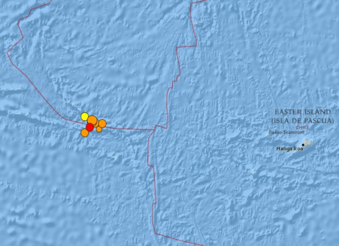
Image credit: USGS
- 5.42014-09-06 07:48:34 UTC10.0 km
- 5.22014-09-06 07:04:07 UTC10.0 km
- 6.12014-09-06 06:53:13 UTC10.0 km
- 5.42014-09-05 21:24:39 UTC10.0 km
- 5.52014-09-05 19:36:31 UTC17.1 km
- 5.12014-09-05 09:19:24 UTC10.0 km
- 4.82014-09-05 09:01:21 UTC10.0 km
- 5.12014-09-04 17:23:15 UTC10.0 km
- 5.92014-09-03 20:34:00 UTC10.0 km
Featured image credit: USGS
Commenting rules and guidelines
We value the thoughts and opinions of our readers and welcome healthy discussions on our website. In order to maintain a respectful and positive community, we ask that all commenters follow these rules.