Typhoon “Kalmaegi” moves out of Philippines
Typhoon "Kalmaegi" struck northeast of the main Philippine island of Luzon on Sunday evening (September 14) with winds of 160 km/h (100 mph) causing floods in mountainous and farming regions of northern Luzon.
Three people were killed and three others remain missing after a passenger ferry sank in the central Philippines as the storm approached on Saturday.
Interior Secretary Manuel Roxas described the storm as only "moderate". "It did not hit heavily populated areas extremely hard."
At 09:00 UTC today, Kalmaegi was located approximately 252 nautical miles (289 miles/566 km) south-southeast of Hong Kong moving at the speed of 18 knots (20 mph/33 km/h). Maximum significant wave height was 20 feet (6 meters).
Kalmaegi's maximum sustained winds at the time were 65 knots (74 mph/120 km/h), wind gusts were 80 knots (92 mph/148 km/h).
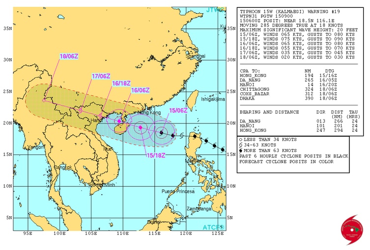
Typhoon "Kalmaegi" forecast track on September 15, 2014. Image credit: JTWC
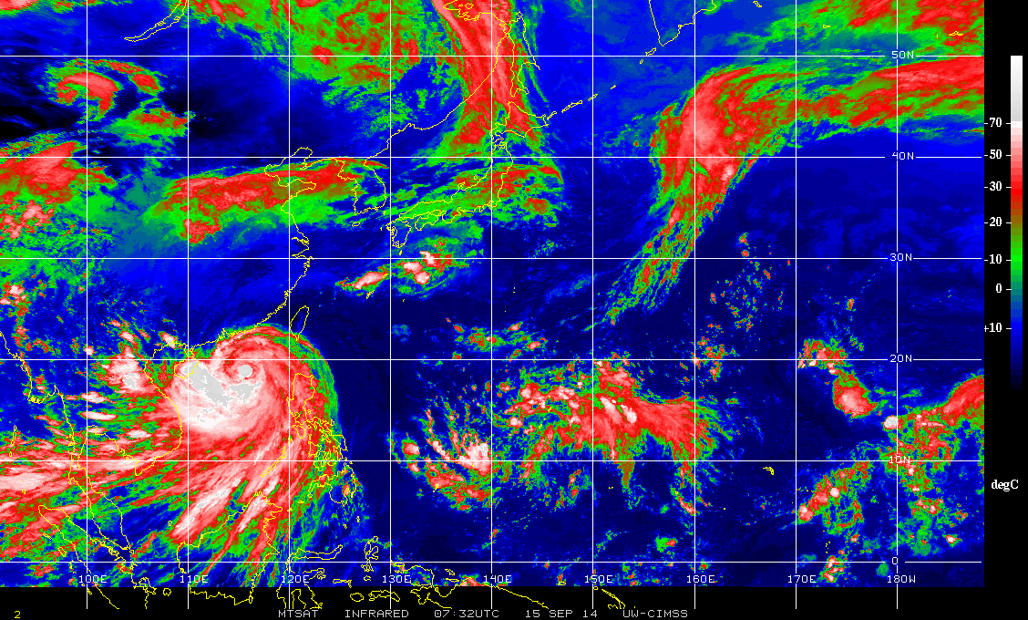
Typhoon "Kalmaegi" infrared image at 07:32 UTC on September 15, 2014. Image credit: UW-CIMSS/MTSAT
The system is now recovering from the land interaction with the Luzon. A short window of intensification is expected today due to favorable conditions of the warm sea surface across the South China Sea and favorable outflow.
Kalmaegi is expected to cross northern Hainan Island within next 24 hours. This interaction with the land will induce a weakening trend.
Dissipation is expected within 72 hours.
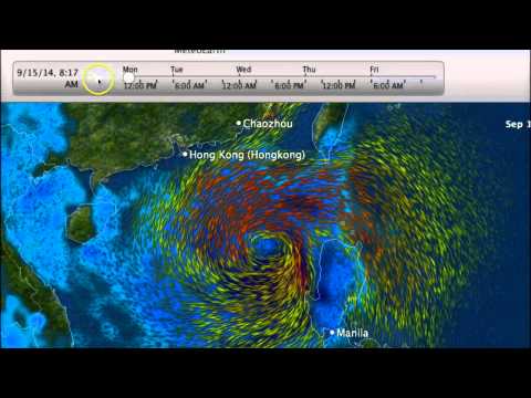
Video courtesy of WestPacWx
In July 2014 Typhoon "Rammasun" killed 98 people in provinces near the capital Manila.
Super Typhoon "Haiyan", the strongest storm ever to make landfall, left more than 7 300 people dead or missing in the central Philippines in November 2013.
Satellite animations
- Storm-Centered Infrared (MTSAT2; NOAA/SSD)
- Storm-Centered Infrared (Aviation Color Enhancement) (MTSAT2; NOAA/SSD)
- Storm-Centered Water Vapor (MTSAT2; NOAA/SSD)
- Storm-Centered Visible (MTSAT2; NOAA/SSD)
- Storm-Centered Visible (Colorized) (MTSAT2; NOAA/SSD)
- Storm-Centered Infrared (MTSAT2; CIMSS)
- Storm-Centered Enhanced Infrared (MTSAT2; CIMSS)
- Storm-Centered Water Vapor (MTSAT2; CIMSS)
- Storm-Centered Visible (MTSAT2; CIMSS)
- South China Sea/West Pacific Infrared (MTSAT2; NOAA)
- South China Sea/West Pacific Enhanced Infrared (MTSAT2; NOAA)
- South China Sea/West Pacific Water Vapor (MTSAT2; NOAA)
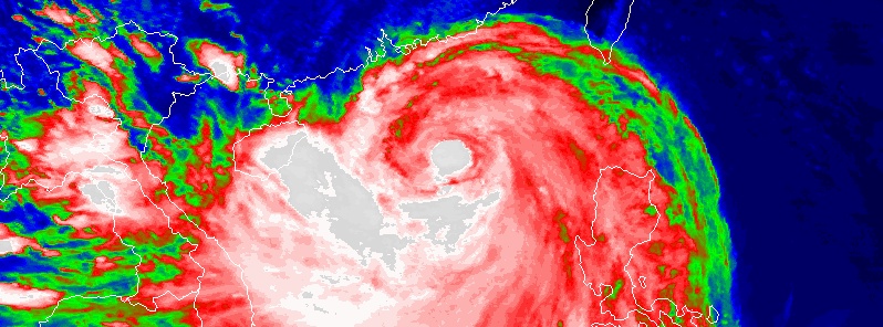
Featured image: Typhoon "Kalmaegi" infrared (NHC enhancement) on September 15, 2014, at 07:32 UTC. Image credit: UW-CIMSS
Commenting rules and guidelines
We value the thoughts and opinions of our readers and welcome healthy discussions on our website. In order to maintain a respectful and positive community, we ask that all commenters follow these rules:
We reserve the right to remove any comments that violate these rules. By commenting on our website, you agree to abide by these guidelines. Thank you for helping to create a positive and welcoming environment for all.