Tropical Storm “Polo” on the track to become next hurricane in Eastern Pacific
Newborn depression in Eastern Pacific developed into Tropical Storm "Polo" off Mexico's southwestern coast on September 16, 2014.
Tropical Storm Watch was issued for the southwestern coast of Mexico for areas from Zihuatanejo to Cabo Corrientes, Mexico. A tropical storm watch means that tropical storm conditions are possible within the watch area, in this case within 24 hours.
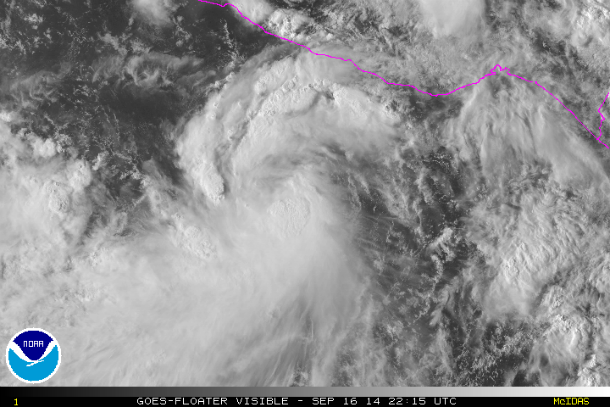
GOES visible satellite image of TS "Polo" at 22:15 UTC on September 16, 2014. (Credit: NOAA/GOES)
.png)
GOES RBTOP IR satellite image at 22:45 UTC on September 16, 2014. (Credit: NOAA/GOES)
According to public advisory issued by National Hurricane Center at 20:23 UTC on September 16, Tropical Storm "Polo" was located about 415 km (260 miles) from Acapulco, Mexico and moving toward the northwest near 19 km/h (12 mph). It is expected to continue over the next two days, paralleling the coast of southwestern Mexico. Tropical storm force winds extend outward up to 110 km (70 miles) from the center. Maximum sustained winds were 75 km/h (45 mph) with higher gusts.
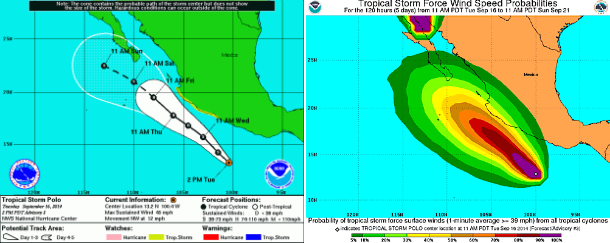
NHC 5-day forecast track and tropical storm force wind speed probabilities map. (Credit: NOAA/NHCC)
National Hurricane Center noted that strengthening is possible during the next 24 hours and "Polo" could become a hurricane by September 18, 2014.
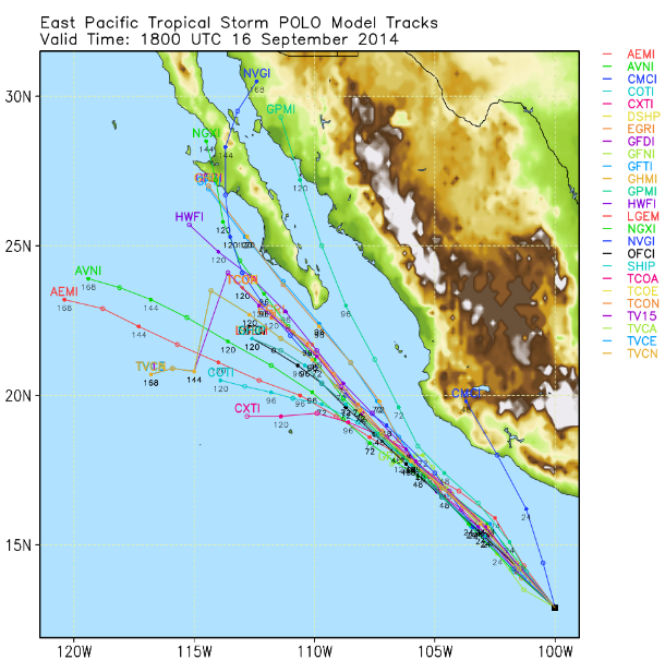
Forecast track models for TS "Polo" development. (Credit: UWM-Spaghetti)
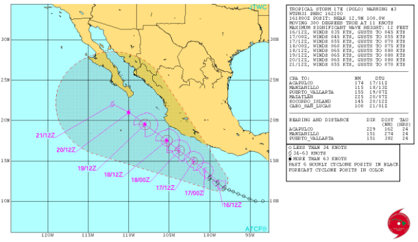
Forecast track by JTWC (Credit: JTWC)
Satellite animations
- Storm-Centered Infrared (GOES 15; NOAA/SSD)
- Storm-Centered Infrared (Aviation Color Enhancement) (GOES 15; NOAA/SSD)
- Storm-Centered Water Vapor (GOES 15; NOAA/SSD)
- Storm-Centered Visible (GOES 15; NOAA/SSD)
- Storm-Centered Visible (Colorized) (GOES 15; NOAA/SSD)
- Storm-Centered Infrared (GOES 15; CIMSS)
- Storm-Centered Enhanced Infrared (GOES 15; CIMSS)
- Storm-Centered Water Vapor (GOES 15; CIMSS)
- Storm-Centered Visible (GOES 15; CIMSS)
- Tropical East Pacific and Caribbean Basin Infrared (GOES 13; NOAA/SSD)
- Tropical East Pacific and Caribbean Basin (Aviation Color Enhancement) (GOES 13; NOAA/SSD)
- Tropical East Pacific and Caribbean Basin Water Vapor (GOES 13; NOAA/SSD)
- Tropical East Pacific and Caribbean Basin Visible (GOES 13; NOAA/SSD)
- Tropical East Pacific and Caribbean Basin Visible (Colorized) (GOES 13; NOAA/SSD)
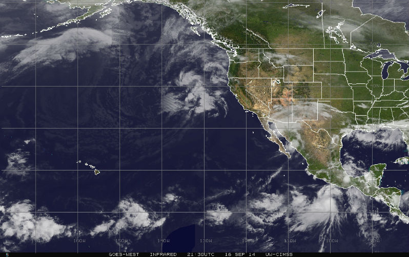
Featured image: GOES West IR satellite image taken at 21:30 UTC on September 16, 2014. (Credit: NOAA-GOES/UW-CIMSS)
Commenting rules and guidelines
We value the thoughts and opinions of our readers and welcome healthy discussions on our website. In order to maintain a respectful and positive community, we ask that all commenters follow these rules:
We reserve the right to remove any comments that violate these rules. By commenting on our website, you agree to abide by these guidelines. Thank you for helping to create a positive and welcoming environment for all.