Phanfone reaches super typhoon status
Typhoon Phanfone rapidly intensified on October 2, with its strength increasing from a Category 1 hurricane to a Category 4 hurricane in 12 hours. On October 4, 2014 JMA reports maximum wind gusts of 250 km/h which means that Phanfone reached super typhoon status (maximum sustained winds of at least 240 km/h). The system continues to track northwestward before taking a turn to the northeast and threatening mainland Japan with powerful winds and heavy rains.
Extremely dangerous seas will build over the ocean south of Japan with an inundating storm surge threatening the southern Honshu coast.
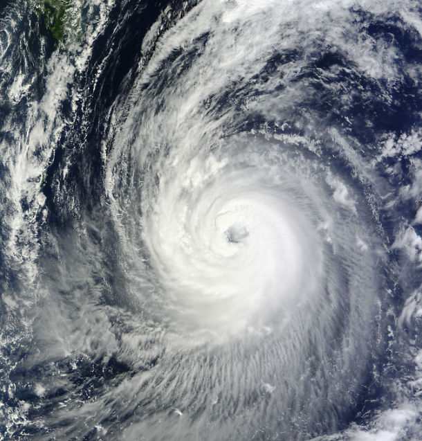
NASA's Terra satellite captured this image of Typhoon Phanfone and its large eye in the western Pacific Ocean on October 3, 2014 at 01:55 UTC. (Credit: MODIS Rapid Response Team)
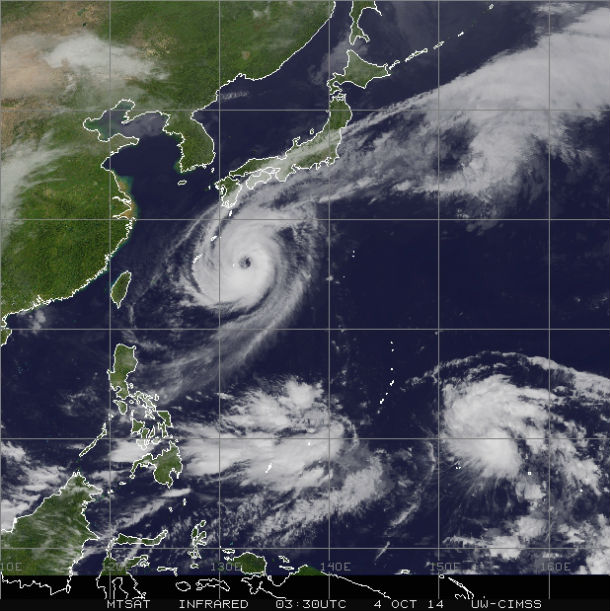
MTSAT IR satellite image taken at 03:30 UTC on October 4, 2014. (Credit: NOAA/UW-CIMSS)
100 to 200 millimeters (4 to 8 inches) of rain is expected to inundate eastern Shikoku, as well as south-central and southeastern Honshu, including Hamamatsu, Shizuoka and Tokyo. Around 300 millimeters (a foot) or more of rain is expected in the mountains which will cause flash flooding and mudslides.
Mount Ontake, site of recent deadly volcanic eruption, will also see some heavy rainfall. Torrential rain in combination with ash could result in debris flows.
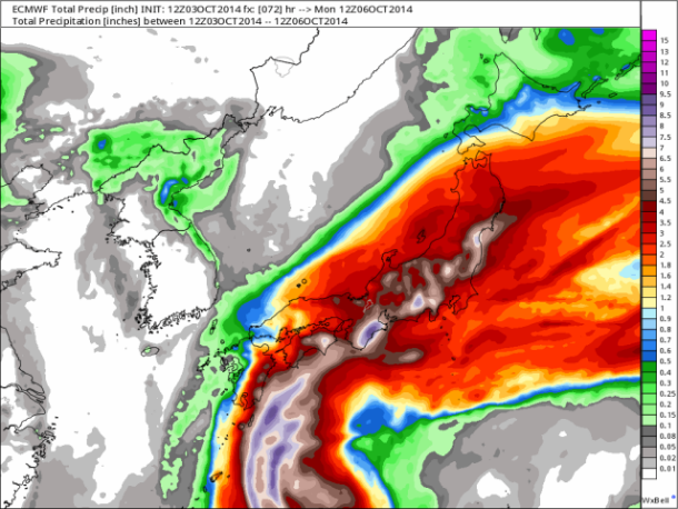
ECMWF total precipitation projection (Credit: ECMWF)
The current projected path of Phanfone takes the typhoon over far southeastern Honshu late on October 5 into October 6, 2014. After that, Phanfone will lose its tropical characteristics as it tracks rapidly northeast across the northern Pacific Ocean. JMA expects winds gusting up to 185 km/h for coastal Kanagawa while the JTWC expects 130 km/h by early October 6, 2014.
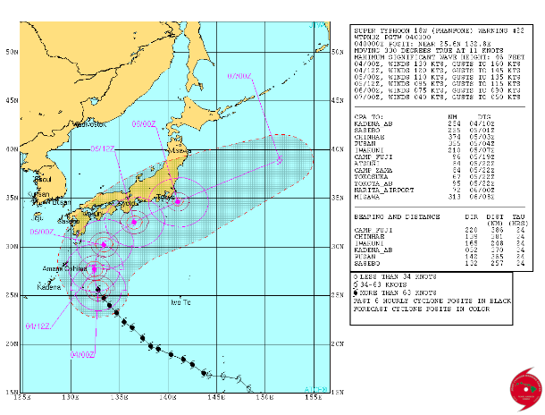
Forecast track by JTWC (Credit: JTWC)
Developing Tropical Storm Vongfong to the east of Guam is also expected to make landfall in Japan by October 6, 2014.
Satellite animations
- Storm-Centered Infrared (MTSAT2; NOAA/SSD)
- Storm-Centered Infrared (Aviation Color Enhancement) (MTSAT2; NOAA/SSD)
- Storm-Centered Water Vapor (MTSAT2; NOAA/SSD)
- Storm-Centered Visible (MTSAT2; NOAA/SSD)
- Storm-Centered Visible (Colorized) (MTSAT2; NOAA/SSD)
- Storm-Centered Infrared (MTSAT2; CIMSS)
- Storm-Centered Enhanced Infrared (MTSAT2; CIMSS)
- Storm-Centered Water Vapor (MTSAT2; CIMSS)
- Storm-Centered Visible (MTSAT2; CIMSS)
- Tropical West Pacific Infrared (MTSAT2; NOAA)
- Tropical West Pacific Enhanced Infrared (MTSAT2; NOAA)
- Tropical West Pacific Water Vapor (MTSAT2; NOAA)
- Tropical West Pacific Visible (MTSAT2; NOAA)
.jpg)
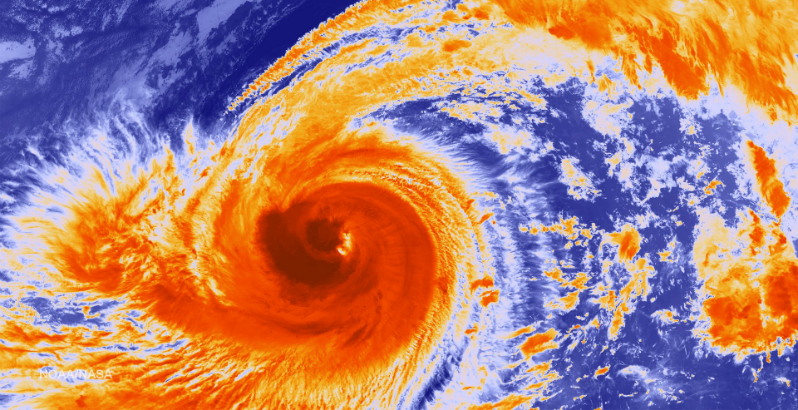
Featured image: SUOMI NPP/VIIRS satellite image of Typhoon Phanfone on October 3, 2014. (Credit: NOAA/SUOMI NPP)
Commenting rules and guidelines
We value the thoughts and opinions of our readers and welcome healthy discussions on our website. In order to maintain a respectful and positive community, we ask that all commenters follow these rules:
We reserve the right to remove any comments that violate these rules. By commenting on our website, you agree to abide by these guidelines. Thank you for helping to create a positive and welcoming environment for all.