Nuri became sixth super typhoon of 2014, heading toward Japan
Tropical Storm "Nuri" formed in the Philippine Sea on Friday, October 31, intensified into a typhoon the next day and started its rapid intensification phase. It became the sixth super typhoon of 2014 yesterday and is now located northeast of Philippines and south of Japan, heading north-northeastward toward Japan.
On Sunday, November 2, JTWC said Nuri had reached super typhoon strength with maximum 1-minute sustained wids of 289 km/h (180 mph). This made Nuri almost comparable to last month's Vongfong. On JMA scale, Nuri became the fourth violent typhoon of 2014. It had 10-minute average winds of 193 km/h (120 mph) and estimated minimum central pressure of 910 mb yesterday.
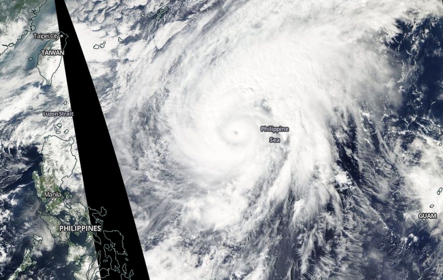
Super Typhoon "Nuri" on November 3, 2014. Image credit: NASA Aqua/MODIS
At 06:00 UTC on Monday, November 3, Nuri had maximum sustained winds of 287 km/h (178 mph) and wind gusts of 351 km/h (218 mph). It was located approximately 531 nautical miles (983 km/611 miles) south-southeast of Okinawa, Japan. The system was tracking north-northeastward at 11 km/h (6.9 mph) over the past six hours. Maximum significant wave height was around 15 meters (50 feet).
PAGASA named the storm "Paeng" and warned that it can generate dangerous conditions and rough seas along eastern Philippines.
Nuri is expected to track east of the Ryukyu Islands and Okinawa and weaken over the next two days.
It's eye should pass southeast of Tokyo, Japan on November 6.
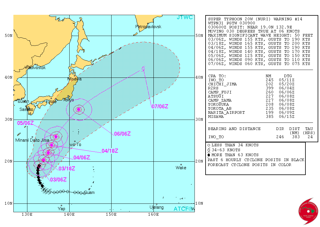
Super Typhoon "Nuri" forecast track by JTWC on November 3, 2014.
Weather.com forecasters said Nuri is expected to eventually join up with the jet stream and a very strong disturbance in the mid-latitude belt of westerly winds. "Sunday afternoon forecasts from both the European and American computer models predict an extremely powerful non-tropical storm to develop from this merger over the Aleutian Islands of Alaska. In fact, both models have suggested the pressure of that post-tropical storm could go as low as 928 millibars late Friday into Saturday – almost as low as it is now as a super typhoon.
Such a powerful storm would whip up damaging winds and dangerous seas across the Aleutians, the Bering Sea and the far northern Pacific this weekend. However, that forecast could change given the amount of time between now and then."
Satellite animations
- Storm-Centered Infrared (MTSAT2; NOAA/SSD)
- Storm-Centered Infrared (Aviation Color Enhancement) (MTSAT2; NOAA/SSD)
- Storm-Centered Water Vapor (MTSAT2; NOAA/SSD)
- Storm-Centered Visible (MTSAT2; NOAA/SSD)
- Storm-Centered Visible (Colorized) (MTSAT2; NOAA/SSD)
- Storm-Centered Infrared (MTSAT2; CIMSS)
- Storm-Centered Enhanced Infrared (MTSAT2; CIMSS)
- Storm-Centered Water Vapor (MTSAT2; CIMSS)
- Storm-Centered Visible (MTSAT2; CIMSS)
- Tropical West Pacific Infrared (MTSAT2; NOAA)
- Tropical West Pacific Enhanced Infrared (MTSAT2; NOAA)
- Tropical West Pacific Water Vapor (MTSAT2; NOAA)
- Tropical West Pacific Visible (MTSAT2; NOAA)
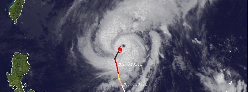
Featured image. Super Typhoon "Nuri" on November 2, 2014. Image credit: UW-CIMSS.
very nice detection of Nuri.