Tropical Storm “Blanca” expected to rapidly intensify off the Pacific coast of Mexico
Tropical Storm "Blanca" formed on June 1, 2015 about 535 km (332 miles) SSW of Zihuatanejo, the Pacific coast of Mexico. At the moment, Blanca is nearly a stationary system with a slow and erratic motion expected over the next couple of days followed by a phase of rapid intensification. It should become a major hurricane by Thursday, June 4.
Blanca is the second named storm of the 2015 eastern Pacific hurricane season which is expected to be above-average in terms of number and strength of hurricanes. The main climate factor expected to enhance this season is El Niño, which is now present, strengthening and predicted to last throughout the hurricane season.
Tropical Storm "Blanca" forecast track by UW-CIMSS on June 2, 2015.
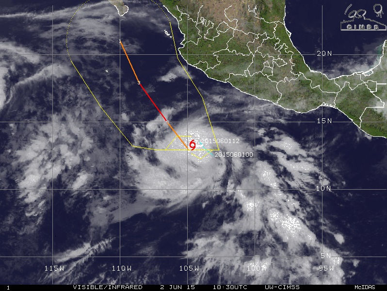
At 09:00 UTC on June 2, 2015, Blanca was located about 585 km (365 miles) SW of Zihuatanejo and about 635 km (395 miles) S of Manzanillo, Mexico.
Its maximum sustained winds were 85 km/h (50 mph), NWS NHC Miami said.
At the time, Blanca was moving W at 2 km/h (1 mph) with minimum central pressure of 1 001 hPa.
Only a slow and erratic motion is expected for the next day or two followed by rapid strengthening. Blanca is forecast to become a major hurricane by late Wednesday/early Thursday (June 3/4).
There are no coastal watches or warnings in effect, NHC said.
Tropical storm force winds extend outward up to 75 km (45 miles) from the center.
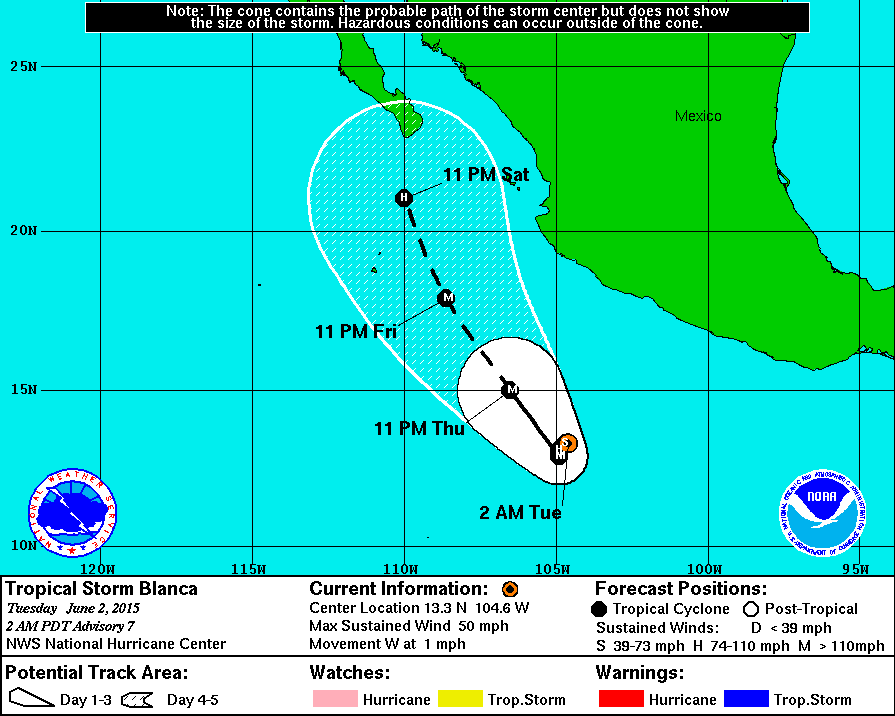
NHC said their forecast remains in good agreement with the SHIPS and FSU Superensemble guidance, which both predict rapid strengthening during the next day or two. After 4 – 5 days, increasing shear and cooler SSTs should result in weakening.

Tropical Storm "Blanca" on June 1, 2015. Image credit: NASA Terra/MODIS.
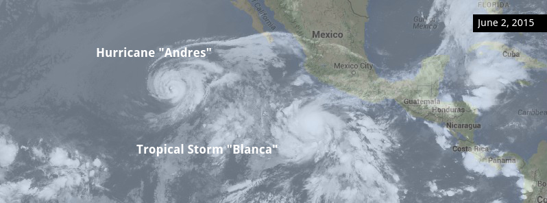
As already mentioned, Blanca is the second named storm of the 2015 eastern Pacific hurricane season and is expected to become a major hurricane. The first named storm and a major hurricane of this season is Andres which briefly reached category 4 (major) hurricane on Monday, June 1 (Andres report is here).
For this season, NOAA estimates a 70% chance of occurrence for each of the following ranges of activity:
- 15-22 named storms,
- 7-12 hurricanes,
- 5-8 major hurricanes,
- An ACE range 110%-190% of the median.
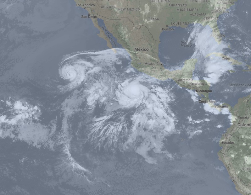
Hurricane "Andres" and Tropical Storm "Blanca" on June 2, 2015. Image credit: Google/UW-CIMSS.
Satellite animations
- Storm-Centered Infrared (GOES 15; NOAA/SSD)
- Storm-Centered Infrared (Aviation Color Enhancement) (GOES 15; NOAA/SSD)
- Storm-Centered Water Vapor (GOES 15; NOAA/SSD)
- Storm-Centered Visible (GOES 15; NOAA/SSD)
- Storm-Centered Visible (Colorized) (GOES 15; NOAA/SSD)
- Storm-Centered Infrared (GOES 15; CIMSS)
- Storm-Centered Enhanced Infrared (GOES 15; CIMSS)
- Storm-Centered Water Vapor (GOES 15; CIMSS)
- Storm-Centered Visible (GOES 15; CIMSS)
- East Pacific Infrared (GOES 15; NOAA/SSD)
- East Pacific (Aviation Color Enhancement) (GOES 15; NOAA/SSD)
- East Pacific Water Vapor (GOES 15; NOAA/SSD)
- East Pacific Visible (GOES 15; NOAA/SSD)
- East Pacific Visible (Colorized) (GOES 15; NOAA/SSD)
Featured image: Hurricane "Andres" and Tropical Storm "Blanca" on June 2, 2015. Image credit: Google/UW-CIMSS. Edit: TW.
Commenting rules and guidelines
We value the thoughts and opinions of our readers and welcome healthy discussions on our website. In order to maintain a respectful and positive community, we ask that all commenters follow these rules:
We reserve the right to remove any comments that violate these rules. By commenting on our website, you agree to abide by these guidelines. Thank you for helping to create a positive and welcoming environment for all.