Tropical Storm “Linfa” makes landfall in southern China
Tropical Storm "Linfa" hit the province of Guangdong, southern China bringing heavy rain and winds of up to 126 km/h (78.3 mph) around 03:00 UTC on Thursday, July 9, 2015. Linfa is the first of two large storms forecast to hit China this week. Typhoon "Chan-hom" is expected to hit Fujian or Zhejiang provinces late July 10 or early July 11, 2015.
In Linfa's advance, Guangdong authorities closed schools, suspended passenger trains, and recalled boats to ports.
From Wednesday night (July 8, local time), gales and torrential rains hit Shantou City about 100 km away from the landing point. Trees in the city were brought down by strong winds while three main bridges to Shanwei City and an offshore island county have all been closed as of Thursday morning.
The state-run Hong Kong Observatory issued a strong wind warning, saying Linfa will bring wind speeds of up to 60 km/h (37.3 mph).
"Even though it has shown indications of weakening, its intensity is not expected to change rapidly in a short period of time," the observatory said.
Update: As of July 10, the Chinese Government reports 56 000 people evacuated and nearly 300 houses collapsed in Guangdong. No casualties have been reported.
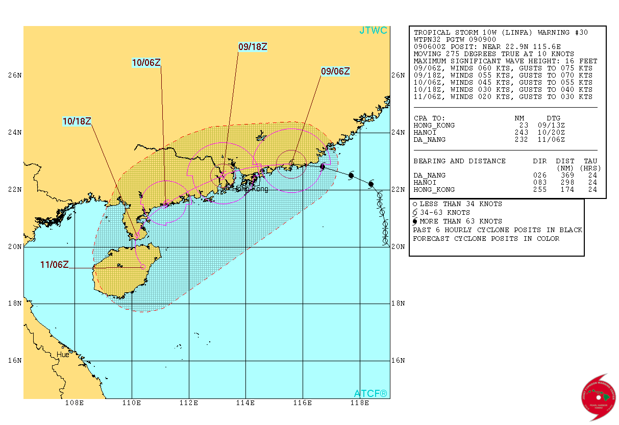
Tropical Storm "Linfa" forecast track by JTWC on July 9, 2015. Credit: JTWC/ATCF.
Further off the coast of China is the more powerful Typhoon "Chan-hom" which is forecast to hit Fujian or Zhejiang provinces late Friday, July 10 or early Saturday, July 11, 2015 (UTC).
Chan-hom is already affecting Okinawa, Japan on Thursday, July 9 and will soon bring heavy rain and very strong winds to northern Taiwan too.
As of 06:00 UTC on July 9, Chan-hom's maximum sustained winds were 144.8 km/h (55.9 mph).
Xinhua says Shanghai plans to suspend all passenger trains along the coast on Friday and Saturday.
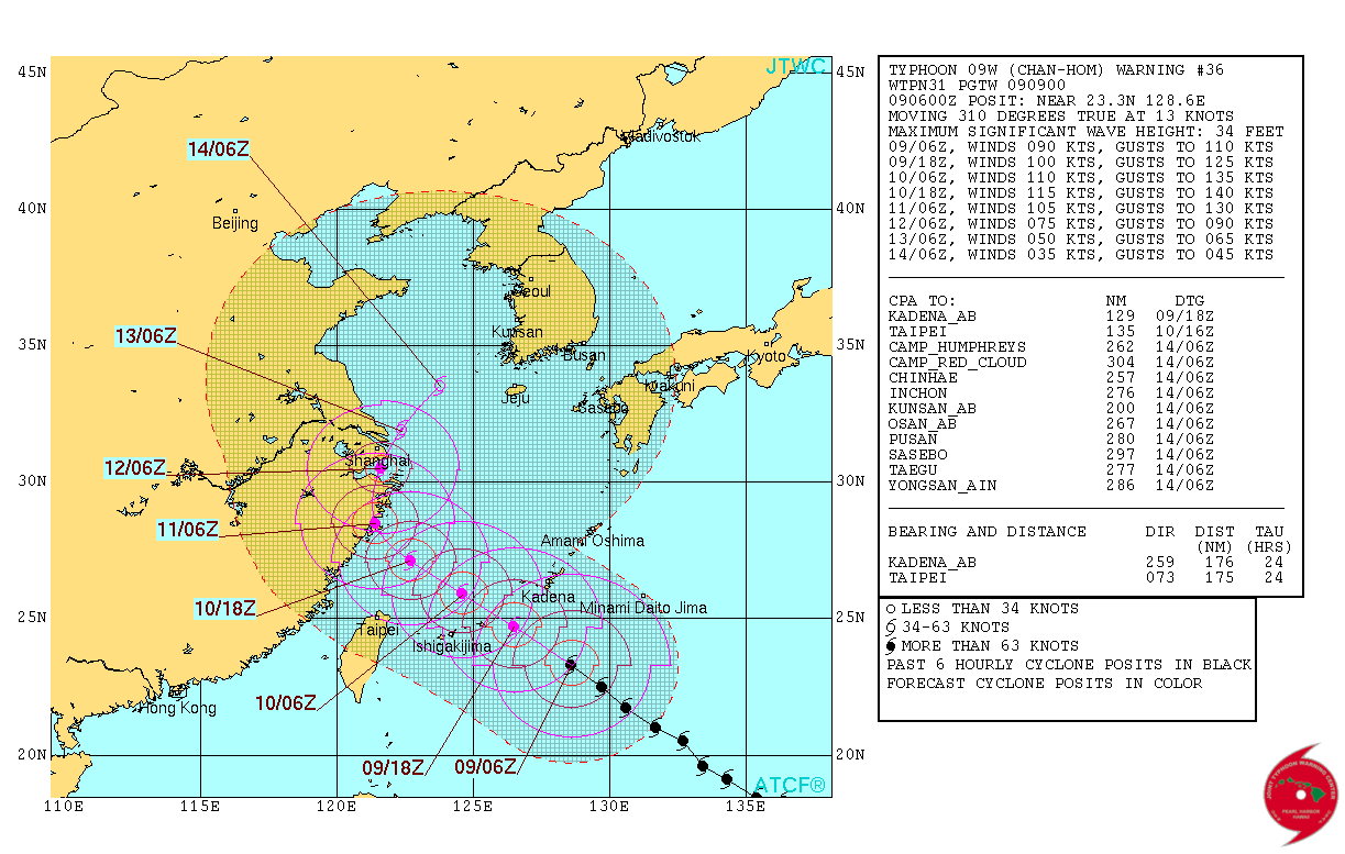
Typhoon "Chan-hom" forecast track by JTWC on July 9, 2015. Image credit: JTWC/ATCF.
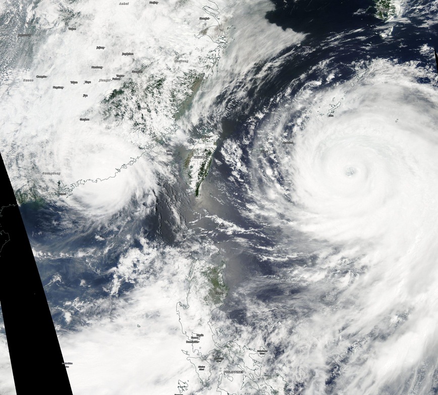
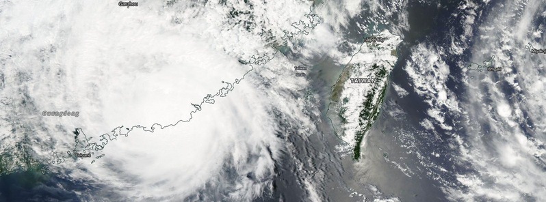
Tropical Storm "Linfa" (left) and Typhoon "Chan-hom" (right) on July 9, 2015. Image credit: NASA Aqua/MODIS.
Even further to the east, Typhoon "Nanga" is following Chan-hom and is passing north of Guam and Northern Marianas Islands.
As of 06:00 UTC on July 9, Nangka had maximum sustained winds near 231 km/h (144 mph), gusts were up to 277.8 km/h (172 mph). This storm system is expected to further intensify over the next 24 hours on its way toward Iwo To, Japan.

Video courtesy of WestPacWx.
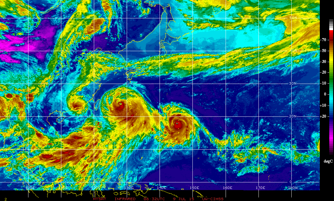
Image credit: UW-CIMSS.
Featured image credit: Tropical Storm "Linfa" on July 9, 2015. Image credit: NASA Aqua/MODIS.
Commenting rules and guidelines
We value the thoughts and opinions of our readers and welcome healthy discussions on our website. In order to maintain a respectful and positive community, we ask that all commenters follow these rules:
We reserve the right to remove any comments that violate these rules. By commenting on our website, you agree to abide by these guidelines. Thank you for helping to create a positive and welcoming environment for all.