Hurricane “Kilo” becomes a typhoon after crossing the International Date Line
Hurricane "Kilo" formed over 1 000 km (621 miles) of the shore of Hawaii islands in the late August and has crossed an International Date Line between the eastern and western Pacific between September 1 and 2, 2015. It, thus, became known as a Typhoon "Kilo". Although, the system currently doesn't pose a threat to mainland, it requires careful monitoring as it is expected to intensify and pass close to Japan during the next week.
Typhoon "Kilo", formerly know as a Hurricane "Kilo" first appeared as a tropical depression about 1 127 km (700 miles) south-southeast of Hilo, Hawaii islands, on August 20, 2015.
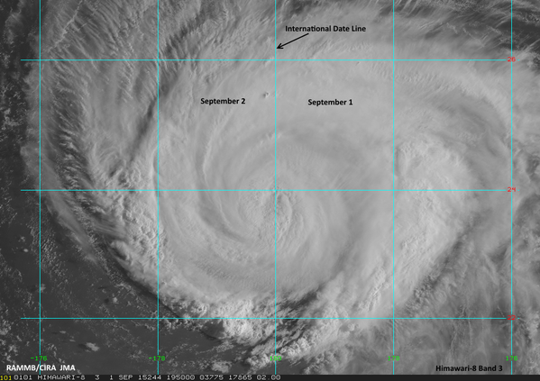
Image credit: JMA/RAMMB/CIRA (Himawari-8)
About a week after its formation in late August, Kilo intensified into a category 4 hurricane west-southwest of the Hawaii. It was expected that the system will travel northwards, get caught in a jet-stream over the North Pacific Ocean and diminish into a post-tropical storm.
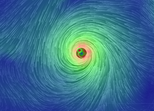
Typhoon "Kilo" wind field. Image credit: earth.nullschooll.net
However, the system passed the International Date Line dividing the eastern and western Pacific in a period between September 1 and 2 and thus became renamed into Typhoon "Kilo". The high air pressure field over the western Pacific will most likely influence the system to move toward the west, as of next week.
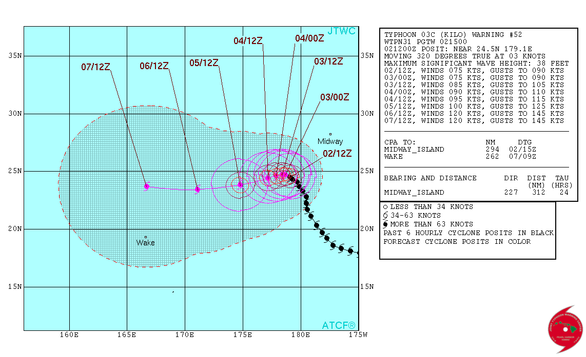
The typhoon's center was located about 1 411 km (877 miles) east-northeast of Wake Island at 15:00 UTC on September 2, according to the Joint Typhoon Warning Center (JTWC), and it was slowly moving toward northwest at 5.56 km/h (3.45 mph). Maximum sustained wind speed was estimated at 139 km/h (86 mph), while the maximum wind gust speed was 167 km/h (104 mph).
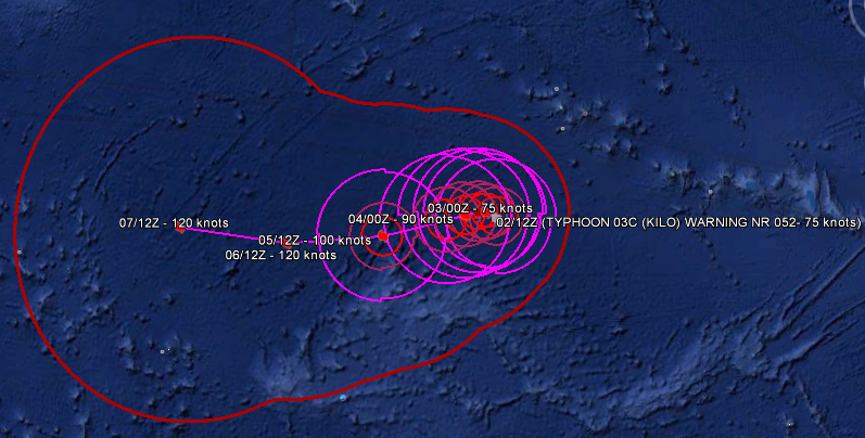
Typhoon "Kilo" 5-day track forecast. Image credit: JTWC/Google Earth
Currently, the system poses no threat to the mainland. By the next week, Kilo could travel close to Japan, although its full path over the next couple of days is still uncertain. Eventually, the jet stream should catch up with the typhoon and turn it it back from the mainland.
As the system is forecasted to move in a favorable environment of warm sea-surface temperatures and low wind-shear, it will most likely gain more strength by September 5.
Typhoon "Kilo" 5-day path forecast. Image credit: JTWC
Typhoon "Kilo" has traveled more than 3 541 km (2 200 miles) since its formation. This is not a distance typically passed by tropical systems. The Hurricane (Typhoon) "John", a system which had a life-span of 30 days, ending on September 10, 1994, was the longest lived tropical cyclone in recorded history so far.
Kilo crossing the dateline into Western Pacific makes it both the 18th named storm of the year & the 13th typhoon. pic.twitter.com/bkbTu1x0xv
— Anthony Sagliani (@anthonywx) September 2, 2015
Generally speaking, tropical systems lasting over 3 weeks are very rare. If Kilo persists on its path, as forecasted, until next week it might become such a rare occurrence.
Typhoon "Kilo" has so far broken a record from 1997, when it became a third tropical cyclone that crossed the International Dateline in the 2015, according to Dr. Phil Klotzbach, a Colorado State University expert.
See also:

Video credit: Himawari-8 Japanese satellite
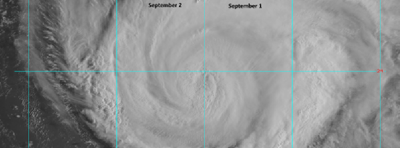
Featured image: Tropical Cyclone "Kilo" crossing the International Date Line, September 1, 02:00 UTC. Image credit: JMA/RAMMB/CIRA (Himawari-8)
Commenting rules and guidelines
We value the thoughts and opinions of our readers and welcome healthy discussions on our website. In order to maintain a respectful and positive community, we ask that all commenters follow these rules:
We reserve the right to remove any comments that violate these rules. By commenting on our website, you agree to abide by these guidelines. Thank you for helping to create a positive and welcoming environment for all.