Tropical Storm “Koppu” (Lando) rapidly intensifying as it approaches Luzon, Philippines
No break seems to be in sight for the Philippines, as the new tropical storm races toward Luzon. Tropical Storm "Koppu" developed over the warm waters of western Pacific on October 14, 2015 and was named "Lando" by Philippine Atmospheric, Geophysical and Astronomical Services Administration (PAGASA) shortly afterwards. The system is rapidly intensifying and is expected to make landfall in Northern Luzon as a violent typhoon by October 18. Residents are warned to take all the necessary precautions as soon as possible.
Tropical Storm "Koppu", in the Philippines known as "Lando", was located about 1346.4 km (836.6 miles) south-southeast of Kadena Air Base in Okinawa, and moving westward at 24 km/h (15 mph), on October 14, 15:00 UTC, according to Joint Typhoon Warning Center (JTWC).
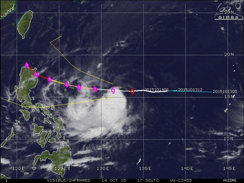
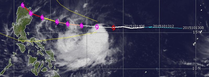
Tropical Storm "Koppu" synoptic situation and track, October 14, 17:32 UTC. Image credit: UW-CIMSS
The storm was packing maximum sustained winds of 83.3 km/h (51.8 mph) and wind gusts up to 102 km/h (63.4 mph) while central pressure was estimate at 989 hPa.
Over the next 72 hours the system is expected to continue moving westward rapidly intensifying as it approaches Luzon, Philippines. JTWC forecast predicts Koppu will develop into a violent typhoon by October 17, with maximum sustained wind speeds of 222 km/h (138 mph) and wind gusts reaching 269 km/h (167 mph). The storm is expected to make landfall by October 18.
Tropical Storm "Koppu", October 14, 2015. Image credit: DOST/PAGASA/Himawari-8
In the extended forecast, Koppu will continue to intensify until it starts to interact with the mountainous terrain in Luzon. The storm will pass over the northeastern tip of Luzon as it continues to turn poleward, according to JTWC.
Tropical Storm "Koppu" 5-day forecast track. Image credit: JTWC
PAGASA has estimated the precipitation to range between moderate to heavy within the 500 km (311 miles) diameter of the system. Fisherman are advised not to travel over the seaboards of Northern Luzon and over the eastern seaboard of Central Luzon. Local residents are advised to take safety measurements before the storm's landfall, including preparing emergency kits and first aid supplies, make evacuation plans in advance and make sure the vehicles are in good condition.
Featured image: Tropical Storm "Koppu" synoptic situation and track. Image credit: UW-CIMSS
Commenting rules and guidelines
We value the thoughts and opinions of our readers and welcome healthy discussions on our website. In order to maintain a respectful and positive community, we ask that all commenters follow these rules:
We reserve the right to remove any comments that violate these rules. By commenting on our website, you agree to abide by these guidelines. Thank you for helping to create a positive and welcoming environment for all.