After wettest December on record, another round of severe weather to hit UK
December 2015 is already a record breaking month for rainfall in parts of the UK. The spell of wet weather spread across portions of north Wales and northwest England on December 26, 2015 brought flooding to the area already saturated with water.
The highest amount of rainfall was observed in Snowdonia with 200 mm (7.9 inches) of precipitation. 130 mm (5.1 inches) was reported in Lancashire while approximately 100 mm (3.9 inches) of rain has fallen around other most affected areas, according to UK Met Office.
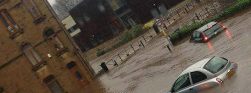
Flooding in UK, December 27, 2015. Image credit: BBC Look North via Weather Watch UK
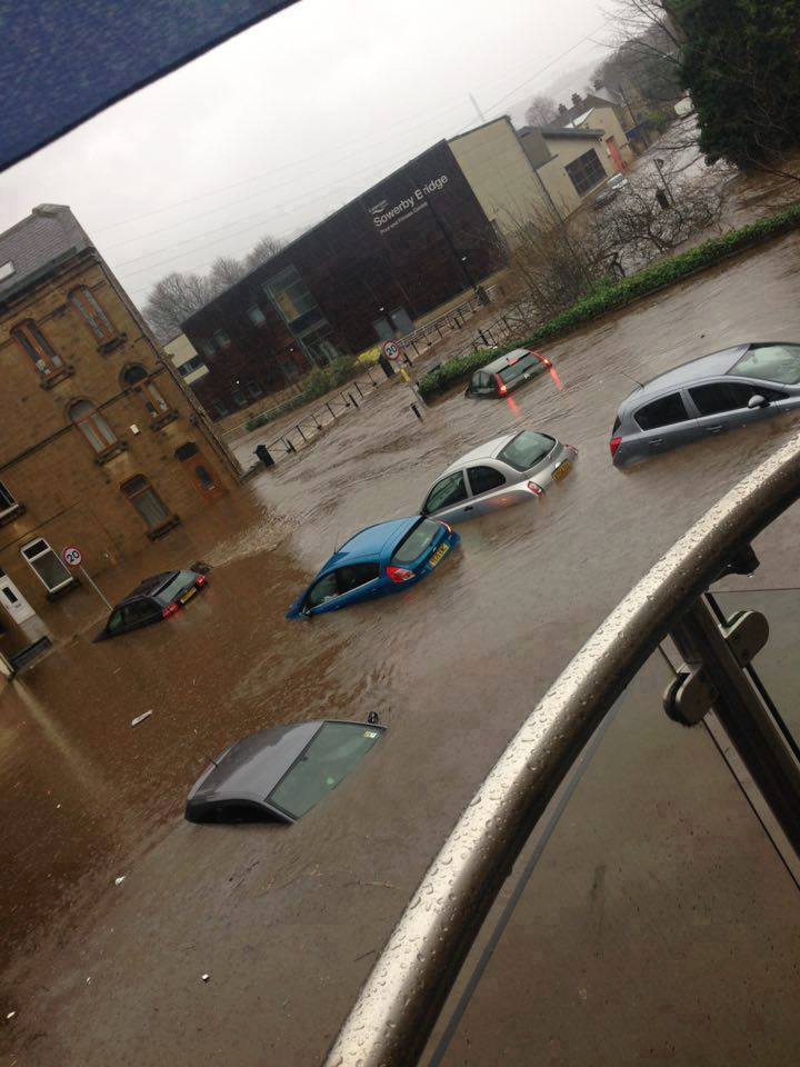
Flooding in UK, December 27, 2015. Image credit: BBC Look North via Weather Watch UK
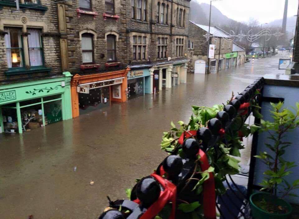
River Irwell overflew its banks in Summerseat, and the Waterside Inn partially collapsed under the water pressure. Parts of Lancashire, North West England, Yorkshire and North Wales also reported heavy flooding.
Wet and windy weather has been forecast to continue across parts of UK into December 30 as Storm "Frank", the sixth named storm of the winter season, approaches to hit the region on December 29. Severe wind gales will hit western parts of UK on the evening of December 29 into December 30.
Most areas will experience gusts between 88.5 and 104.6 km/h (55 and 65 mph) while some areas in northwest Scotland and Shetland might see gusts of 112.6 and 128.7 km/h (70 and 80 mph). Persistent heavy rains will hit parts of Northern Ireland, west and southwest Scotland, northwest England and Wales. Amber severe weather warnings are already in place, signalizing citizens to be prepared.
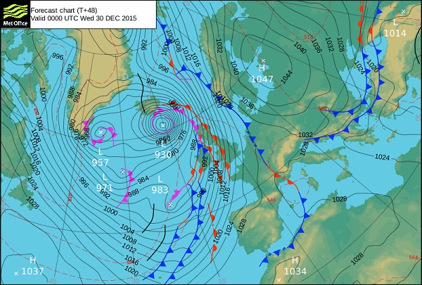
Storm "Frank" approaching UK, December 28, 2015. Image credit: Met Office
Between 20 and 40 mm (0.8 and 1.6 inches) of rainfall is expected across those areas. 80 mm (3.1 inches) is possible over high ground and exposed parts of southwest Scotland and Cumbria might receive between 100 and 150 mm (3.9 and 5.9 inches) of precipitation.
"We expect stormy conditions to return midweek, and have already issued National Severe Weather Warnings for gales on Tuesday and heavy rain on Wednesday, as a rapidly deepening area of low pressure, Storm "Frank", passes to the northwest of the UK," Will Lang, Met Office Chief Meteorologist, said.
"Everyone should be aware of the potential for disruption in places from further flooding and the impacts of the gales to transport, especially in areas such as southern and central Scotland and Cumbria where Amber 'be prepared' warnings are in place."
Featured image: Flooding in UK, December 27, 2015. Image credit: BBC Look North via Weather Watch UK
Commenting rules and guidelines
We value the thoughts and opinions of our readers and welcome healthy discussions on our website. In order to maintain a respectful and positive community, we ask that all commenters follow these rules:
We reserve the right to remove any comments that violate these rules. By commenting on our website, you agree to abide by these guidelines. Thank you for helping to create a positive and welcoming environment for all.