Tropical Cyclone “Ula” forms near American Samoa, to reach hurricane-force on December 31
Tropical low pressure area located east of American Samoa, South Pacific Ocean and designated as System 92P consolidated overnight and was named Tropical Cyclone "Ula" at 09:00 UTC on December 30, 2015.
According to the JTWC, Ula's maximum sustained winds were near 83.3 km/h (53.7 mph) at the time. The system was located about 522 km (324 miles) ENE of Pago Pago, American Samoa and moving to the SSW at 24 km/h (14.9 mph).
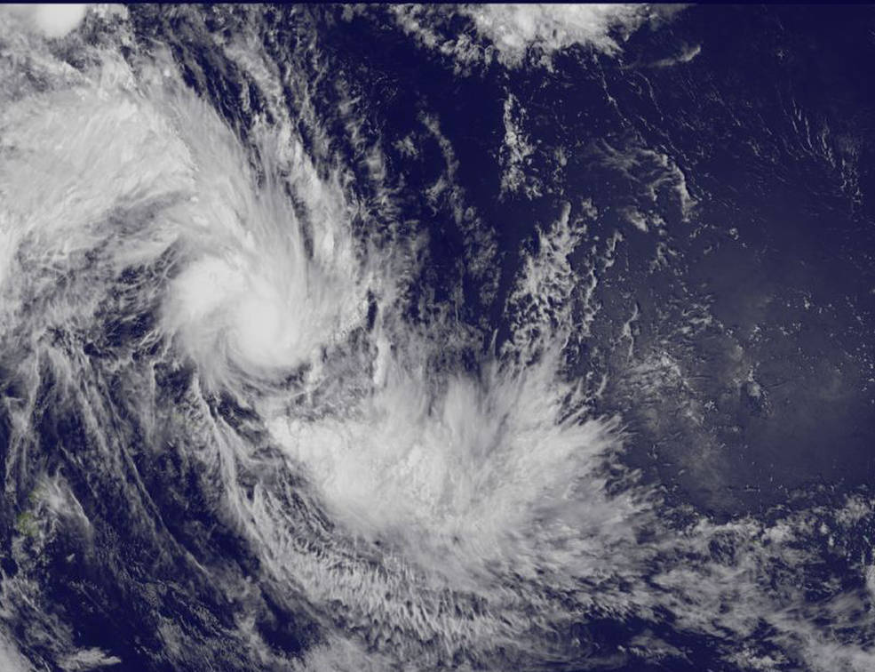
NOAA's GOES-West satellite captured this image of newborn Tropical Cyclone "Ula" in the South Pacific Ocean on December 29 at 23:22 UTC. Credit: NASA/NOAA GOES Project
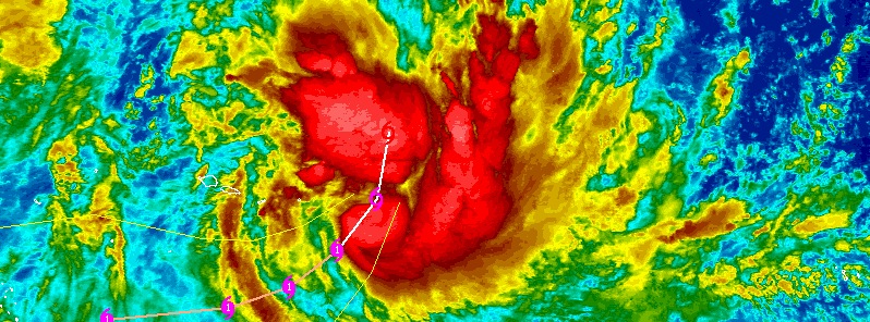
Animated multispectral satellite imagery shows a rapidly-consolidating, compact low-level circulation center with tightly-curved convective banding of thunderstorms wrapping into a central dense overcast. Microwave satellite data shows an eye in that central dense overcast.
IR image of Tropical Cyclone "Ula" on December 30, 2015. Credit: JTWC/SATOPS
JTWC forecasters expect Ula to curve to the southwest, remaining south of Pago Pago while intensifying to hurricane-force on December 31.
Over the next 72 hours (by January 2), Ula is expected to slow and begin curving to the southwest as it approaches Fiji.
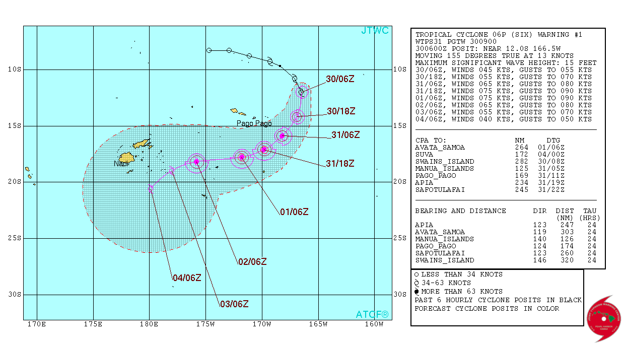
Tropical Cyclone "Ula" forecast track by JTWC on December 30, 2015.
The system is forecast to intensify to a peak intensity of 138 km/h (86 miles) under favorable conditions and weaken after January 2 due to increasing vertical wind shear and cooler sea surface temperatures.
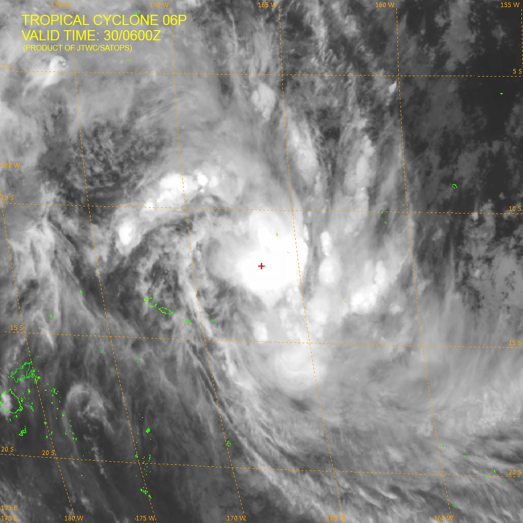
Featured image: Tropical Cyclone "Ula" IR (NHC) on Decembre 30, 2015. Credit: UW-CIMSS
TC Ula heading towards Fiji