Unpredictable Tropical Cyclone “Winston” to intensify and become quasi-stationary in South Pacific
Tropical Cyclone "Winston" formed over the warm waters of South Pacific Ocean between Vanuatu and Fiji on February 11, 2016, and passed east of Tafea Province (Vanuatu) on February 12, as an Intense Tropical Cyclone. The system will intensify into a category 4 cyclone over the next couple of days, and remain quasi-stationary afterward. Locally heavy rains and strong winds may affect the Lau group of islands and parts of Tonga.
Winston was located approximately 614.9 km (382 miles) southwest of Pago Pago, American Samoa, and tracking east-northwestward at 20.4 km/h (12.7 mph) on February 16, at 09:00 UTC, according to the Joint Typhoon Warning Center (JTWC).
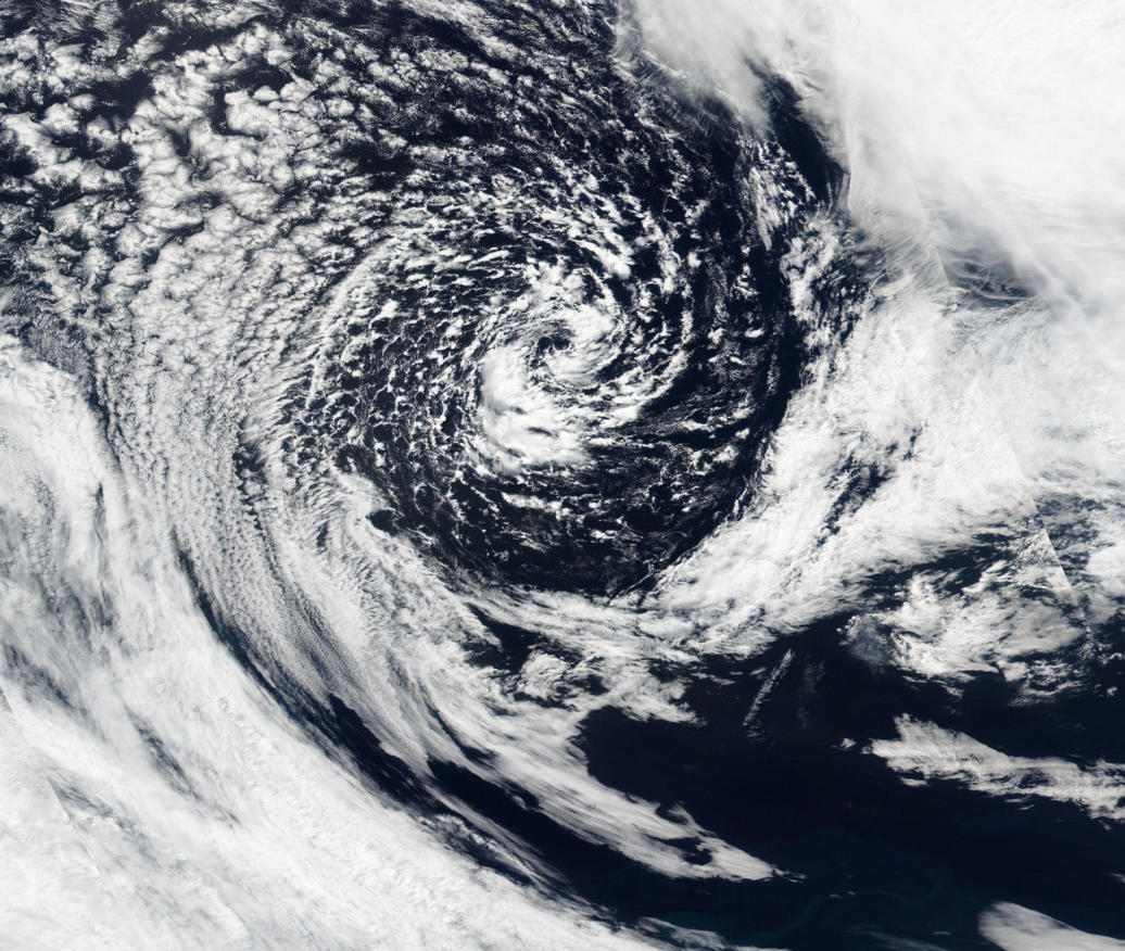
Tropical Cyclone "Winston", February 15, 2016. Image credit: NASA/Suomi NPP/VIIRS
The system was packing maximum sustained winds of 101.9 km/h (63.3 mph) with gusts up to 129.6 km/h (80.5 mph), and its minimum central pressure was estimated at 978 hPa.
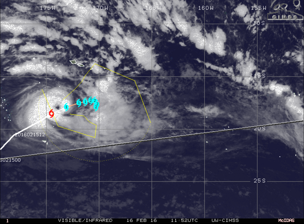
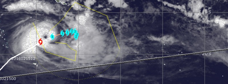
Tropical Cyclone "Winston" moving path, February 16, 2016, at 11:52 UTC. Image credit: UW-CIMSS
Tropical Cyclone "Winston" is currently positioned in a good environment for intensification with favorable sea surface temperatures of 30 °C (86 °F) and low vertical wind shear with speeds between 18.5 and 27.8 km/h (11.5 and 17.3 mph). According to the JTWC, a strong westerly outflow channel is also supporting further intensification, tapping into a longwave trough positioned to the southeast.

On February 11, 2016, GPM saw rain falling at a rate of over 60 mm (2.4 inches) per hour on the northwestern side of a forming eye wall and highest cloud tops over 17 km (10.5 miles) in a feeder band well to the northeast of Winston's center of circulation. Image credit: NASA/JAXA/SSAI, Hal Pierce
Over the next 36 hours, the cyclone will most likely become quasi-stationary. Due to the high ocean heat content, Winston is expected to steadily intensify to a category 4 cyclone strength over the next 72 hours. Maximum sustained winds will reach 175.9 km/h (109.3 mph) while wind gusts will rise up to 212.9 km/h (132.3 mph). Its strength will be equivalent to a category 2 hurricane on the Saffir-Simpson wind scale.
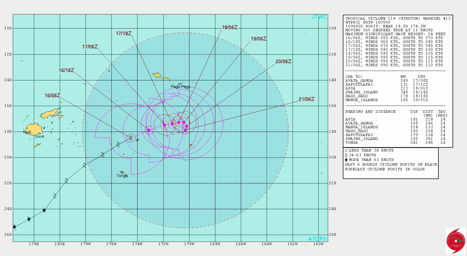
Tropical Cyclone "Winston" 6-day forecast track. Image credit: JTWC
Forecast path of the cyclone remains uncertain after it becomes quasi-stationary, and due to the proximity to Pago Pago, American Samoa, JTWC will issue warnings every six hours.
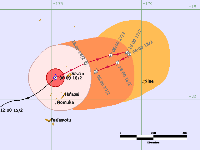
Tropical Cyclone "Winston" 4-day forecast track. Image credit: Fiji Meteorological Service
Locally heavy rainfall and strong winds already affected some areas of Fiji and Vanuatu on February 12. Over the next couple of days, heavy rains and strong winds may affect the Lau group of islands (Fiji), especially Onai-Liau and Vatoa, and portions of Tonga.
Featured image: Tropical Cyclone "Winston", February 16, 2016, 11:52 UTC. Image credit: UW-CIMSS
Commenting rules and guidelines
We value the thoughts and opinions of our readers and welcome healthy discussions on our website. In order to maintain a respectful and positive community, we ask that all commenters follow these rules.