Record rainfall lashes Pacific Northwest, US, more precipitation on the way
The "Pineapple Express" storm system lashed the Pacific Northwest with an abundant amount of rain over the last few days. Several high precipitation records were broken, and this winter is set to become one of the wettest winters on record.
Rivers overflowed their banks in western Washington on February 16, 2016, and more rain is expected across the region by the end of the week, according to the National Weather Service (NWS). The storm system is currently pointed toward Oregon, AP reports.
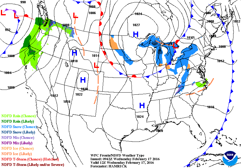
Image credit: NWS
"It’s going to be pretty wet for a while," said Johnny Burg, the meteorologist from the NWS.
Bellingham and Quillayute reported record 24 hours rainfall accumulation on February 15. 41.65 mm (1.64 inches) of precipitation was recorded at the Bellingham Airport, which set a new record. The old one, set in 1986, measured 25.9 mm (1.02 inches).
On the same day, 84.8 mm (3.34 inches) of rainfall was observed near Forks, at the north Washington coast. The recorded amount broke a 35-year-old record of 77.47 mm (3.05 inches).
A little less than 563.8 mm (22.2 inches) of rainfall was measured at Seattle-Tacoma International Airport from the beginning of December last year until February 15, 2016. The wettest winter period so far was recorded during 1999, when 578.36 mm (22.77 inches) was recorded between December and February. This record will most likely fall this year, with only two more weeks left until the end of the month.
A President's Day storm brought record rainfall to Pacific Northwest and sent rivers overflowing their banks i… https://t.co/TBaDH4G8Ay
— Julie Tatum (@samasters) February 17, 2016
At least 16 roads in Snohomish and King region were closed on February 16 due to flooding. Settlements east of the Cascade Range reported local floods, as well.
On the morning of February 16 (local time) flood warnings were in effect for the rivers in Clallam, King, Kittitas, Mason, Snohomish and Whatcom counties.
The Snohomish River and the Snoqualmie River will most likely remain at or near the flood stage throughout February 17 while other warnings expired on the evening of February 16.
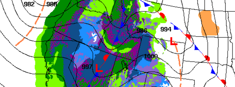
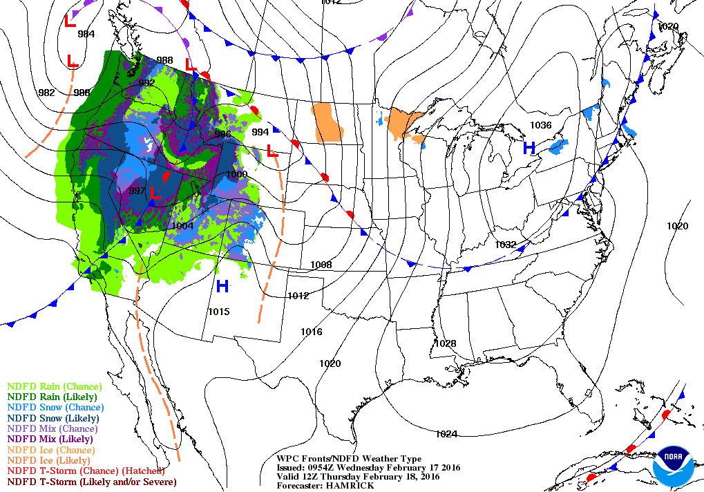
The storm system brought an abundant amount of rainfall to higher elevations, although snowfall at the Cascade Range is more commonly observed during this time of the year. Snow levels were above 1 371.6 m (4 500 feet) during February 15 and 16, and it was expected to rise to 1 828.8 m (6 000 feet) by February 17.
Forecast map for February 18, 2016. Image credit: NWS
The NWS warns of the approaching weather: "A strong Pacific cold front and low pressure system is forecast to reach the West Coast by Wednesday afternoon and result in widespread lower elevation and mountain snow through Thursday. The Cascades and Sierra Nevada are expected to get the greatest snowfall totals, with amounts in excess of one foot likely. Precipitation is also expected from Nevada to Colorado as the front moves inland."
Featured image: Forecast map for February 18, 2016. Image credit: NWS
Commenting rules and guidelines
We value the thoughts and opinions of our readers and welcome healthy discussions on our website. In order to maintain a respectful and positive community, we ask that all commenters follow these rules.