Flash floods, severe thunderstorms and tornadoes to hit the southcentral US over weekend
Another spell of severe weather is in the store for the southcentral US over the coming weekend. Starting on May 7, 2016, strong thunderstorms are expected to develop over the region and spread toward the east by May 9. Hailstorms and strong winds will dominate on Saturday while the next two days will bring high chances for damaging thunderstorms, flash floods and tornadoes.
The first round of severe weather will begin to influence portions of the High Plains on the afternoon of May 7 (local time), bringing hail and winds, and intensifying afterward. By May 8, the system will spread from central Kansas to western central Oklahoma, and central western Texas, including the cities of Wichita, Kansas, Oklahoma City and San Angelo. On May 9, severe weather, including flash floods, severe thunderstorms, and several isolated tornado events, could affect Kansas City, Missouri, Tulsa in Oklahoma, Dallas and San Antonio in Texas.
.gif)
Image credit: DOC/NOAA/NWS/NCEP/Weather Prediction Center
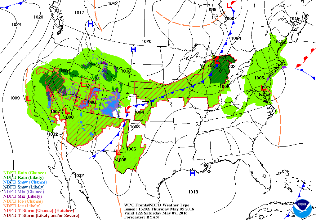
Image credit: NWS/NOAA/WPC/NCEP/DOC
"Storms may erupt as far west and north as the Denver Metro area and foothills of the Colorado Rockies to the Oklahoma and northern Texas panhandles, including western Kansas on Saturday. The severe storm threat on Saturday will mainly be limited to hail and damaging wind gusts, as the atmosphere in the region will not be terribly moist," said Andrew Gagnon, the AccuWeather Assistant Director of Storm Warning Services.
The threat for tornadoes should be taken seriously, as their occurrence during the month of May is, on average, the highest. This happens because, during this time of the season, the day heating and humidity levels are significant while masses of dry and moist air collide, producing a strong vertical shear. All the factors are crucial in developing severe thunderstorms, accompanied by tornadoes.
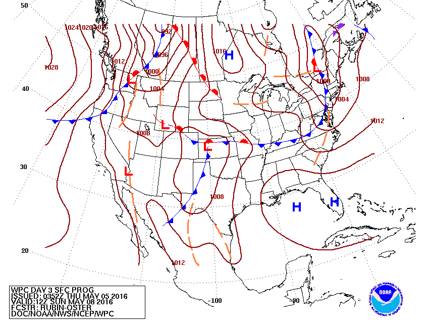
Image credit: DOC/NOAA/NWS/NCEP/WPC
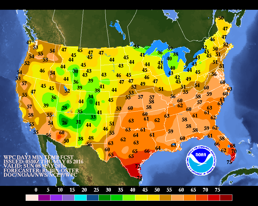
Image credit: DOC/NOAA/NWS/NCEP/WPC
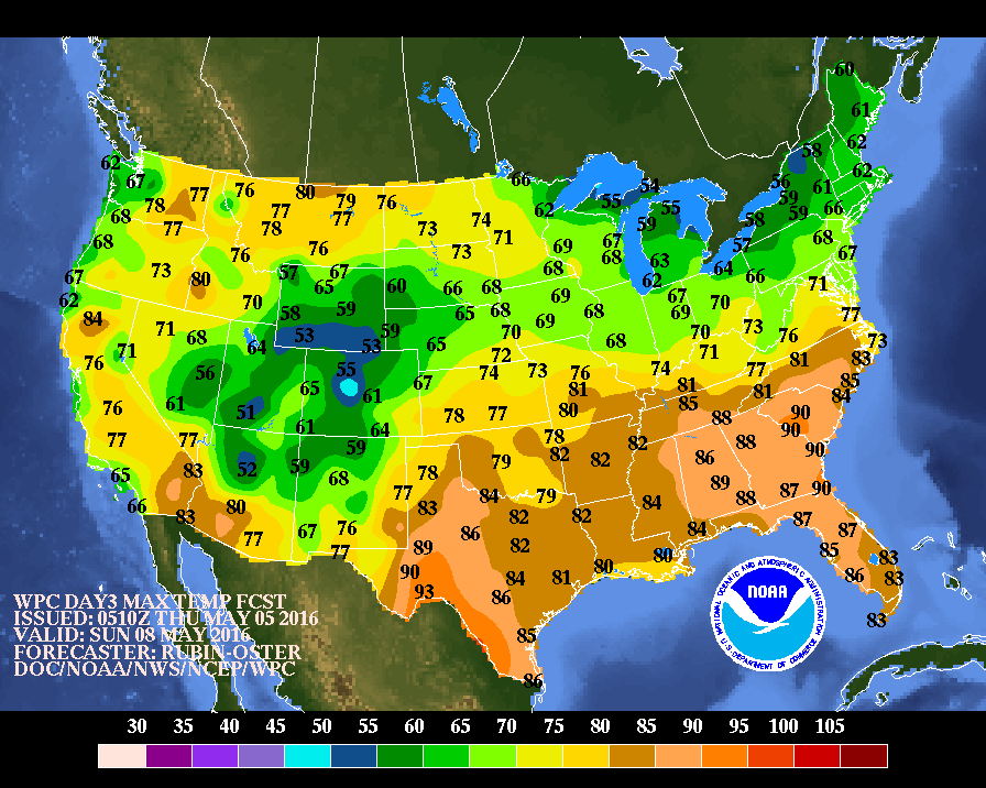
Image credit: DOC/NOAA/NWS/NCEP/WPC
On average, 259 tornadoes occur during the month of May, while the whole year sees 989 such events. The preliminary count of tornadoes was 362 on May 2, 2016, according to the National Weather Service (NWS) Storm Prediction Center.
Generally speaking, the highest risk of severe weather is between 3 and 9 pm while tornadoes reach their maximum between 5 and 6 pm, according to the National Climatic Data Center.
"Storms that hold off until late in the day and are isolated in nature could become intense and, under certain circumstances, lead to violent tornadoes," explained Rick Putnam, the AccuWeather Senior Storm Warning Meteorologist Rich Putnam.
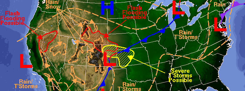
Featured image: Weather forecast for May 7, 2016. Image credit: DOC/NOAA/NWS/NCEP/WPC
Commenting rules and guidelines
We value the thoughts and opinions of our readers and welcome healthy discussions on our website. In order to maintain a respectful and positive community, we ask that all commenters follow these rules:
We reserve the right to remove any comments that violate these rules. By commenting on our website, you agree to abide by these guidelines. Thank you for helping to create a positive and welcoming environment for all.