Gas output increases at Mount Ruapehu, volcanic alert raised
GNS scientists have observed an increase in the output of volcanic gas from Mount Ruapehu's Crater Lake on May 10, 2016. As a result, the Volcanic Alert Level was raised to Level 2. The Aviation Colour Code was also changed, from Green to Yellow.
New Zealand's Ruapehu volcano came back to our attention in late April 2016 during a volcanic earthquake swarm first noticed on April 26.
In their report published April 29, Geonet scientists said swarms like this are uncommon on Ruapehu in recent years. They also noted that the temperature of the Crater Lake has been rising since late 2015 and that since mid-April 2016 it has risen from 25 to 40 °C (77 to 104 °F).
At the time, the volcano didn't exhibit any changes in other monitored parameters like volcanic gas, lake chemistry or lake overflow.
However, in a report published May 11, 2016, Geonet said that most recent visits to the volcano have confirmed an increase in the output of volcanic gas. "Moderate levels of volcanic tremor continue," volcanologist Geoff Kilgour said.
Two monitoring visits to Mt Ruapehu were made yesterday, one was a gas flight to measure the gas output and the other was to sample the Crater Lake water and make additional ground based gas measurements.
"Volcanic gas measurements indicate an increase in the amount of both carbon dioxide (CO2) and sulfur dioxide (SO2) output. The ground based gas measurements were complimentary to the airborne data. The level of tremor has increased but is not exceptional in terms of the last few years," Kilgour noted.
For the last couple of days the temperature of the Crater Lake ranged between 45 and 46 ºC (113 and 114.8 °F).
The increased gas output coupled with high heat flow and volcanic tremor imply a higher likelihood of activity, Geonet warned.
Geological summary
Ruapehu, one of New Zealand's most active volcanoes, is a complex stratovolcano constructed during at least four cone-building episodes dating back to about 200,000 years ago. The 110 cu km dominantly andesitic volcanic massif is elongated in a NNE-SSW direction and surrounded by another 100 cu km ring plain of volcaniclastic debris, including the Murimoto debris-avalanche deposit on the NW flank. A series of subplinian eruptions took place between about 22,600 and 10,000 years ago, but pyroclastic flows have been infrequent.
A single historically active vent, Crater Lake, is located in the broad summit region, but at least five other vents on the summit and flank have been active during the Holocene. Frequent mild-to-moderate explosive eruptions have occurred in historical time from the Crater Lake vent, and tephra characteristics suggest that the crater lake may have formed as early as 3000 years ago. Lahars produced by phreatic eruptions from the summit crater lake are a hazard to a ski area on the upper flanks and to lower river valleys. (GVP)
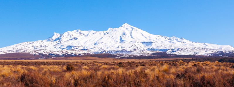
Featured image: Mount Ruapehu on August 17, 2014. Credit: russellstreet (CC – Flickr)
I have seen this mountain in a dream, repeatedly. It’s going to blow like Kracatoa, it will be heard around the world. It will happen soon and the ash fall will be bad. How weird that I would be talking about and searching out the volcanic facts today with a friend. After searching the Internet for the pictures, this is the one that features the ice cap that will be so explosive and shows the vertical diamensions I’ve visualized in my dreams for 10 or more years has me shaking in my knees. God help us if this goes off, it will be. Like Krakatoa!