Increased seismicity at Pavlof, Aviation Color Code raised to Orange, Alaska
At about 18:35 UTC on May 13, 2016, seismic activity at Pavlof volcano increased to levels that are typically associated with minor eruptive activity, Alaska Volcano Observatory (AVO) reports.
Based on the change and character of the seismicity, it is possible that an eruption may be in progress, and accordingly, AVO changed the Aviation Color Code and Volcano Alert Level to Orange/Watch at 20:04 UTC (12:04 AKDT) today.
Since the increase in seismicity, nothing indicative of eruptive activity has been observed in satellite data or in web camera images.
However, Pavlof has been obscured by thick clouds and no thermal signals or ash emissions have been observed through the cloud cover.
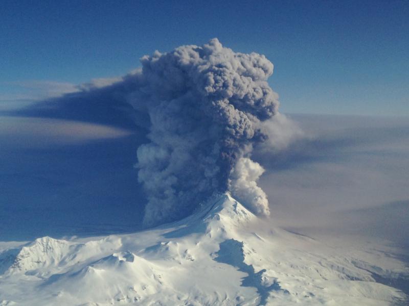
Pavlof volcano eruption on March 28, 2016. Image credit: Nahshon Almandmoss. Taken from Coast Guard 1713, a HC-130H Hercules based at Air Station Kodiak.
The last eruption of this volcano took place on March 27, 2016. Seismicity at the volcano began to increase from background levels at about 23:53 UTC on March 27 with a quick onset of continuous tremor. An ash plume rose to an altitude of 6.1 km (20,000 ft) a.s.l. and by 00:18 UTC on March 28 was drifting north.
During the night lava fountaining from the summit crater was observed by mariners, pilots, and residents of Cold Bay (60 km / 37 milesSW), AVO reported. Lightning in the ash plume was detected in the morning, and infrasound data from a sensor network located in Dillingham (650 km / 404 miles away) also indicated sustained ash emissions.
At 15:00 UTC a continuous ash plume was evident in satellite images drifting more than 650 km NE. A SIGMET issued by the National Weather Service (NWS) Alaska Aviation Weather Unit indicated that the maximum ash-cloud altitude was 11 km (37 000 ft) a.s.l.
The intensity of the eruption significantly declined at 20:30 UTC on 28 March; seismicity and infrasound signals decreased to low levels. Ash emissions decreased through the night and were barely visible in a satellite image acquired at 14:25 UTC on March 29.
Geological summary
The most active volcano of the Aleutian arc, Pavlof is a 2519-m-high Holocene stratovolcano that was constructed along a line of vents extending NE from the Emmons Lake caldera. Pavlof and its twin volcano to the NE, 2142-m-high Pavlof Sister, form a dramatic pair of symmetrical, glacier-covered stratovolcanoes that tower above Pavlof and Volcano bays. A third cone, Little Pavlof, is a smaller volcano on the SW flank of Pavlof volcano, near the rim of Emmons Lake caldera.
Unlike Pavlof Sister, Pavlof has been frequently active in historical time, typically producing Strombolian to Vulcanian explosive eruptions from the summit vents and occasional lava flows. The active vents lie near the summit on the north and east sides. The largest historical eruption took place in 1911, at the end of a 5-year-long eruptive episode, when a fissure opened on the N flank, ejecting large blocks and issuing lava flows. (GVP)
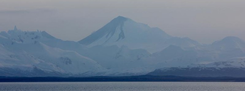
Featured image credit: Pavlof volcano, as seen from Cold Bay, showing deposits of March 27-28 eruption. Photo by Candace Shaack.
Commenting rules and guidelines
We value the thoughts and opinions of our readers and welcome healthy discussions on our website. In order to maintain a respectful and positive community, we ask that all commenters follow these rules.