Tropical Storm “Colin” forms in the Gulf of Mexico, heading toward Florida
Tropical Depression 03 has strengthened into Tropical Storm "Colin" early Monday, June 6, 2016. Colin is expected to strengthen and bring heavy rain, strong winds, coastal flooding and isolated tornadoes to portions of the US Southeast today. Landfall is expected today.
At 03:00 UTC on June 6, NHC has changed Tropical Storm Watch to a Tropical Storm Warning from Altamaha Sound, Georgia to the Flager/Volusia county line, Florida. TS Warning has been issued south of the Flager/Volusia county line to Sebastian Inlet, Florida. TS Watch has been issued north of Altamaha Sound, Georgia to the South Santee River, South Carolina.
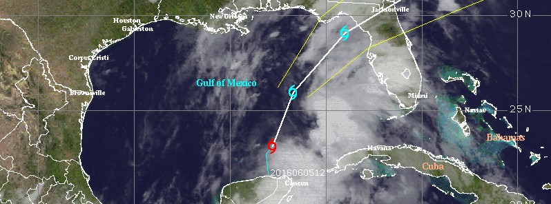
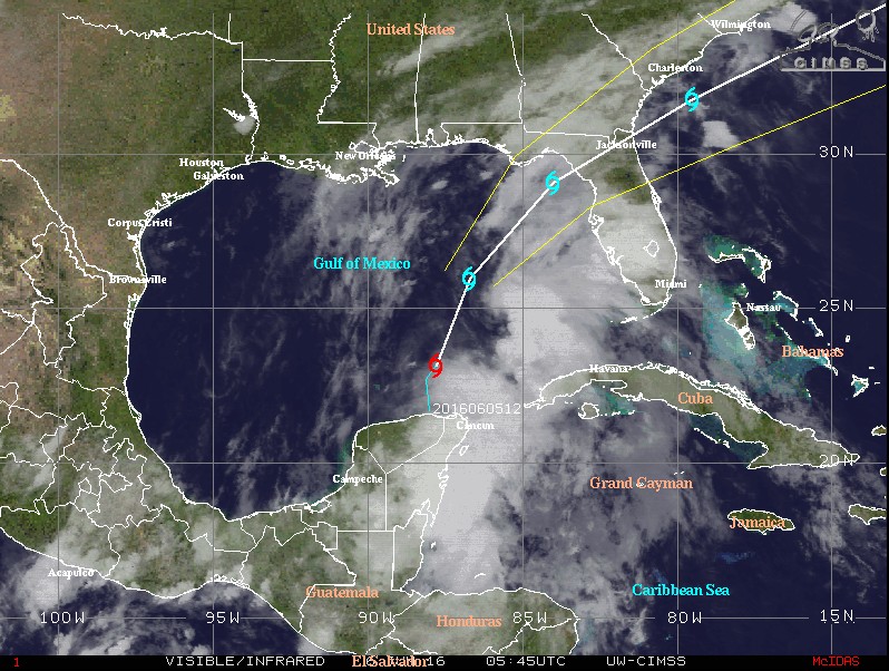
At 06:00 UTC, the center of Tropical Storm "Colin" was located about 665 km (410 miles) SW of Tampa and Apalachicola, Florida. The system is moving toward the north, across the central Gulf of Mexico, at a speed of 16 km/h (10 mph). Colin's maximum sustained winds are 65 km/h (40 mph), it's minimum central pressure is 1 003 hPa.
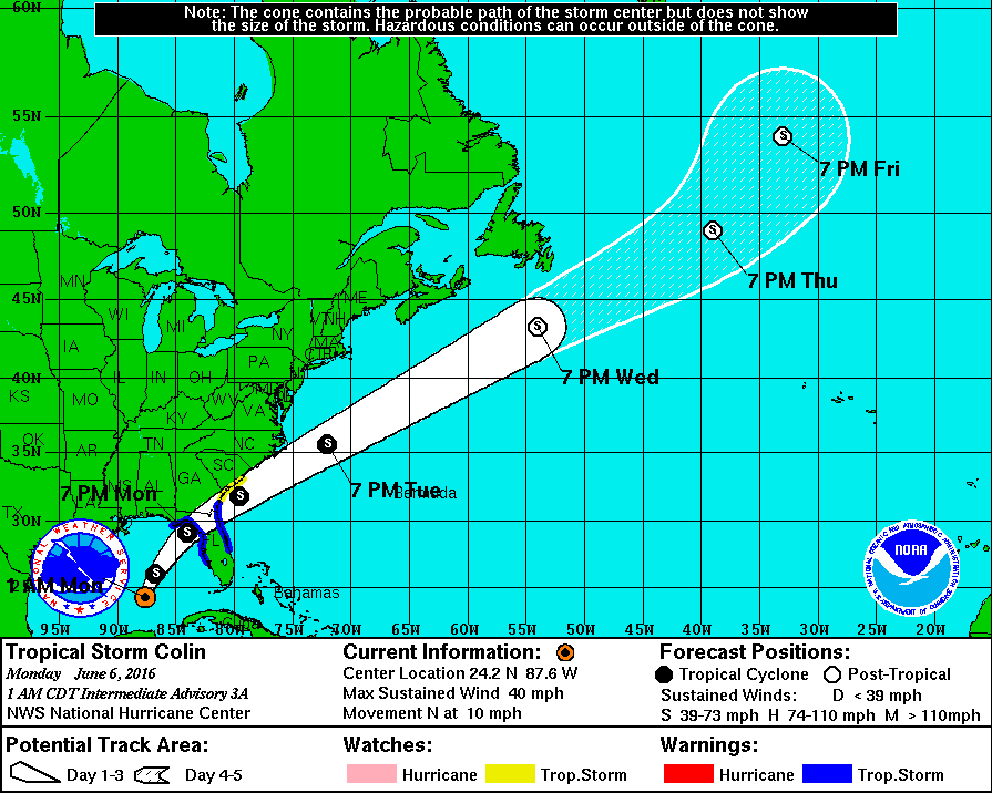
Tropical Storm "Colin" forecast track at 05:45 UTC on June 6, 2016. Credit: UW-CIMSS
On this track, the center of Colin is forecast to approach the coast of the Florida Big Bend area Monday afternoon or evening (local time). Some strengthening is forecast before Colin reaches the coast of Florida.
Tropical-storm-force winds extend outward up to 300 km (185 miles) to the east of the center.
Colin is expected to produce rainfall amounts of 76.2 mm to 127 mm (3 to 5 inches) with isolated maximum totals of 203.2 mm (8 inches) possible across the northeastern Yucatan Peninsula, western Cuba, western Florida, eastern Georgia, and coastal areas of the Carolinas through Tuesday, June 7.
The combination of a storm surge and the tide will cause normally dry areas near the coast to be flooded by rising waters. The water could reach the following heights above ground if the peak surge occurs at the time of high tide:
- Indian Pass to Tampa Bay: 0.3 to 0.9 m (1 to 3 feet) with slightly higher amounts possible in a few locations.
- Tampa Bay south to Florida Bay: 0.3 to 0.6 m (1 to 2 feet).
Localized coastal flooding and dangerous surf is possible along the Florida East Coast within the Tropical Storm Watch area.
The deepest water will occur along the immediate coast. Surge-related flooding depends on the relative timing of the surge and the tidal cycle, and can vary greatly over short distances.
Tropical storm conditions are expected to first reach the Gulf coast within the warning area by Monday afternoon, and the Atlantic coast within the warning area by early Tuesday. Tropical storm conditions are possible along the Atlantic coast within the watch area on Tuesday.
A few tornadoes are possible on Monday across portions of Florida and far southern Georgia.
Featured image: Tropical Storm "Colin" forecast track at 05:45 UTC on June 6, 2016. Credit: UW-CIMSS
Commenting rules and guidelines
We value the thoughts and opinions of our readers and welcome healthy discussions on our website. In order to maintain a respectful and positive community, we ask that all commenters follow these rules:
We reserve the right to remove any comments that violate these rules. By commenting on our website, you agree to abide by these guidelines. Thank you for helping to create a positive and welcoming environment for all.