Hurricane “Celia” to weaken as it moves away from Mexico
Tropical Depression 04E strengthened into a tropical storm on July 8, 2016, and was named Celia. By Sunday, July 10, Celia strengthened into a second hurricane of the 2016 eastern Pacific hurricane season.
At 15:00 UTC on July 8, the center of Tropical Storm "Celia" was located about 1 185 km (735 miles) south-southwest of the southern tip of Baja California, Mexico. It was moving toward the west near 15 km/h (9 mph) and the National Hurricane Center (NHC) said that this motion is expected to continue with some increase in forward speed during the next couple of days. Maximum sustained winds have increased to near 75 km/h (45 mph) with higher gusts. The estimated minimum central pressure at the time was 1 003 hPa.
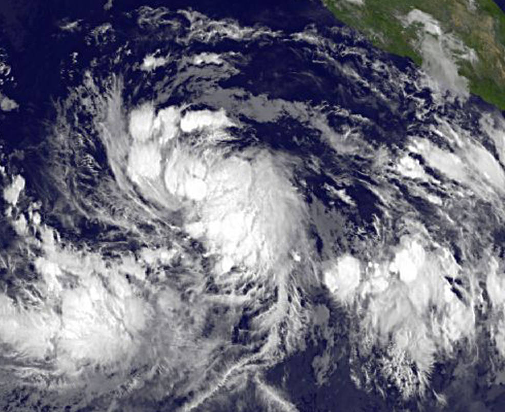
Tropical Storm "Celia" at 12:00 UTC on July 8, 2016. Credit: NASA/NOAA GOES Project
Celia strengthened into a hurricane over the weekend of July 9 and 10. On July 11, NHC said that after developing what had been a decent looking eye with a diameter of about 37 km (23 miles), dry air has once again penetrated into the inner-core region and has eroded most of the eyewall convection.
At 15:00 UTC on July 11, its center was located about 1 850 km (1 150 miles) WSW of the southern tip of Baja California. Celia was moving toward the west near 20 km/h (13 mph). A turn toward the west-northwest with a slight decrease in forward speed was expected into Tuesday, July 12. Maximum sustained winds have increased to near 150 km/h (90 mph) and some additional strengthening is expected. The estimated minimum central pressure at the time was 977 hPa.
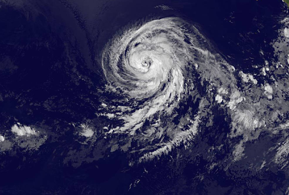
Hurricane "Celia" on July 11 at 12:00 UTC. Credit: NASA/NOAA GOES Project
At 09:00 UTC on July 12, the center of Hurricane "Celia" was located about 2 025 km (1 260 miles) WSW of the southern tip of Baja California. Its maximum sustained winds were 155 km/h (100 mph). The system was moving WNW at 17 km/h (10 mph). Its minimum estimated central pressure was 972 hPa.
A turn toward the northwest is expected later today. Weakening is forecast during the next 48 hours, and Celia could weaken to a tropical storm on Wednesday, July 13.
Hurricane-force winds extend outward up to 45 km (30 miles) from the center and tropical-storm-force winds extend outward up to 220 km (140 miles).

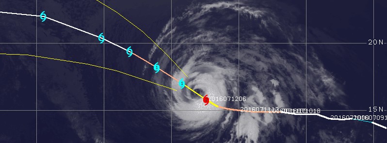
Hurricane "Celia" at 11:30 UTC on July 12, 2016. Credit: UW-CIMSS
There are no coastal warnings or watches in effect.
Featured image: Hurricane "Celia" at 11:30 UTC on July 12, 2016. Credit: UW-CIMSS
Commenting rules and guidelines
We value the thoughts and opinions of our readers and welcome healthy discussions on our website. In order to maintain a respectful and positive community, we ask that all commenters follow these rules:
We reserve the right to remove any comments that violate these rules. By commenting on our website, you agree to abide by these guidelines. Thank you for helping to create a positive and welcoming environment for all.