Tropical Storm “Mirinae” hits China’s Hainan before moving on to Vietnam

Tropical Storm "Mirinae" made landfall over the Hainan province in China on July 26, 2016. Intense wind gusts toppled trees and power lines, causing traffic disruptions. Over 3 000 people have been evacuated ahead of the storm. No victims or injuries were reported. The storm was expected to slightly intensify prior to making another landfall over north Vietnam.
Tropical Storm "Mirinae" developed on July 26 from Tropical Depression 05W, formed on July 25 over the South China Sea, just before making landfall over Hainan. It is the third tropical system reported to hit China this year, the third named tropical system of the 2016 Pacific typhoon season and the first to make landfall over Vietnam this year.
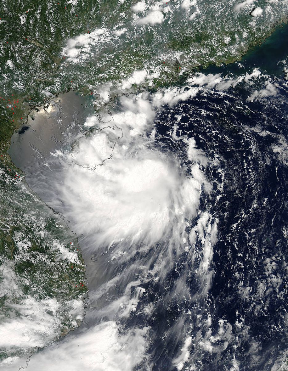
On July 26, 2016, at 06:05 a.m. EDT NASA's Aqua satellite captured this visible image of Tropical Storm Mirinae spreading over Hainan Island, China. Image credit: NASA Goddard MODIS Rapid Response Team
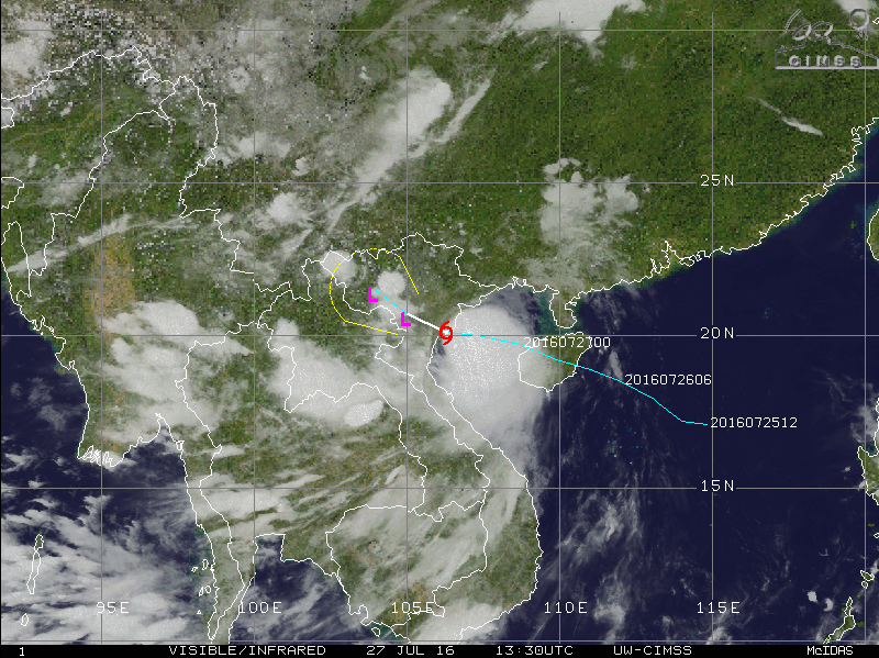 Tropical Storm "Mirinae", July 27, 2016, at 13:30 UTC. Image credit: UW-CIMSS
Mirinae made landfall over Dong'ao, Wanning, Hainan at 14:20 UTC on July 26.
Winds around 100 km/h (62 mph) were reported across the affected areas. Air traffic at the Haikou Meilan International Airport and Sanya Phoenix International Airport has been temporarily suspended but is now operational again. Over 25 000 fishing vessels remained in the harbor due to extreme weather conditions, and passenger ships in the Qiongzhou Strait were delayed up to a few hours ago while the bullet trains in Hainan were scheduled to continue traveling on short notice.

Video credit: WION
#BREAKING Typhoon Mirinae makes landfall in southern China's Hainan with wind reaching 100 km/h pic.twitter.com/gp2mkR1UqD
— CCTVNEWS (@cctvnews) July 26, 2016
The system is currently located approximately 107.4 km (66.7 miles) south-southeast of Hanoi, Vietnam, and was moving west-northwestwards at a speed of 16.7 km/h (10.4 mph) over the last couple of hours. According to the Joint Typhoon Warning Center (JTWC), Mirinae made landfall over the northeast coast of Vietnam, about 111 km (69 miles) south-southeast of Hanoi, on July 27 at 12:00 UTC.
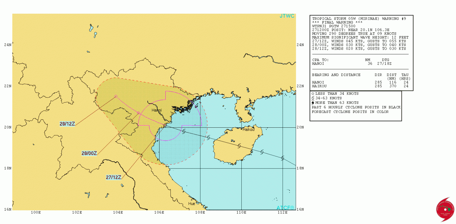
Tropical Storm "Mirinae" 24-hour forecast track. Image credit: JTWC
Tropical Storm "Mirinae" was packing maximum sustained winds of 83.3 km/h (51.7 mph). According to the JTWC, the storm will track further inland under the influence of the subtropical ridge and will dissipate over the mountainous Vietnam terrain in the next 24 hours.
Featured image credit: WION
Commenting rules and guidelines
We value the thoughts and opinions of our readers and welcome healthy discussions on our website. In order to maintain a respectful and positive community, we ask that all commenters follow these rules:
We reserve the right to remove any comments that violate these rules. By commenting on our website, you agree to abide by these guidelines. Thank you for helping to create a positive and welcoming environment for all.