After Meranti, Typhoon “Malakas” (Gener) nears the Philippines and Taiwan
Tropical Storm "Malakas" formed on September 12, 2016, about 320 km (200 miles) SSW of Guam, and became a typhoon around 12:00 UTC on September 14. At the time, it had maximum sustained winds of 129 km/h (80.5 mph) and was located about 1 090 km (677 miles) NNE of Manila, Philippines.
PAGASA named this typhoon Gener and issued TCWS 1 for the Batanes Group of Islands in the Luzon Strait. Unlike Super Typhoon "Meranti," which passed right over the Philippines island of Itbayat, south of Taiwan, Malakas will track east of Taiwan and pass about 80 km (51 miles) NE of its northeastern tip.
The center of Typhoon "Malakas" was located about 616 km (382 miles) east of Tuguegarao City at 08:00 UTC on September 15, according to the PAGASA. It had maximum sustained winds of 140 km/h (87 mph) near the center and gustiness of up to 170 km/h (106 mph). The typhoon is expected to move WNW at 25 km/h (15.5 mph).
Estimated rainfall amount is from moderate to heavy within the 400 km (248 miles) diameter of the typhoon.
At 08:00 UTC on September 16, the center of Malakas is expected to be located about 165 km (102 miles) NE of Aparri, Cagayan.
Currently, Tropical Cyclone Warning Signal 1 is in effect for the Batanes Group of Islands in the Luzon Strait. Wave height at open sea is between 1.2 and 4 m (4 to 13 feet).

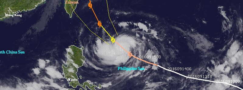
Typhoon "Malakas" at 11:30 UTC on September 15, 2016. Credit: UW-CIMSS
At 09:00 UTC, JTWC said Malakas will continue tracking to the northwest along the steering ridge under favorable conditions. The upper-level low is expected to persist and influence outflow on the eastern periphery, however, enhanced poleward flow is also expected to improve giving an opportunity for intensification over the next 36 hours reaching a peak intensity of 204 km/h (127 mph).
After 21:00 UTC on September 16, Malakas is expected to slow down as it rounds the ridge axis near northeastern Taiwan. Slight land interaction is expected during this time leading to a gradual weakening.
Malakas will then continue to track northeastward along the northern periphery of the subtropical ridge into the westerly jet. Vertical wind shear will increase significantly leading to rapid weakening of the system by 09:00 UTC on September 20.
At this time, confidence in the JTWC's Malakas forecast track is low.
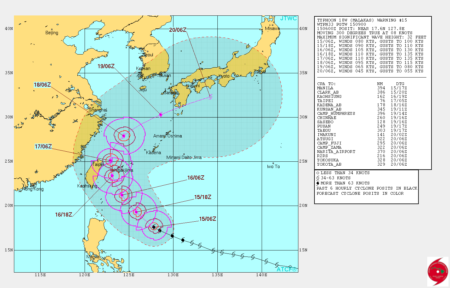
Typhoon "Malakas" forecast track by JTWC at 09:00 UTC on September 15, 2016
Featured image: Typhoon "Malakas" at 11:30 UTC on September 15, 2016. Credit: UW-CIMSS
Commenting rules and guidelines
We value the thoughts and opinions of our readers and welcome healthy discussions on our website. In order to maintain a respectful and positive community, we ask that all commenters follow these rules:
We reserve the right to remove any comments that violate these rules. By commenting on our website, you agree to abide by these guidelines. Thank you for helping to create a positive and welcoming environment for all.