Ophelia weakens to a tropical storm as it races toward the Avalon peninsula of Newfoundland
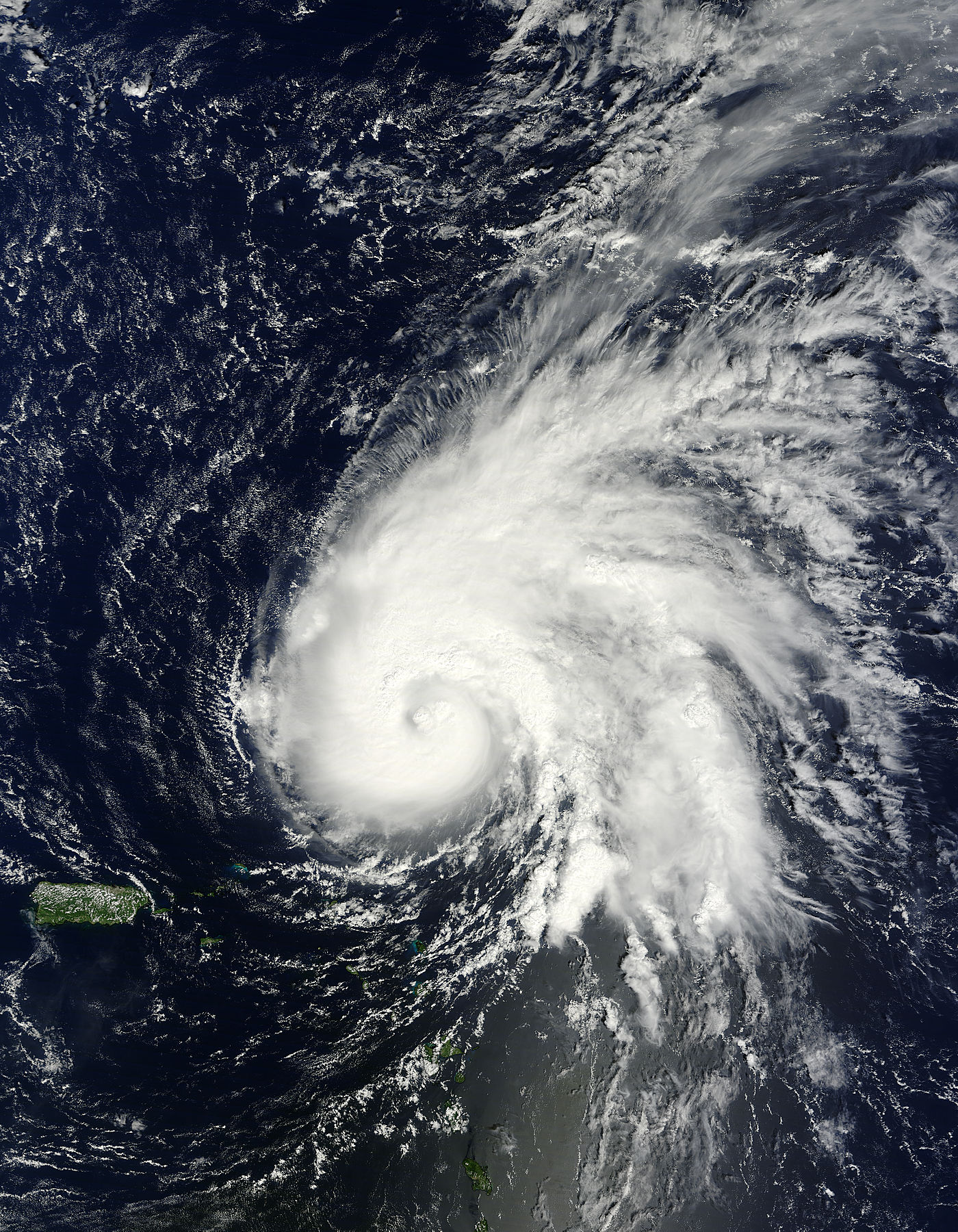
Ophelia was strengthening into a hurricane when the Moderate Resolution Imaging Spectroradiometer (MODIS) on NASA’s Terra satellite captured this natural-color image on September 29, 2011. MODIS acquired this image at 10:40 a.m. Atlantic Standard Time (AST). Twenty minutes later, the U.S. National Hurricane Center (NHC) reported that Ophelia had winds of 70 miles (110 kilometers) per hour, and was headed north-northwest.
At 11:00 a.m. AST on September 30, the NHC reported that Hurricane Ophelia had maximum sustained winds of 115 miles (185 kilometers) per hour, making it a Category 3 hurricane on the Saffir-Simpson Hurricane Wind Scale. At that time the storm was continuing to travel toward the north-northwest. By 8:00 p.m. AST on October 2, Ophelia was weakening as it moved quickly north-northeastward towards the Avalon Peninsula of Newfoundland. At that time it was located 445 miles (715 kilometers) south-west of Cape Race, Newfoundland and had maximum sustained winds of near 90 miles (150 kilometers) per hour, making it a Category One hurricane.
The NHC forecast steady weakening; however Ophelia is expected to be near hurricane strength when it passes near to the Avalon Peninsula. Once past southern Newfoundland, the storm is expected to quickly become a post-tropical cyclone and dissipate. (MODIS)
| 5:00 AM AST Mon Oct 3 Location: 46.5°N 54.2°W Max sustained: 70 mph Moving: NE at 43 mph Min pressure: 983 mb |
Public Advisory #43 500 AM AST |
Aviso Publico none issued in last 12 hrs |
Forecast/ Advisory #43 0900 UTC |
Forecast Discussion #43 500 AM AST |
Wind Speed Probabilities #43 0900 UTC |

.
.
Commenting rules and guidelines
We value the thoughts and opinions of our readers and welcome healthy discussions on our website. In order to maintain a respectful and positive community, we ask that all commenters follow these rules.