Tropical Storm “Hagibis” to make landfall in southeastern China
Chinese authorities issued a blue level alert (lowest, 1 out of 4) on Saturday, June 14, as Tropical Storm "Hagibis" approached southeastern China. Hagibis is expected to make landfall late on Sunday, June 15, along the Guangdong Province coast and move near the city of Shantou.
Torrential rains and storms started affecting eastern areas of Guangdong, southern Fujian and southern Taiwan late on Saturday.
According to latest warning issued by Joint Typhoon Warning Center (JTWC) at 09:00 UTC today, Tropical Storm "Hagibis" was located approximately 153 NM (283 km, 176 miles) east-northeast of Hong Kong, and has tracked northward at 07 knots (12.9 km/h, 7 mph) over the past six hours.
Maximum significant wave height at 06:00 UTC today was 16 feet (4.8 meters). Maximum sustained winds were 40 knots (74 km/h, 46 mph), with wind gusts of 50 knots (92 km/h, 57.5 mph).
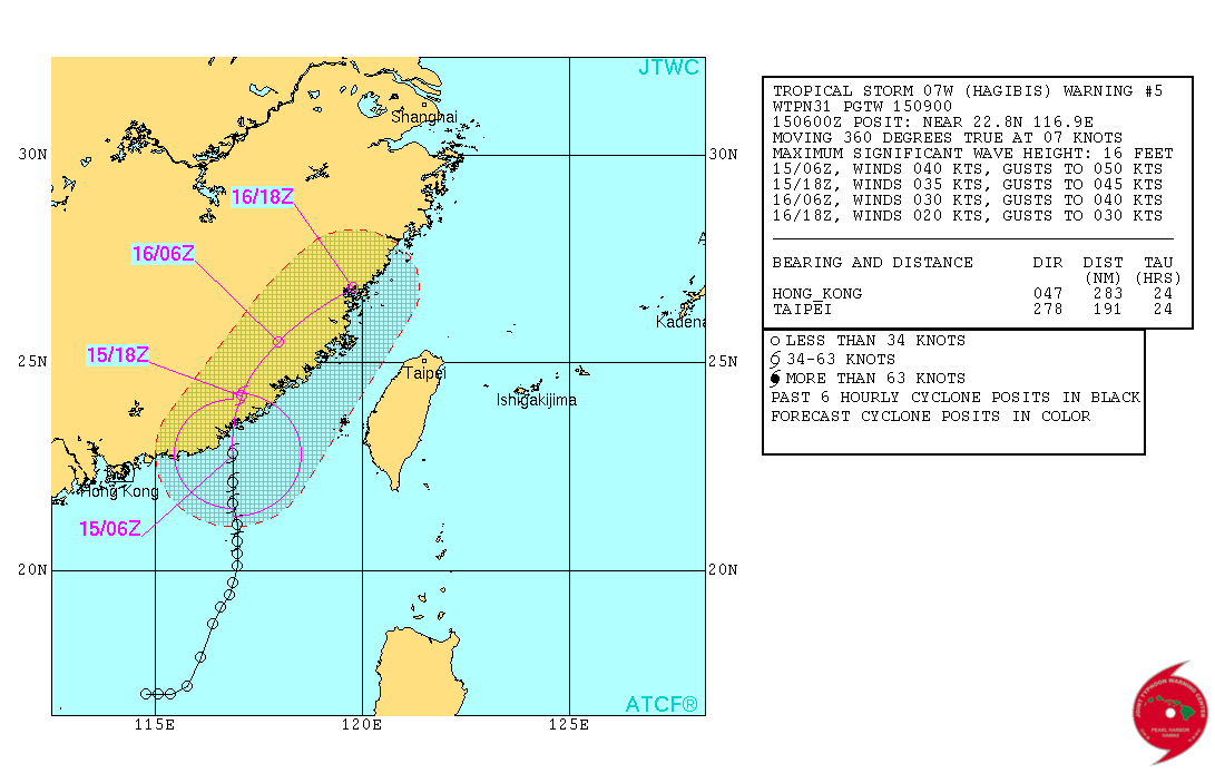
Tropical Storm "Hagibis" forecast track on June 15, 2014. Image credit: JTWC
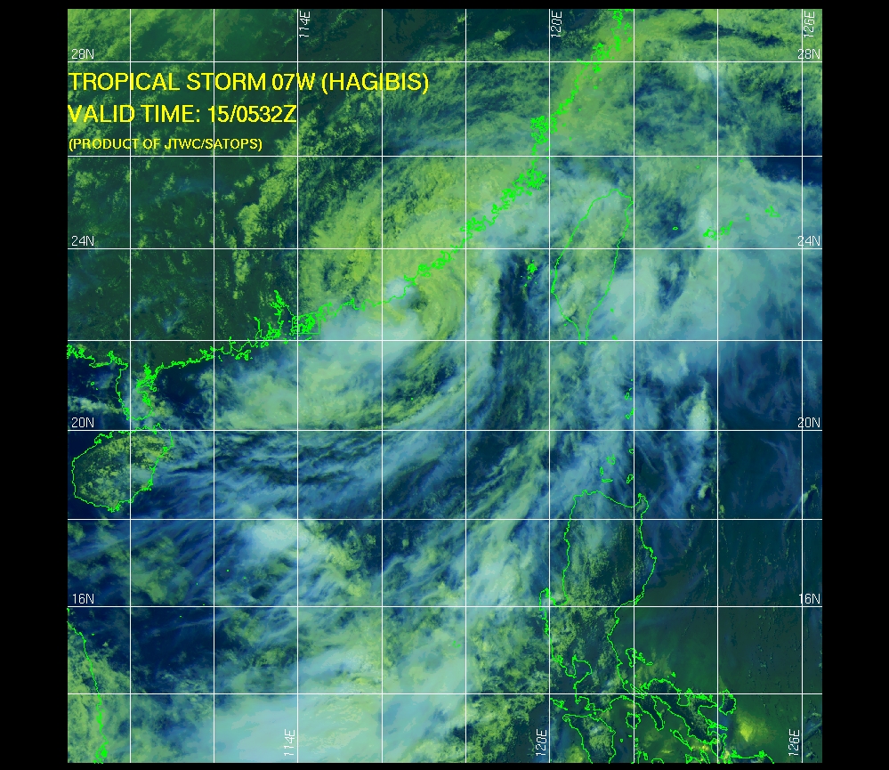
Tropical Storm "Hagibis" – multispectral satellite image on June 15, 2014. Image credit: JTWC/SATOPS
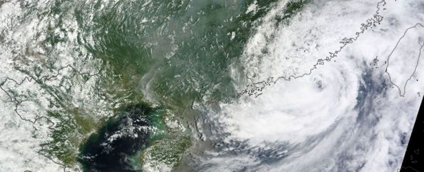
Featured image: NASA – Terra / MODIS on June 15, 2014.
Commenting rules and guidelines
We value the thoughts and opinions of our readers and welcome healthy discussions on our website. In order to maintain a respectful and positive community, we ask that all commenters follow these rules.