Tropical Storm “Ana” heading toward Hawaii
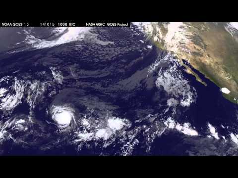
A Tropical Storm Watch was issued yesterday for Hawaii County, Hawaii, as Tropical Storm "Ana" continues on its path toward the islands. Heavy rainfall is expected to reach the Big Island on Friday, October 17, 2014 causing life-threatening flash floods and mud slides.
Ana is forecast to move to the west-northwest and strengthen into a hurricane, approaching the Big Island by Saturday, October 18 and then tracking parallel to the islands over the two days following.
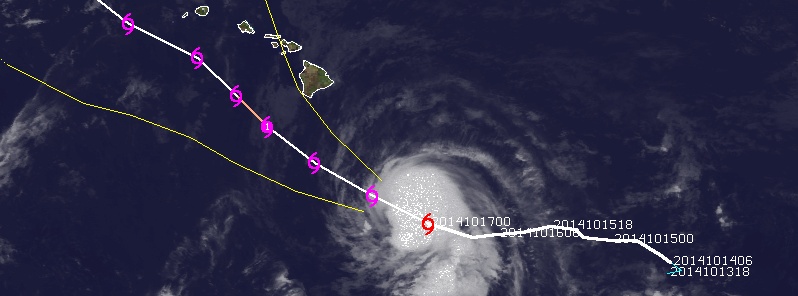
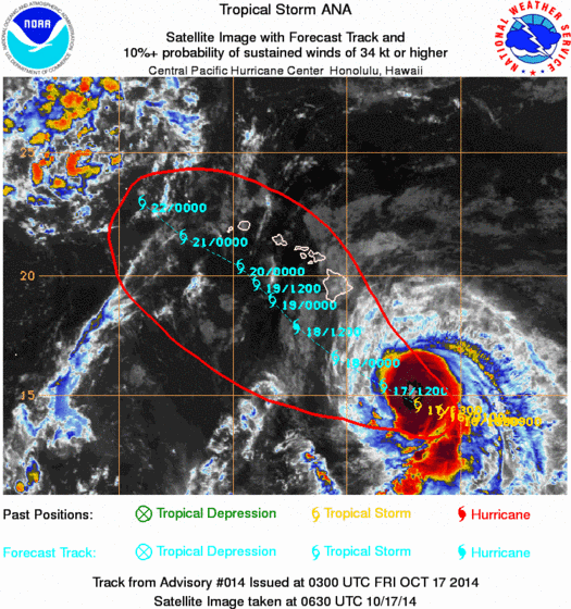
In their 06:00 UTC update on October 17, 2014, NOAA's Central Pacific Hurricane Center (CPHC) said Ana was located about 605 km (375 miles) SSE of Hilo and about 920 km (570 miles) SE of Honolulu. Maximum sustained winds were 105 km/h (65 mph). Minimum central pressure was 998 MB or 29.47 inches.
Ana was moving WNW at 19 km/h (12 mph).
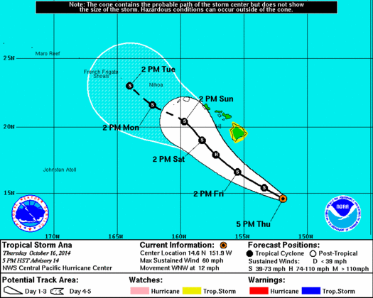
Some strengthening is expected during the next 24 hours, with Ana possibly becoming a hurricane on Friday. Weakening is expected Friday night and Saturday (local time, UTC -10).
Tropical storm force winds extended outward up to 95 km (60 miles) from the center.
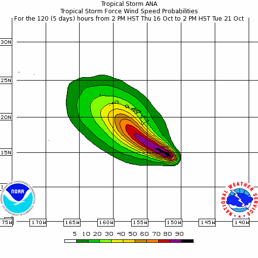
Large swells produced by Ana are expected to build over the eastern end of the main Hawaiian island chain through Friday morning. These large swells will continue to spread up the island chain through the weekend. Surf produced by these swells could potentially be damaging along exposed south and southeast shorelines beginning late Friday and Saturday, and persisting through the weekend in some areas.
Heavy rainfall associated with Ana may reach the Big Island of Hawaii Friday afternoon, with total rain accumulations between 15 and 30 cm (6 – 12 inches) expected. Heavy rain could potentially affect the other islands Saturday and Sunday. This rainfall could cause life-threatening flash floods and mud slides.
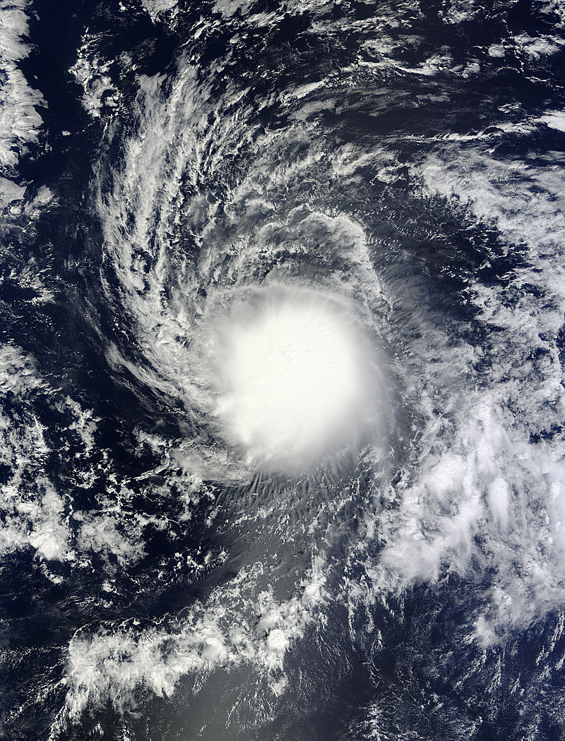
Tropical Storm "Ana" on October 15, 2014. Image credit: NASA Goddard MODIS Rapid Response Team
Satellite animations
- Storm-Centered Infrared (GOES 13; NOAA/SSD)
- Storm-Centered Infrared (Aviation Color Enhancement) (GOES 13; NOAA/SSD)
- Storm-Centered Water Vapor (GOES 13; NOAA/SSD)
- Storm-Centered Visible (GOES 13; NOAA/SSD)
- Storm-Centered Visible (Colorized) (GOES 13; NOAA/SSD)
- Storm-Centered Infrared (GOES 15; CIMSS)
- Storm-Centered Enhanced Infrared (GOES 15; CIMSS)
- Storm-Centered Water Vapor (GOES 15; CIMSS)
- Storm-Centered Visible (GOES 15; CIMSS)
- Central Pacific Infrared (GOES 11; NOAA)
- Central Pacific Infrared (Aviation Color Enhancement) (GOES 11; NOAA)
- Central Pacific Water Vapor (GOES 11; NOAA)
- Central Pacific Visible (GOES 11; NOAA)
- Central Pacific Visible (Colorized) (GOES 11; NOAA)
Featured image: Tropical Storm "Ana" forecast track by UW-CIMSS on October 17, 2014.
Commenting rules and guidelines
We value the thoughts and opinions of our readers and welcome healthy discussions on our website. In order to maintain a respectful and positive community, we ask that all commenters follow these rules.