New island being formed by Hunga Tonga-Hunga Ha’apai eruption
Continuous volcanic eruptions of Hunga Tonga-Hunga Ha'apai which started mid-December 2014 are creating a new island about 65 km northwest of Nuku’alofa, Tonga.
As of January 15, 2015 the island was more than 1 km long, about 2 km wide and around 100 meters high, Tonga's Lands, Survey and Natural Resources Ministry deputy secretary Taaniela Kula said.
"A new island has been built by the eruption between the existing islands of Hunga Tonga and Hunga Ha'apai, and is now joined to Hunga Ha'apai," he said.
.jpg)
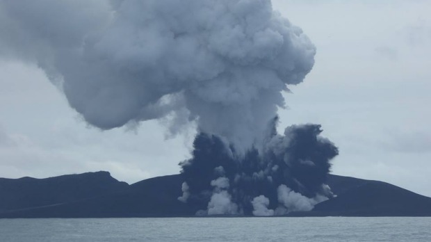
The eruption site as reported on December 20, 2014. Image credit: Lands, Survey and Natural Resources Ministry – Tonga
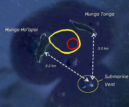
The location of new island. Image credit: Lands, Survey and Natural Resources Ministry – Tonga / Matangi Tonga
"During our observations the volcano was erupting about every five minutes to a height of about 400 meters, accompanied by some large rocks. As the ash is very wet, most is being deposited close to the vent, building up the new island."
Hazardous surges of ash and steam were seen to spread out horizontally during eruptions, and these extended more than 1 km from the erupting vent.
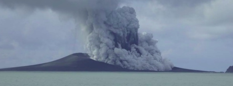
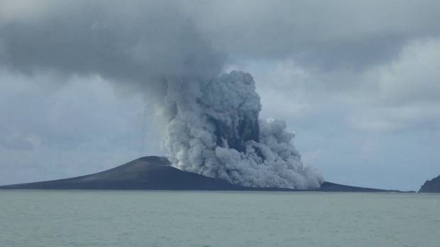
Hunga Tonga-Hunga Ha'apai eruption on January 15, 2015. Image credit: New Zealand High Commission – Tonga
Kula says the scientists have not been able to establish any connection between the volcano and the large ocean algal bloom which has turned a wide area of the sea red.
Leaves on trees on Hunga Tonga and Hunga Ha'apai have died, probably caused by volcanic ash and gases.
No large rafts of pumice or other floating volcanic debris were observed. Strong smells of volcanic gases were noticed on a few occasions.
Hunga Tonga-Hunga Ha'apai eruption on January 15, 2015. Image credit: New Zealand High Commission – Tonga
This eruption is similar to that at Hunga Ha’apai in 2009, but producing a larger volume of materials building the island, Kula said.
Ash and acid rain is falling within 10 km of the eruption.
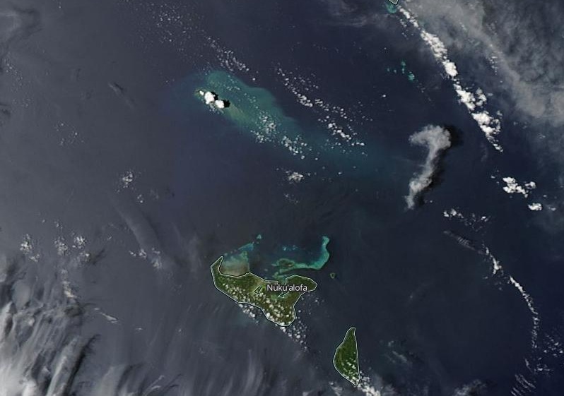
Image credit: NASA Aqua/MODIS. Acquired: January 15, 2015
Geologic summary
The small islands of Hunga Tonga and Hunga Ha'apai cap a large seamount located about 30 km SSE of Falcon Island. The two linear andesitic islands are about 2 km long and represent the western and northern remnants of the rim of a largely submarine caldera lying east and south of the islands.
Hunga Tonga and Hunga Ha'apai reach an elevation of only 149 m and 128 m above sea level, respectively, and display inward-facing sea cliffs with lava and tephra layers dipping gently away from the submarine caldera. A rocky shoal 3.2 km SE of Hunga Ha'apai and 3 km south of Hunga Tonga marks the most prominent historically active vent. Several submarine eruptions have occurred at Hunga Tonga-Hunga Ha'apai since the first historical eruption in 1912. (GVP)
Featured image: Hunga Tonga-Hunga Ha'apai eruption on January 15, 2015. Image credit: New Zealand High Commission – Tonga
Commenting rules and guidelines
We value the thoughts and opinions of our readers and welcome healthy discussions on our website. In order to maintain a respectful and positive community, we ask that all commenters follow these rules.