Tropical Storm “Bill” to make landfall along the Texas coast today, US
Tropical Storm "Bill" was named early June 16, 2015 (late June 15 CDT) and is heading toward landfall along the Texas today. A Tropical Storm Warning is in effect for Baffin Bay to High Island. Bill is expected to bring more heavy rain to already saturated grounds of Texas and Oklahoma causing more flooding.
Coastal Galveston County issued a voluntary evacuation for the Bolivar Peninsula on Monday. Potential rainfall could flood roads on the peninsula, making it harder to leave later or for emergency responders to reach them.
Texas Gov. Greg Abbott said that a special operations center is on alert. "Any additional rainfall will exacerbate already saturated grounds, which could quickly lead to dangerous flash flooding and extended river flooding," he said.
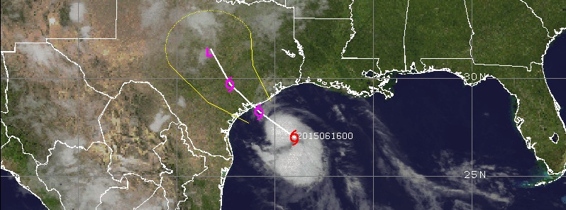
At 06:00 UTC on Tuesday, June 16 (01:00 CDT), the center of Tropical Storm "Bill" was located 155 km (95 miles) SE of Port O'Connor and 195 km (120 miles) SSW of Galveston, Texas with maximum sustained winds of 85 km/h (50 mph).
Storm's present movement is NW at 20 km/h (13 mph) and this general motion is expected to continue today. Minimum central pressure is 1005 hPa.

On the forecast track, NWS NHC said, Bill is expected to make landfall along the Texas coast later this morning (local time) and move inland over south-central Texas this afternoon and tonight (June 16, local time).
Slight strengthening is possible before landfall and Bill is expected to weaken after the center moves inland.
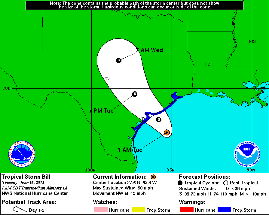
Tropical storm force winds extend outward up to 260 km (160 miles) from the center.
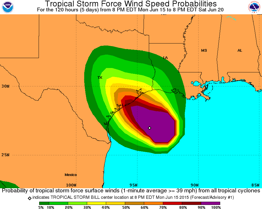
Tropical Storm "Bill" is expected to produce total rain accumulations of 4 to 8 inches (10 – 20 cm) over eastern Texas and eastern Oklahoma and 2 to 4 inches (5 – 10 cm) over western Louisiana and western Arkansas, with possible isolated amounts of 12 inches (30 cm) in eastern Texas.
The combination of a storm surge and the tide will cause normally dry areas near the coast to be flooded by rising waters. The water could reach the following heights above ground if the peak surge occurs at the time of high tide:
- Upper Texas coast: 2 – 4 feet (60 – 120 cm)
- Western Louisiana coast: 1 – 2 feet (30 – 60 cm)
The deepest water will occur along the immediate coast near and to the right of the landfall location. Surge-related flooding depends on the relative timing of the surge and the tidal cycle, and can vary greatly over short distances, NHC said.

Featured image: Tropical Storm "Bill" on June 16, 2015. Credit: UW-CIMSS.
Commenting rules and guidelines
We value the thoughts and opinions of our readers and welcome healthy discussions on our website. In order to maintain a respectful and positive community, we ask that all commenters follow these rules.