Hakoneyama volcano activity rises to a new level, Japan
The Japan Meteorological Agency (JMA) has raised the eruption warning of Hakoneyama volcano from level 2 to 3 on Tuesday, June 30, 2015 following a small scale eruption.
Authorities evacuated about 40 people from nearby hot spring tourist resort and further limited access to the area, warning more eruptions are possible.
JMA official said activity in the area, some 80 km (50 miles) west of Tokyo, seemed to have risen "to a new level". "It was an extremely small scale eruption, but there is the chance of a larger one that could affect a wider area," he said at a news conference.
The JMA has confirmed that fresh layers of volcanic ash had been detected near a newly-found vent in the Owakudani valley, after the volcano had been emitting irregular amounts of steam in recent months.
According to Xinhua, JMA has sent a team of experts to the mountain today, while Prime Minister Shinzo Abe's office set up an emergency liaison office to deal with the disaster and its potential escalation.
The JMA said it had detected 14 earthquakes on Monday, June 29 with magnitudes ranging between 1.9 and 3.2.
"Predicting the scale of any eruption is hard because the mountain last erupted 800 years ago," volcanologist Toshitsugu Fujii, an emeritus professor of Tokyo University, said as quoted by Reuters.
"If hot water or magma becomes involved, it could explode at a deeper level, and there would probably be very little warning," he said. "Things are now taking place at a shallow level and probably it won't go that far, but you can't say when that might change."
The increase in frequency of earthquakes under Hakoneyama started on April 26, 2015. On May 4, a total of 34 volcanic earthquakes was recorded and by 06:00 UTC on May 5, this number tripled and was at 98.
On May 6, 2015, JMA raised the alert level to 2 warning people to stay away from the crater.
"Activity at Hakone… is in a state of uncertainty," JMA said in an advisory issued in May, warning people not to enter dangerous zones.
"There is a possibility that a minor eruption may suddenly occur. Shallow hot-water activity in parts of the Owakudani Valley has become unstable,” the agency added.
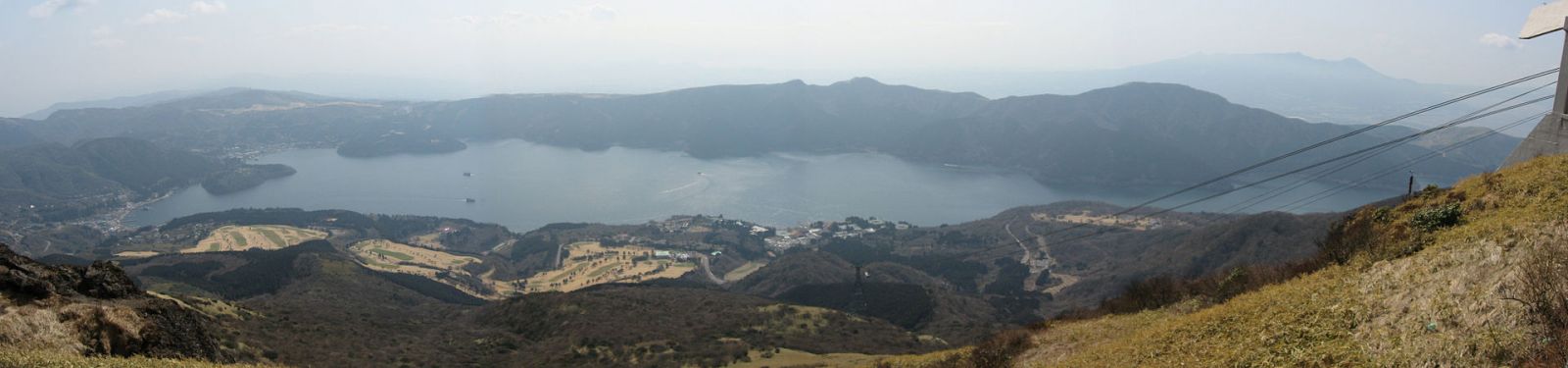
Lake Ashi from Mt. Komagatake. (CC – Wikimedia).
1 400 small earthquakes were recorded around Hakoneyama in February 2013, but they were not followed by eruption.
Elevated seismicity at the volcano was also recorded during June and August 2001. It was associated with a small amount of inflation that was centered at the volcano. Earthquake hypocenters occurred at depths less than 5 km beneath the volcano. A small swarm was also recorded under the northern end of the Ashino-ko (caldera lake).
JMA noted at the time that the change in activity might not be a precursor to an eruption since similar activity has occurred in the past that was not followed by an eruption.
The last known eruption of this volcano took place in the year 1170 (845 years ago/VEI unknown).
Geologic summary
Hakoneyama volcano is truncated by two overlapping calderas, the largest of which is 10 x 11 km wide. The calderas were formed as a result of two major explosive eruptions about 180,000 and 49,000-60,000 years ago. Scenic Lake Ashi lies between the SW caldera wall and a half dozen post-caldera lava domes that were constructed along a SW-NE trend cutting through the center of the calderas.
Dome growth occurred progressively to the south, and the largest and youngest of these, Kamiyama, forms the high point of Hakoneyama. The calderas are breached to the east by the Hayakawa canyon.
A phreatic explosion about 3000 years ago was followed by collapse of the NW side of Kamiyama, damming the Hayakawa valley and creating Lake Ashi. The latest magmatic eruptive activity about 2900 years ago produced a pyroclastic flow and a lava dome in the explosion crater, although phreatic eruptions took place as recently as the 12-13th centuries CE. Seismic swarms have occurred during the 20th century. Lake Ashi, along with major thermal areas in the caldera, forms a popular resort area SW of Tokyo. (GVP)
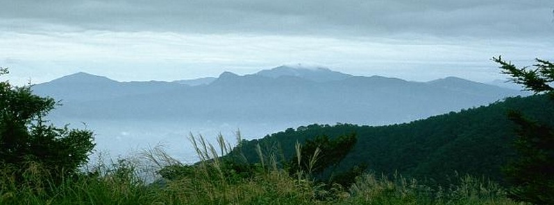
Featured image: Hakone volcano, seen here from the west. Photo by Lee Siebert, 1977 (Smithsonian Institution).
Commenting rules and guidelines
We value the thoughts and opinions of our readers and welcome healthy discussions on our website. In order to maintain a respectful and positive community, we ask that all commenters follow these rules.