Hurricane “Guillermo” – fifth hurricane of 2015 eastern Pacific hurricane season moving toward Hawaii
Tropical Storm "Guillermo" formed on July 30, 2015 about 3 190 km (1 980 miles) ESE of Hilo, Hawaii and by July 31 it strengthened into the fifth hurricane of 2015 eastern Pacific hurricane season.
Infrared image taken by GOES-West on July 30 showed bands of thunderstorms spiraling around the northern quadrant and wrapping into the low-level center from the west. Fragmented band of thunderstorms from the eastern quadrant also wrapped around the northern quadrant of the storm.
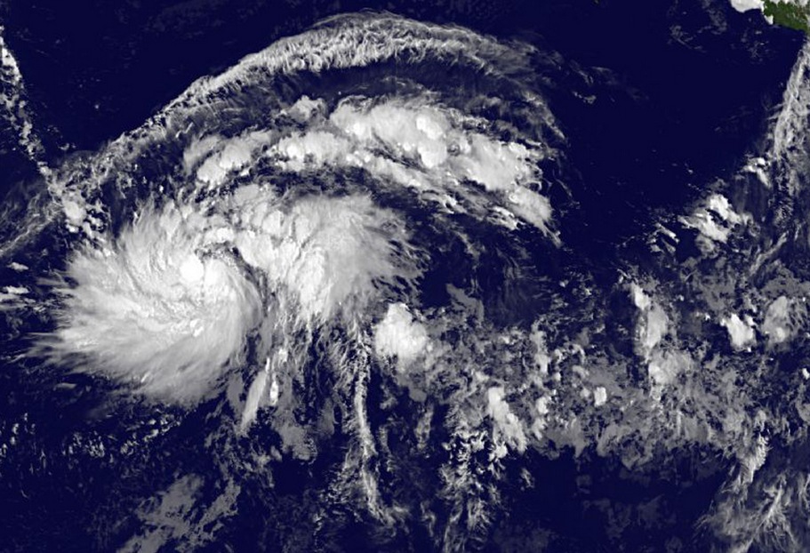
This GOES-West infrared image of Guillermo, taken on July 30, 2015, shows bands of thunderstorms spiraling around the northern quadrant and wrapping into the low-level center from the west. Credits: NASA/NOAA GOES Project.
At 09:00 UTC on July 31, Guillermo's maximum sustained winds have increased to near 130 km/h (80 mph) with higher gusts. Its center was located about 2 826 km (1 756 miles) ESE of Hilo, Hawaii. The storm was moving toward the WNW near 26 km/h (16 mph) with minimum central pressure of 985 hPa.
The hurricane-force winds covered a small area, and were extending outward up to 35 km (25 miles) from the center. Tropical storm force winds extended outward up to 185 km (115 miles) from the center.
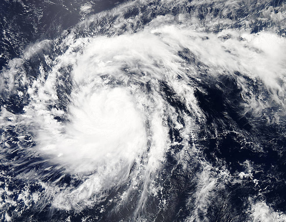
NASA's Aqua satellite captured this visible-light image of Hurricane Guillermo on July 30, 2015 at 21:55 UTC. Image credit: NASA Aqua/MODIS.
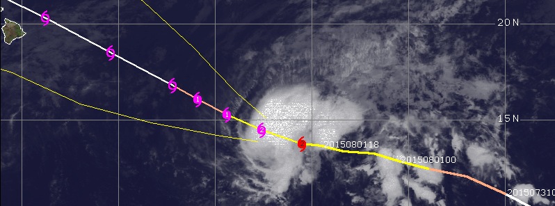
As of 03:00 UTC on August 2, the center of Hurricane "Guillermo" was located about 1 625 km (1 010 miles) ESE of Hilo, Hawaii. Its maximum sustained winds reached 165 km/h (105 mph). The storm was moving toward the WNW at 19 km/h (12 mph) with minimum central pressure of 970 hPa. This general motion is expected to continue through the next couple of days as the forward motion gradually decreases.
There are currently no coastal watches or warnings in effect, but interests in the Hawaiian islands should monitor the progress of Guillermo over the next few days, NHC said.
Hurricane force winds extend outward up to 35 km (25 miles), and tropical storm force winds extend outward up to 220 km (140 miles).
Large swells traveling ahead of Guillermo will build over the Hawaiian islands on Sunday and Monday, August 2 and 3. Surf will steadily build along east facing shores and will become large and life threatening on August 3 (local time).
Weakening is expected through the next five days.
NHC noted it is important for those in the Hawaiian islands not to focus too closely on the exact forecast track of Guillermo. "It is still too soon to determine with any certainty which islands would be most likely to experience the greatest impact from Guillermo. It is also important to note that significant impacts from tropical cyclones can extend well away from the center."
Satellite animations
- Storm-Centered Infrared (GOES 15; NOAA/SSD)
- Storm-Centered Infrared (Aviation Color Enhancement) (GOES 15; NOAA/SSD)
- Storm-Centered Water Vapor (GOES 15; NOAA/SSD)
- Storm-Centered Visible (GOES 15; NOAA/SSD)
- Storm-Centered Visible (Colorized) (GOES 15; NOAA/SSD)
- Storm-Centered Infrared (GOES 15; CIMSS)
- Storm-Centered Enhanced Infrared (GOES 15; CIMSS)
- Storm-Centered Water Vapor (GOES 15; CIMSS)
- Storm-Centered Visible (GOES 15; CIMSS)
- East Pacific Infrared (GOES 15; NOAA/SSD)
- East Pacific (Aviation Color Enhancement) (GOES 15; NOAA/SSD)
- East Pacific Water Vapor (GOES 15; NOAA/SSD)
- East Pacific Visible (GOES 15; NOAA/SSD)
- East Pacific Visible (Colorized) (GOES 15; NOAA/SSD)
Featured image: Hurricane "Guillermo" forecast track by UW-CIMSS on August 2, 2015.
Commenting rules and guidelines
We value the thoughts and opinions of our readers and welcome healthy discussions on our website. In order to maintain a respectful and positive community, we ask that all commenters follow these rules.