Newton to hit Baja California as a hurricane, reach Arizona on September 7
Tropical Storm "Newton" (15E) has formed near the west coast of Mexico on September 5, 2016. The system is strengthening and is expected to make landfall over the southern tip of Baja California early Tuesday (UTC), September 6. A dangerous storm surge is expected to produce significant coastal flooding near and to the east of where the center makes landfall. Life-threatening flash floods and mudslides, especially in areas of mountainous terrain, are expected.
At 18:00 UTC on September 5, the center of Tropical Storm "Newton" was located about 440 km (235 miles) SSE of Cabo San Lucas and 355 km (220 miles) WNW of Manzanillo, Mexico. The system is moving northwest at 24 km/h (15 mph) with maximum sustained winds of 105 km/h (65 mph). Its minimum estimated central pressure is 989 hPa, NHC said.
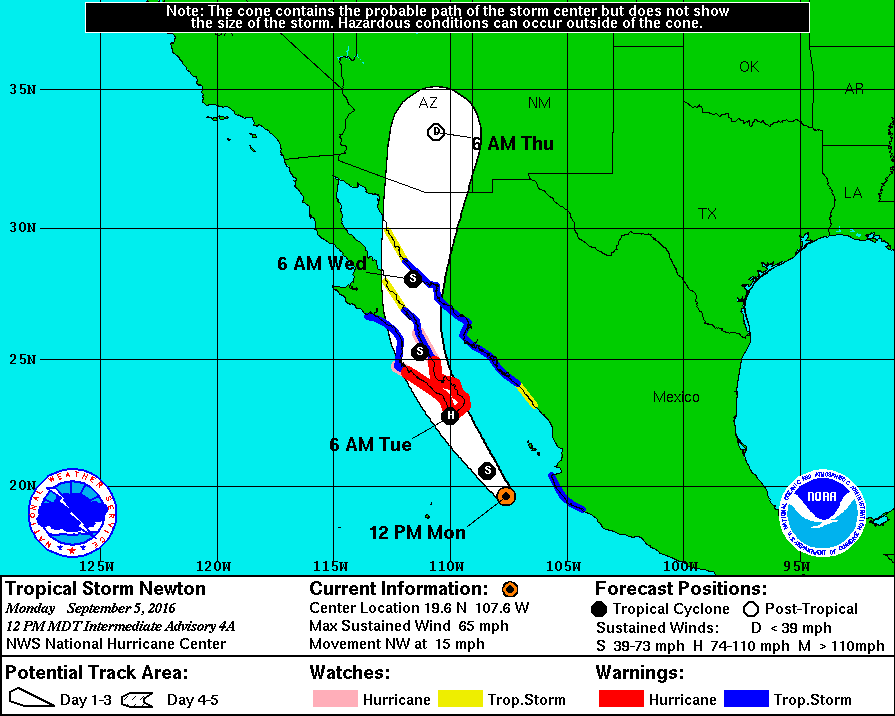
Tropical Storm "Newton" forecast by NWS/NHC on September 5, 2016
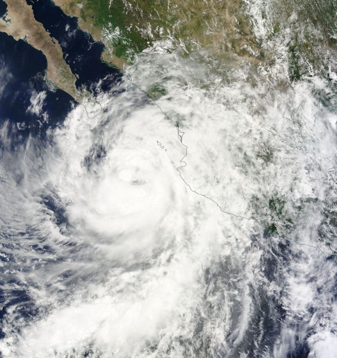
Tropical Storm "Newton" on September 5, 2016. Credit: NASA Terra/MODIS
A Hurricane Warning is in effect for Puerto Cortes to San Evaristo, including Cabo San Lucas. Hurricane conditions are expected somewhere within the warning area, in this case within 24 hours. Preparations to protect life and property should be rushed to completion.
A Tropical Storm Warning is in effect for Manzanillo to Cabo Corrientes, north of Puerto Cortes to Punta Abreojos, north of San Evaristo to Mulege, and Bahia Tempehuaya to Bahia Kino
A Hurricane Watch is in effect for north of Puerto Cortes to Cabo San Lazaro and north of San Evaristo to Loreto
A Tropical Storm Watch is in effect for north of Mulege to Bahia San Juan Bautista, Mazatlan to the south of Bahia Tempehuaya, and north of Bahia Kino to Puerto Libertad.
A turn toward the north-northwest, and then to the north, is expected late Tuesday and Wednesday. On the forecast track, Newton should be near or over the southern tip of the Baja California peninsula on Tuesday morning (local time), and move over portions of the southern Baja California peninsula late Tuesday and Wednesday.
Additional strengthening is likely, and Newton is forecast to become a hurricane before landfall.
Tropical-storm-force winds extend outward up to 240 km (150 miles) from the center, primarily to the east of the center.
For the Baja California peninsula, hurricane conditions are expected to reach the coast within the hurricane warning area early Tuesday morning. Winds are expected to first reach tropical storm strength by late tonight, making outside preparations difficult or dangerous.
For the Mexican mainland, tropical storm conditions are occurring from Manzanillo to Cabo Corrientes today. Farther northward, tropical storm conditions are expected over northwestern Mexico beginning Tuesday morning, and these conditions will gradually spread northward throughout the day. Tropical storm conditions are possible within the tropical storm watch areas in Sinaloa early Tuesday. Tropical storm conditions are possible in the watch in Sonora by early Wednesday.
Newton is expected to produce rainfall totals of 127 to 254 mm (5 to 10 inches) for coastal portions of the Mexican states of Michoacan, Colima, Jalisco, Nayarit, Sinaloa, as well as much of the state of Baja California Sur, with isolated maximum amounts of 381 mm (15 inches) through Tuesday night. These rains could cause life-threatening flash floods and mud slides, especially in areas of mountainous terrain.
Rainfall amounts of up to 50.8 mm (2 inches) are expected across portions of southern Arizona and southwestern New Mexico from late Wednesday into Thursday, with localized amounts of up to 76.2 mm (3 inches) possible. These rains could result in flash flooding.
A dangerous storm surge is expected to produce significant coastal flooding near and to the east of where the center makes landfall. Near the coast, the surge will be accompanied by large and destructive waves.

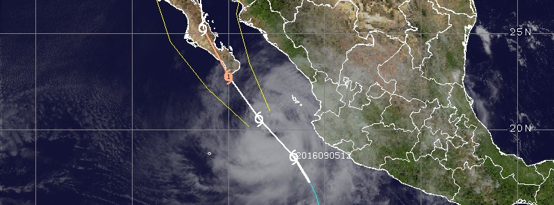
Tropical Storm "Newton" at 17:30 UTC on September 5, 2016. Credit: UW-CIMSS
Large swells generated by Newton are expected to affect the coast of southwestern Mexico through Tuesday, and begin to subside on Wednesday.
Swells should increase across the southern and central portions of the Baja California peninsula today and Tuesday.
These swells are likely to cause life-threatening surf and rip current conditions, NWS/NHC forecasters warned.
Featured image: Tropical Storm "Newton" at 17:30 UTC on September 5, 2016. Credit: UW-CIMSS
Commenting rules and guidelines
We value the thoughts and opinions of our readers and welcome healthy discussions on our website. In order to maintain a respectful and positive community, we ask that all commenters follow these rules.