Level of volcanic activity at White Island volcano increased, alerts raised – New Zealand
The level of volcanic activity at New Zealand's White Island volcano has increased on September 13, 2016, with minor volcanic ash passively emitted from a vent on the 2012 lava dome. GNS has raised the Volcanic Alert Level from 1 to 3 (of 5). The Aviation Colour Code is changed from Green to Orange.
The current activity is minor," GNS Science duty volcanologist Steve Sherburn said at 00:15 UTC (12:15 NZST) today. "We are unsure of the implications for visitor safety."
In his 03:15 UTC (15:15 NZST) update, Sherburn said: "As far we can tell from our monitoring data there has been no escalation in the level of activity at White Island since late morning. Seismic activity remains low on the island. Some of our cameras are now been affected by ash and steam, so we may not see much from them in the short term."
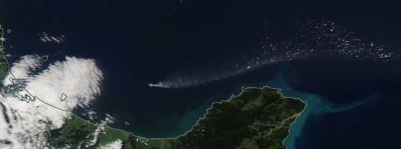
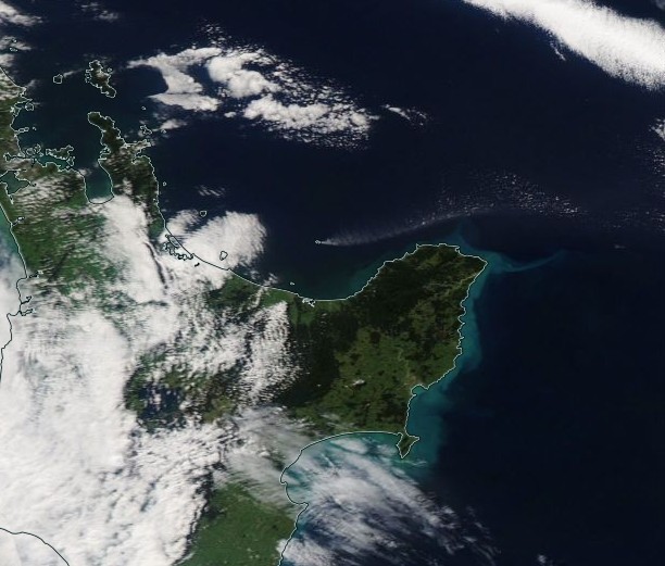
The ash is visible on a NZ Metservice visible satellite image, which shows a plume extending offshore of East Cape. Any ash fall will follow wind direction and is likely to be blown offshore over the next day.
Unless changes occur overnight, volcanologists will review the situation tomorrow morning local time. "Implications for visitor safety remain unclear," Sherburn added.
Ash plume as seen from the south side of the island, September 13, 2016. Credit: GNS
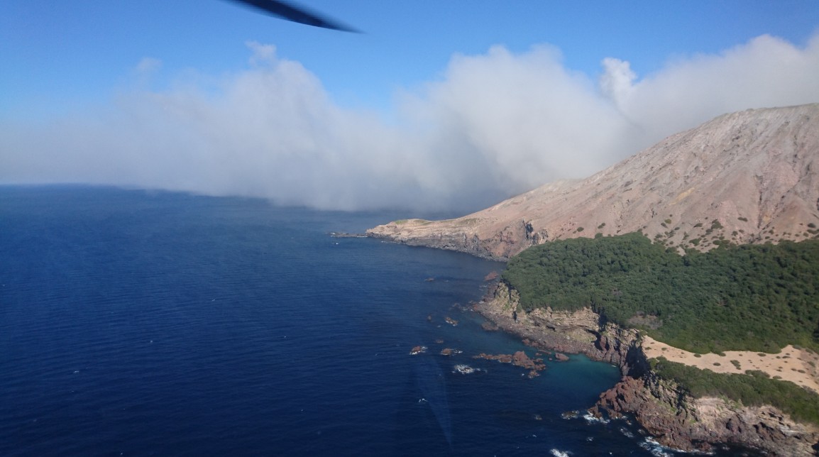
Ash plume as seen from the north side of the island, September 13, 2016. Credit: GNS
Ash plume as seen by NASA's Aqua satellite, September 13, 2016. Credit: NASA Aqua/MODIS
Credit: JMA/Himawari-8
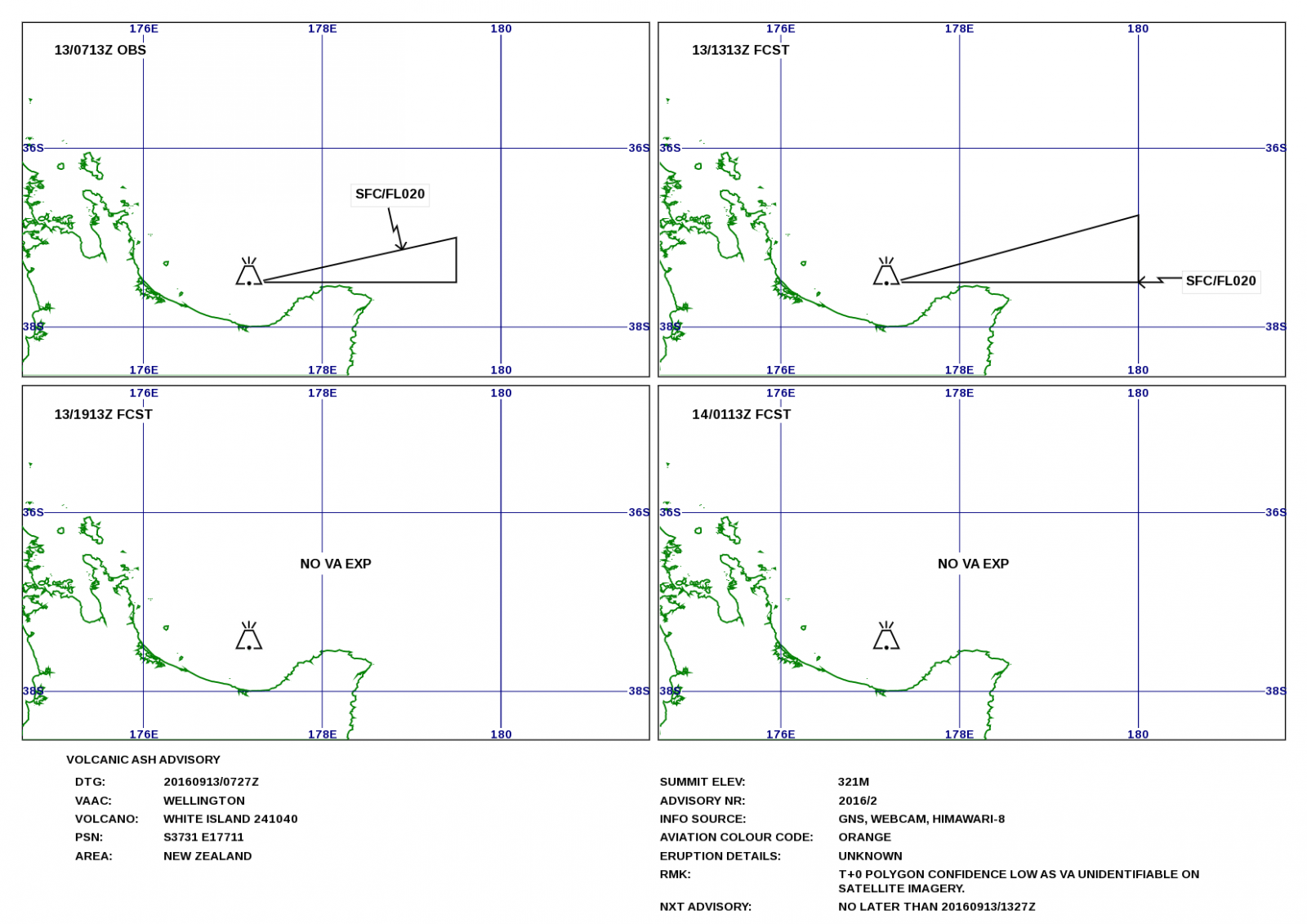
At 07:27 UTC on September 13, the Wellington VAAC said ash plume at 07:13 UTC was reaching 610 m (2 000 feet).
GNS' staff visited the volcano last week to continue their routine monitoring and complete reinstating the leveling and magnetic networks. The staff has also collected thermal IR images of the lava dome area, measured the Crater Lake level and temperature and fumarole temperatures.
Observations during that visit confirmed the Crater Lake is reforming and growing. The April 27 eruption removed about 13 – 15 m (42 – 49 feet) of lake floor sediments and the new lake is forming at a lower level on the floor of the crater. The lake is currently about 28.4 m (93.2 feet) below the overflow level. The water level has risen about 3 m (9.8 feet) since May 19 and the lake temperature has decreased as it gets larger. The temperature is now 52 ºC (125.6 ºF). The lake is now a light lime green color, having changed from a milky gray shortly after the April eruption.
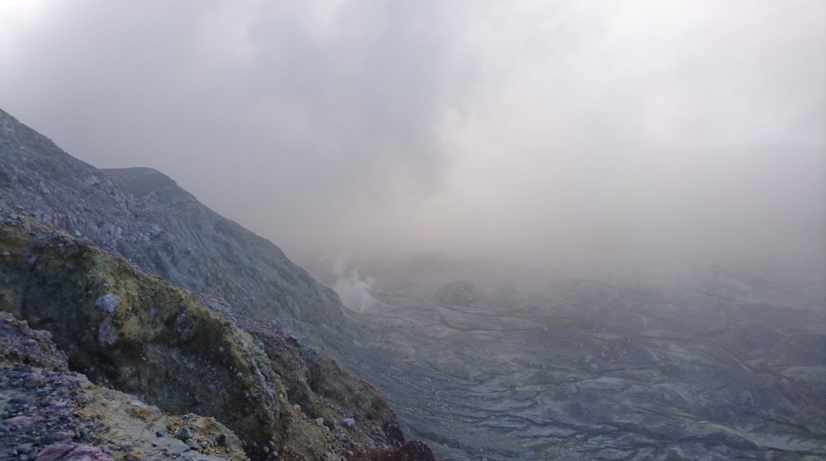
"We are sometimes able to get Thermal IR images of a rocky lava mound in the back of the 1978/90 Crater and have established information on the very high temperatures that are present there. This is the same area where a lava dome grew in 2012. There are two areas of hot gas output and the temperature measurements ranged from 198 to 295 ºC (388.4 to 563 ºF). These are down on the measurements we made in August when they ranged 292 to 337 ºC (557.6 to 638.6 ºF) in the hottest area. The temperature of Fumarole 0 (the largest accessible one) has changed little. We measured 170 – 173 ºC (338 – 343.4 ºF) this time and 168 – 171 ºC (334.4 – 339.8 ºF) last visit," Sherburn said.
Many of White Island's survey pegs were sheared off or broken by the April eruption. This has had implications for the regular surveys they do like leveling, magnetics, and soil gas flux. The pegs are now reinstalled and first observations were made last week.
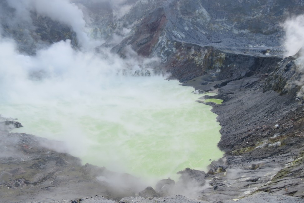
White Island crater lake on September 6, 2016. Credit: GNS
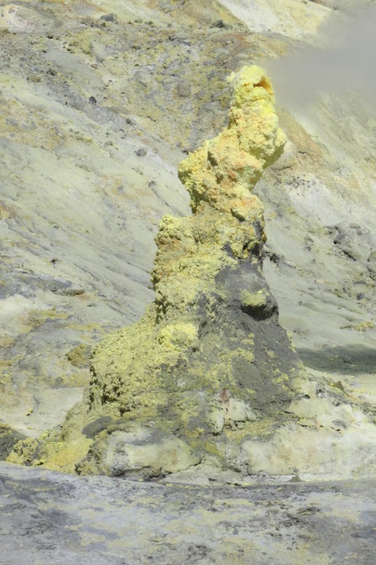
Sulfur tower growing near Fumarole 0, White Island, September 2016. Credit: GNS
Geological summary
Uninhabited 2 x 2.4 km White Island, one of New Zealand's most active volcanoes, is the emergent summit of a 16 x 18 km submarine volcano in the Bay of Plenty about 50 km offshore of North Island. The 321-m-high island consists of two overlapping andesitic-to-dacitic stratovolcanoes; the summit crater appears to be breached to the SE because the shoreline corresponds to the level of several notches in the SE crater wall. Volkner Rocks, four sea stacks that are remnants of a lava dome, lie 5 km NNE of White Island.
Intermittent moderate phreatomagmatic and strombolian eruptions have occurred at White Island throughout the short historical period beginning in 1826, but its activity also forms a prominent part of Maori legends. Formation of many new vents during the 19th and 20th centuries has produced rapid changes in crater floor topography. The collapse of the crater wall in 1914 produced a debris avalanche that buried buildings and workers at a sulfur-mining project. (GVP)
Featured image: White Island eruption on September 13, 2016. Credit: NASA Aqua/MODIS
Commenting rules and guidelines
We value the thoughts and opinions of our readers and welcome healthy discussions on our website. In order to maintain a respectful and positive community, we ask that all commenters follow these rules.